Dumbarton Parish, New Brunswick
Dumbarton Parish is a Statistics Canada census subdivision, and local service district in the province of New Brunswick.[3]
Dumbarton Parish Paroisse de Dumbarton | |
|---|---|
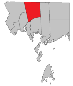 Location within Charlotte County. | |
| Country | |
| Province | |
| County | Charlotte |
| Established | 1856 |
| Government | |
| • Type | Local service district |
| Area | |
| • Land | 374.43 km2 (144.57 sq mi) |
| Population (2016)[1] | |
| • Total | 335 |
| • Density | 0.9/km2 (2/sq mi) |
| • Change 2011-2016 | |
| • Dwellings | 195 |
| Time zone | UTC-4 (AST) |
| • Summer (DST) | UTC-3 (ADT) |
| Highways | Route 3 / Route 127 / Route 170 [2] |
It was created when it was partitioned from Saint Patrick Parish in 1856.[4] The entire parish forms the local service district of the parish of Dumbarton, established in 1969 to assess for community services.[5] Fire protection was added to the assessment in 1970. Like most of Charlotte County, it is part of Southwest New Brunswick Service Commission.
It is defined in the Territorial Division Act[6] as being bounded: West by Saint David Parish and Saint James Parish; north by the County line; east by the northern prolongation of the eastern boundary of Saint Patrick Parish; and south by Saint Patrick Parish.
Census data
Population
| Canada census – Dumbarton Parish, New Brunswick community profile | |||
|---|---|---|---|
| 2016 | 2011 | 2006 | |
| Population: | 335 (-9.0% from 2011) | 368 (+3.4% from 2006) | 356 (-17.2% from 2001) |
| Land area: | 374.43 km2 (144.57 sq mi) | 375.08 km2 (144.82 sq mi) | 375.06 km2 (144.81 sq mi) |
| Population density: | 0.9/km2 (2.3/sq mi) | 1.0/km2 (2.6/sq mi) | 0.9/km2 (2.3/sq mi) |
| Median age: | 51.3 (M: 49.0, F: 52.1) | 48.4 (M: 47.8, F: 48.6) | 43.7 (M: 45.1, F: 43.5) |
| Total private dwellings: | 195 | 204 | 187 |
| Median household income: | $46,784 | $.N/A | $27,336 |
| Notes: 2011 income data for this area has been suppressed for data quality or confidentiality reasons. – References: 2016[7] 2011[8] 2006[9] earlier[10] | |||
| Historical Census Data - Dumbarton Parish, New Brunswick | |||||||||||||||||||||||||||||
|---|---|---|---|---|---|---|---|---|---|---|---|---|---|---|---|---|---|---|---|---|---|---|---|---|---|---|---|---|---|
|
|
| |||||||||||||||||||||||||||
| [11][1] | |||||||||||||||||||||||||||||
Language
| Canada Census Mother Tongue - Dumbarton Parish, New Brunswick[11] | ||||||||||||||||||
|---|---|---|---|---|---|---|---|---|---|---|---|---|---|---|---|---|---|---|
| Census | Total | English |
French |
English & French |
Other | |||||||||||||
| Year | Responses | Count | Trend | Pop % | Count | Trend | Pop % | Count | Trend | Pop % | Count | Trend | Pop % | |||||
2011 |
375 |
360 | 96.00% | 15 | 4.00% | 0 | 0.00% | 0 | 0.00% | |||||||||
2006 |
355 |
345 | 97.18% | 0 | 0.00% | 0 | 0.00% | 10 | 2.82% | |||||||||
2001 |
430 |
430 | 100.00% | 0 | 0.00% | 0 | 0.00% | 0 | 0.00% | |||||||||
1996 |
445 |
445 | n/a | 100.00% | 0 | n/a | 0.00% | 0 | n/a | 0.00% | 0 | n/a | 0.00% | |||||
References
- "Census Profile, 2016 Census Dumbarton, Parish [Census subdivision], New Brunswick". Statistics Canada. Retrieved 8 September 2019.
- Atlantic Canada Back Road Atlas ISBN 978-1-55368-618-7 Pages 4, 12
- "Dumbarton". Provincial Archives of New Brunswick. Retrieved 22 June 2020.
- "Saint Patrick Parish". archives.gnb.ca. Provincial Archives of New Brunswick. Retrieved 13 June 2020.
- "Regulation 69-17 under the Municipalities Act (O. C. 69-161)". The Royal Gazette. Fredericton, NB, Canada. 127: 149. 12 March 1969. Filed February 19, 1969.
- "Territorial Division Act (R.S.N.B. 1973, c. T-3)". Government of New Brunswick website. Retrieved 19 August 2016.
- "2016 Community Profiles". 2016 Canadian Census. Statistics Canada. 21 February 2017. Retrieved 8 September 2019.
- "2011 Community Profiles". 2011 Canadian Census. Statistics Canada. 5 July 2013. Retrieved 15 March 2014.
- "2006 Community Profiles". 2006 Canadian Census. Statistics Canada. 30 March 2011. Retrieved 15 March 2014.
- "2001 Community Profiles". 2001 Canadian Census. Statistics Canada. 17 February 2012.
- Statistics Canada: 1996, 2001, 2006, 2011 census
Places adjacent to Dumbarton Parish, New Brunswick | |
|---|---|
| Subdivisions |
|
|---|---|
| Cities | |
| Counties | |
| |
This article is issued from Wikipedia. The text is licensed under Creative Commons - Attribution - Sharealike. Additional terms may apply for the media files.