Saint David Parish, New Brunswick
Saint David Parish is a Statistics Canada census subdivision, and local service district in the province of New Brunswick.
Saint David Parish Paroisse de Saint-David | |
|---|---|
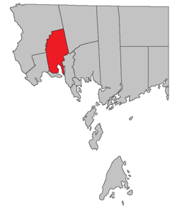 Location within Charlotte County. | |
| Country | |
| Province | |
| County | Charlotte County |
| Established | 1786 |
| Government | |
| • Type | Local Service District |
| Area | |
| • Land | 190.66 km2 (73.61 sq mi) |
| Population (2016)[1] | |
| • Total | 1,529 |
| • Density | 8.0/km2 (21/sq mi) |
| • Pop 2011-2016 | |
| • Dwellings | 743 |
| Time zone | UTC-4 (AST) |
| • Summer (DST) | UTC-3 (ADT) |
It is one of 14 parishes in Charlotte County, formed in 1784 when New Brunswick was partitioned from Nova Scotia.[2] The local service district was established in 1969[3] to provide community services following the abolition of county councils with the 1966 Municipalities Act.[4] Fire protection was added in 1970 and non-fire related rescue in 2013.
It includes the unincorporated settlements of Oak Bay and Honeydale.
Census data
Population
| Canada census – Saint David Parish, New Brunswick community profile | |||
|---|---|---|---|
| 2016 | 2011 | 2006 | |
| Population: | 1,529 (-4.7% from 2011) | 1,605 (+7.1% from 2006) | 1,499 (-6.0% from 2001) |
| Land area: | 190.66 km2 (73.61 sq mi) | 189.93 km2 (73.33 sq mi) | 189.91 km2 (73.32 sq mi) |
| Population density: | 8.0/km2 (21/sq mi) | 8.5/km2 (22/sq mi) | 7.9/km2 (20/sq mi) |
| Median age: | 50.5 (M: 50.9, F: 50.0) | 47.8 (M: 47.9, F: 47.6) | 42.6 (M: 41.9, F: 43.1) |
| Total private dwellings: | 743 | 787 | 676 |
| Median household income: | $54,240 | $41,215 | |
| References: 2016[5] 2011[6] 2006[7] earlier[8] | |||
| Historical Census Data - Saint David Parish, New Brunswick | |||||||||||||||||||||||||||||
|---|---|---|---|---|---|---|---|---|---|---|---|---|---|---|---|---|---|---|---|---|---|---|---|---|---|---|---|---|---|
|
|
| |||||||||||||||||||||||||||
| [9][1] | |||||||||||||||||||||||||||||
Language
| Canada Census Mother Tongue - Saint David Parish, New Brunswick[9] | ||||||||||||||||||
|---|---|---|---|---|---|---|---|---|---|---|---|---|---|---|---|---|---|---|
| Census | Total | English |
French |
English & French |
Other | |||||||||||||
| Year | Responses | Count | Trend | Pop % | Count | Trend | Pop % | Count | Trend | Pop % | Count | Trend | Pop % | |||||
2011 |
1,590 |
1,530 | 96.23% | 40 | 2.52% | 5 | 0.31% | 15 | 0.94% | |||||||||
2006 |
1,495 |
1,440 | 96.32% | 25 | 1.67% | 10 | 0.67% | 20 | 1.34% | |||||||||
2001 |
1,585 |
1,555 | 98.11% | 30 | 1.89% | 0 | 0.00% | 0 | 0.00% | |||||||||
1996 |
1,630 |
1,580 | n/a | 96.93% | 40 | n/a | 2.45% | 0 | n/a | 0.00% | 10 | n/a | 0.61% | |||||
References
- "Census Profile, 2016 Census: Saint David, Parish [Census subdivision], New Brunswick". Statistics Canada. Retrieved 30 August 2019.
- Slumkoski, Corey (2005). "The Partition of Nova Scotia". The Winslow Papers. Electronic text centre (UNB Libraries). Retrieved 5 May 2020.
- "Regulation 69-17 under the Municipalities Act (O. C. 69-161)". The Royal Gazette. Fredericton, NB, Canada. 127: 149. 12 March 1969. Filed February 19, 1969.
- "Local Government Legislation in New Brunswick" (PDF). Government of New Brunswick. Retrieved 24 June 2020.
- "2016 Community Profiles". 2016 Canadian Census. Statistics Canada. 21 February 2017. Retrieved 30 August 2019.
- "2011 Community Profiles". 2011 Canadian Census. Statistics Canada. 5 July 2013. Retrieved 17 March 2014.
- "2006 Community Profiles". 2006 Canadian Census. Statistics Canada. 30 March 2011. Retrieved 17 March 2014.
- "2001 Community Profiles". 2001 Canadian Census. Statistics Canada. 17 February 2012.
- Statistics Canada: 1996, 2001, 2006, 2011 census
External links
Territorial Division Act (R.S.N.B. 1973, c. T-3): detailed definitions of New Brunswick's internal divisions.
Places adjacent to Saint David Parish, New Brunswick | ||||||||||
|---|---|---|---|---|---|---|---|---|---|---|
| ||||||||||
| Subdivisions |
|
|---|---|
| Cities | |
| Counties | |
| |
This article is issued from Wikipedia. The text is licensed under Creative Commons - Attribution - Sharealike. Additional terms may apply for the media files.