Saint Croix Parish, New Brunswick
Saint Croix Parish is a census subdivision for Statistics Canada and a local service district in the province of New Brunswick. It is named for the Saint Croix River which forms one of its borders.[3] It was partitioned from Saint Andrews Parish in 1874.[4]
Saint Croix Parish Paroisse de Sainte-Croix | |
|---|---|
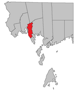 Location within Charlotte County. | |
| Country | |
| Province | |
| County | Charlotte County |
| Established | 1874 |
| Named for | Saint Croix River |
| Government | |
| • Type | Local Service District |
| Area | |
| • Land | 78.67 km2 (30.37 sq mi) |
| Population (2016)[1] | |
| • Total | 657 |
| • Density | 8.4/km2 (22/sq mi) |
| • Pop 2011-2016 | |
| • Dwellings | 368 |
| Time zone | UTC-4 (AST) |
| • Summer (DST) | UTC-3 (ADT) |
| Highways | Route 1 / Route 127 / Route 170 / Route 760[2] |
The local service district was created in 1970.[5] Like most of Charlotte County, it is part of Southwest New Brunswick Service Commission.[6]
Parish population includes the unincorporated settlements of Bayside, Saint Croix, and Waweig.
Census data
Population
| Canada census – Saint Croix Parish, New Brunswick community profile | |||
|---|---|---|---|
| 2016 | 2011 | 2006 | |
| Population: | 657 (+6.7% from 2011) | 616 (-8.1% from 2006) | 670 (+5.7% from 2001) |
| Land area: | 78.67 km2 (30.37 sq mi) | 78.77 km2 (30.41 sq mi) | 78.67 km2 (30.37 sq mi) |
| Population density: | 8.4/km2 (22/sq mi) | 7.8/km2 (20/sq mi) | 8.5/km2 (22/sq mi) |
| Median age: | 48.1 (M: 49.5, F: 46.3) | 45.2 (M: 45.8, F: 45.0) | 43.0 (M: 43.4, F: 41.5) |
| Total private dwellings: | 368 | 322 | 353 |
| Median household income: | $55,040 | $45,812 | $38,485 |
| References: 2016[7] 2011[8] 2006[9] earlier[10] | |||
| Historical Census Data - Saint Croix Parish, New Brunswick | ||||||||||||||||||||||||||||||||
|---|---|---|---|---|---|---|---|---|---|---|---|---|---|---|---|---|---|---|---|---|---|---|---|---|---|---|---|---|---|---|---|---|
|
|
| ||||||||||||||||||||||||||||||
(A) adjustment due to boundary change. [11][1] | ||||||||||||||||||||||||||||||||
Language
| Canada Census Mother Tongue - Saint Croix Parish, New Brunswick[11] | ||||||||||||||||||
|---|---|---|---|---|---|---|---|---|---|---|---|---|---|---|---|---|---|---|
| Census | Total | English |
French |
English & French |
Other | |||||||||||||
| Year | Responses | Count | Trend | Pop % | Count | Trend | Pop % | Count | Trend | Pop % | Count | Trend | Pop % | |||||
2011 |
610 |
590 | 96.72% | 10 | 1.64% | 0 | 0.00% | 10 | 1.64% | |||||||||
2006 |
665 |
655 | 98.50% | 0 | 0.00% | 0 | 0.00% | 10 | 1.50% | |||||||||
2001 |
635 |
620 | 97.64% | 15 | 2.36% | 0 | 0.00% | 0 | 0.00% | |||||||||
1996 |
660 |
650 | n/a | 98.48% | 10 | n/a | 1.52% | 0 | n/a | 0.00% | 0 | n/a | 0.00% | |||||
See also
References
- "Census Profile, 2016 Census Saint Croix, Parish [Census subdivision], New Brunswick". Statistics Canada. Retrieved 30 August 2019.
- Atlantic Canada Back Road Atlas ISBN 978-1-55368-618-7 Pages 4, 12
- "Territorial Division Act (R.S.N.B. 1973, c. T-3)". Government of New Brunswick website. Retrieved 26 August 2016.
- "Saint Croix Parish". Provincial Archives of New Brunswick. Retrieved 24 June 2020.
- "Regulation 70-63 under the Municipalities Act (O. C. 70-385)". The Royal Gazette. Fredericton, NB, Canada. 128: 343–344. 17 June 1970. Filed June 3, 1970.
- "Southwest New Brunswick Service Commission Annual Report & Financial Statements 2018" (PDF). Southwest New Brunswick Service Commission. Retrieved 24 June 2020.
- "2016 Community Profiles". 2016 Canadian Census. Statistics Canada. 21 February 2017. Retrieved 30 August 2019.
- "2011 Community Profiles". 2011 Canadian Census. Statistics Canada. 5 July 2013. Retrieved 16 March 2014.
- "2006 Community Profiles". 2006 Canadian Census. Statistics Canada. 30 March 2011. Retrieved 16 March 2014.
- "2001 Community Profiles". 2001 Canadian Census. Statistics Canada. 17 February 2012.
- Statistics Canada: 1996, 2001, 2006, 2011 census
Places adjacent to Saint Croix Parish, New Brunswick | |
|---|---|
| Subdivisions |
|
|---|---|
| Cities | |
| Counties | |
| |
This article is issued from Wikipedia. The text is licensed under Creative Commons - Attribution - Sharealike. Additional terms may apply for the media files.