Russey Keo Section
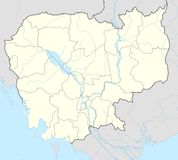
Russey Keo (Khmer: ខណ្ឌប្ញស្សីកែវ, "Crystal Bamboo"), also spelled Russei Keo, is a district (Khan) in the municipality of Phnom Penh, Cambodia. This district consists of the northern and north-eastern outskirts of the main city of Phnom Penh, stretching from Khan Sen Sok in the west to the Tonle Sap River in the east. It is the second-largest district of Phnom Penh and covers an area of 105.56 km². According to the 2008 census of Cambodia, it had a population of 175,295 within nine Sangkats.[1]
Russey Keo ខណ្ឌប្ញស្សីកែវ | |
|---|---|
District (Khan) | |
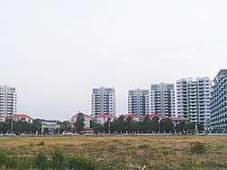 Camko City | |

| |
 Russey Keo | |
| Coordinates: 11°37′10″N 104°54′36″E | |
| Country | |
| Province | Phnom Penh |
| Area | |
| • Total | 105.56 km2 (40.76 sq mi) |
| Population (2008) | |
| • Total | 175,295 |
| Time zone | UTC+7 (Cambodia) |
| Postal code | 12100 |
| Geocode | 1207 |
Camko City
Camko City is an urban development zone being developed by a consortium spearheaded by World City Co., Ltd of South Korea in the Russey Keo district. It has a projected investment valued at $2.063 billion. This mix-use development zone will have residential and commercial areas including health facilities, sports complex, educational institutions, cultural and convention center.
Administration
According to the 1998 census, Russey Keo consisted of 12 Sangkats with a total population of 180,076;[2] in 2008–2009 three Sangkats—Khmuonh, Phnom Penh Thmei and Tuek Thla—formed Khan Sen Sok[3] and the population recorded by the 2008 census in the resulting nine-Sangkat area was 175,295.[1]
In 2010, Bak Kaeng and Kaoh Dach communes were added to the Khan from Mukh Kampul District, Kandal Province.[4] In 2013, both Sangkats, along with Chrouy Changvar, Preaek Lieb and Preaek Ta Sek, formed a new entity, Khan Chroy Changvar,[5] taking Russey Keo's number of Sangkats to six. In 2016, Tuol Sangkae was split in two separate Sangkats, Tuol Sangkae I and Tuol Sangkae II.[5]
As of 2020, Russey Keo is subdivided into seven Sangkats (communes) and 30 Phums (villages).[5]
| Geocode | Sangkat (commune) | Phums (villages) |
|---|---|---|
| 120703 | Svay Pak | La Kambaor, Lu, Svay Pak |
| 120704 | Kilomaetr 7 | Kraol Kou, Spean Khpos, Boeung Chhuk |
| 120706 | Russey Keo | Mittapheap, Samakki, Khleang Sang, Boeung Salang |
| 120711 | Chrang Chamreh I | Phum I, Phum II, Phum II, Phum IV |
| 120712 | Chrang Chamreh II | Phum Ka, Phum Kha I, Phum Kha II, Phum Koa |
| 120713 | Tuol Sangkae I | Phsar Touch, Tuol Sangkae, Tuol Kouk, Chong Khsach, Bak Touk, Tuol Sampov |
| 120714 | Tuol Sangkae II | Kongkea Phos, Kos Andaet, Pong Peav, Boeung Rang, Tuol Porpae, Tuol Thgan |
See also
- Chroy Changva District
References
- "2008 Census – Ruessei Kaev District". opendevelopmentcambodia.net. Open Development Cambodia. Retrieved 23 May 2020.
- "General Population Census of Cambodia 1998, Final Census Results" (PDF). National Institute of Statistics, Ministry of Planning, Cambodia. August 2002. p. 174. Retrieved 23 May 2020.
- "General Population Census of Cambodia 2008" (PDF). National Institute of Statistics. August 2009. p. 170. Retrieved 23 May 2020.
- "Administrative Area Changes of Phnom Penh Municipality on 5 November 2010" (PDF). stat.go.jp. Statistics Bureau of Japan. Retrieved 23 May 2020.
- "Cambodia Gazetteer Database Online". National Committee for Sub-National Democratic Development. Retrieved 23 May 2020.
| Autonomous municipality |
| ||||||||||||||||||||||||||||||||||||||||||||||||||
|---|---|---|---|---|---|---|---|---|---|---|---|---|---|---|---|---|---|---|---|---|---|---|---|---|---|---|---|---|---|---|---|---|---|---|---|---|---|---|---|---|---|---|---|---|---|---|---|---|---|---|---|
| Provinces |
| ||||||||||||||||||||||||||||||||||||||||||||||||||