Takéo Province
Takeo (Khmer: ខេត្តតាកែវ, IPA: [taː kaew], literally "Crystal Grandfather") is a province (khaet) of Cambodia. Located in the south of Cambodia to the west of Bassac River, Takeo borders the provinces of Kampot to the west, Kampong Speu to the northwest and Kandal to the north and east. Its southern boundary is the international border with Vietnam. The provincial capital, recently known as the provincial town Doun Kaev (formerly called Takeo), is a small city with a population of 39,186.
Takeo Province ខេត្តតាកែវ | |
|---|---|
.JPG) Temple in Takeo | |
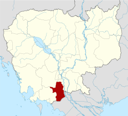 Map of Cambodia highlighting Takeo | |
| Coordinates: 010°59′N 104°47′E | |
| Country | |
| Provincial status | 1907 |
| Capital | Doun Kaev Municipality |
| Government | |
| • Governor | Ouch Phea |
| Area | |
| • Total | 3,563 km2 (1,376 sq mi) |
| Area rank | Ranked 20th |
| Population (2019 census)[1] | |
| • Total | |
| • Rank | 6th |
| • Density | 252/km2 (650/sq mi) |
| • Density rank | 3rd |
| Time zone | UTC+7 (ICT) |
| Dialing code | +855 |
| ISO 3166 code | KH-21 |
| Districts | 10 |
| Communes | 100 |
| Villages | 1117 |
| HDI (2017) | 0.612[2] medium · 2nd |
Takeo is often referred to as the "cradle of Khmer civilization" due to the former kingdom of Funan its successor, Water Chenla, being centered in the region.
Administration
As of 2019, the province has 9 districts and 1 municipality, 97 communes and 3 sangkats, and 1,119 villages.[3]
Previously, before Doun Kaev District was renamed to Krong Doun Kaev, the province was subdivided into 10 districts, 100 communes and 1,117 villages.[4][5]
| ISO Code | District | Khmer |
|---|---|---|
| 21-01 | Angkor Borei | ស្រុកអង្គរបូរី |
| 21-02 | Bati | ស្រុកបាទី |
| 21-03 | Bourei Cholsar | ស្រុកបូរីជលសារ |
| 21-04 | Kiri Vong | ស្រុកគីរីវង់ |
| 21-05 | Koh Andaet | ស្រុកកោះអណ្ដែត |
| 21-06 | Prey Kabbas | ស្រុកព្រៃកប្បាស |
| 21-07 | Samraŏng | ស្រុកសំរោង |
| 21-08 | Doun Kaev Municipality | ក្រុងដូនកែវ |
| 21-09 | Tram Kak | ស្រុកត្រាំកក់ |
| 21-10 | Treang | ស្រុកទ្រាំង |
Sites
- Phnom Chisor is a mountain north of the city of Takeo. At the summit there are temple ruins from the 10th and 11th centuries. From the mountain there is a good view. The climb is 503 steps. At the summit there are simple beverage stalls. A moped can be taken for the 26-kilometer journey.
- Phnom Da - a 17 meter high temple dating back to the Funan kingdom (6th century) on a 100 m high hill. It can be reached by an hour boat ride from Takeo. Farmers on the partially flooded rice fields and fishermen and many duck farms can be observed. Large wooden boats deliver cargoes from Vietnam.
- Angkor Borei - On the road from the town of Takeo is Phnom Da temple. Previously, this was an important trading center. At the harbor there is a small museum documenting the Funan kingdom.
Notable people
- Haing S. Ngor, actor, physician, author
- Ho Vann, politician
- Kem Ley, activist
- Kem Sokha, politician
- Khim Borey, footballer
- Khun Srun, writer
- Ou Chanrith, politician
- Pen Sovan, former Prime Minister
- Prach Chhuon (Khmer: ប្រាជ្ញឈួន), master of the classical Khmer cultural string instrument of Chapei
- Preah Maha Ghosananda, Supreme Patriarch of Cambodia
- Sok An, deputy prime minister
- Ta Mok, former Khmer Rouge militant
- Yem Ponhearith, politician
- Dr. Kol Pheng, Director Pannasastra university
See also
- Transport in Cambodia
- Phnom Chisor, an Angkorian site located in Takeo province
References
- "General Population Census of the Kingdom of Cambodia 2019 - Provisional Population Totals". National Institute of Statistics. Ministry of Planning. June 2019. Retrieved 12 August 2019.
- "Sub-national HDI - Area Database - Global Data Lab". hdi.globaldatalab.org. Retrieved 2018-09-13.
- "Cambodia Gazetteer Database Online". Cambodia NCDD Databases. National Committee for Sub-National Democratic Development (NCDD). 2019. Retrieved 2019-08-24.
- The National Institute of Statistics (NIS) of Cambodia
- Statistics of the Cambodian Government Archived 2008-12-24 at the Wayback Machine
Places adjacent to Takéo Province | ||||||||||
|---|---|---|---|---|---|---|---|---|---|---|
| ||||||||||

| Autonomous municipality | ||
|---|---|---|
| Provinces | ||