Puerto Rico Highway 140
Puerto Rico Highway 140 (PR-140) is a road that travels from Jayuya, Puerto Rico to Barcleoneta, passing through Utuado, Ciales and Florida.[2] This highway begins at PR-143 in Pica and ends at PR-2 in Florida Afuera.[3]
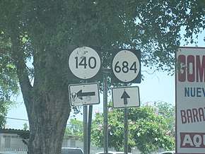
Signs for PR-140 in Barceloneta.

Sign for PR-140, and Florida pharmaceuticals, Exit 57 from PR-2.
| ||||
|---|---|---|---|---|
| Route information | ||||
| Maintained by Puerto Rico DTPW | ||||
| Length | 69.9 km[1] (43.4 mi) | |||
| Major junctions | ||||
| South end | ||||
| ||||
| North end | ||||
| Location | ||||
| Municipalities | Jayuya, Utuado, Ciales, Florida, Barceloneta | |||
| Highway system | ||||
| ||||


Major intersections
| Municipality | Location | km[1] | mi | Destinations | Notes |
|---|---|---|---|---|---|
| Ponce–Jayuya– Utuado municipal tripoint | Anón–Pica– Consejo tripoint | 0.0 | 0.0 | Southern terminus of PR-140 | |
| Jayuya–Utuado municipal line | Pica–Consejo line | 2.1 | 1.3 | ||
| Jayuya | Collores | 8.1 | 5.0 | ||
| 9.0 | 5.6 | ||||
| Utuado | Paso Palma | 15.0– 15.1 | 9.3– 9.4 | ||
| Las Palmas | 21.4– 21.5 | 13.3– 13.4 | |||
| Caonillas Abajo | 25.1 | 15.6 | |||
| 28.0 | 17.4 | ||||
| 29.1 | 18.1 | ||||
| Mameyes Abajo | 38.2 | 23.7 | |||
| Ciales | Frontón | 44.6 11.0[lower-alpha 1] | 27.7 6.8 | Western terminus of PR-146 concurrency | |
| 11.3[lower-alpha 1] 44.7 | 7.0 27.8 | Eastern terminus of PR-146 concurrency | |||
| Florida | Florida Adentro | 52.1 | 32.4 | ||
| 53.1 | 33.0 | ||||
| 53.6 | 33.3 | ||||
| 53.8 | 33.4 | Eastbound access via Calle Luis Muñoz Rivera | |||
| 55.2 | 34.3 | ||||
| 56.1 | 34.9 | ||||
| Barceloneta | Florida Afuera | 61.8 | 38.4 | ||
| 62.4– 62.5 | 38.8– 38.8 | ||||
| 63.8 | 39.6 | ||||
| 65.3 | 40.6 | PR-22 exit 57; partial cloverleaf interchange | |||
| 67.6– 67.7 | 42.0– 42.1 | ||||
| 68.0 | 42.3 | ||||
| 69.2 | 43.0 | PR-22 exit 55; partial cloverleaf interchange | |||
| 69.9 | 43.4 | Northern terminus of PR-140 | |||
1.000 mi = 1.609 km; 1.000 km = 0.621 mi
| |||||
- Kilometer markers represent the distance along PR-146 rather than PR-140.
References
- Google (24 March 2020). "PR-140" (Map). Google Maps. Google. Retrieved 24 March 2020.
- National Geographic Maps (2011). Puerto Rico (Map). 1:125,000. Adventure Map. Evergreen, CO: National Geographic Maps. ISBN 978-1566955188. OCLC 756511572.
- "Tránsito Promedio Diario (AADT)". Puerto Rico Department of Transportation and Public Works (in Spanish). p. 77-78. Retrieved 19 June 2019.
This article is issued from Wikipedia. The text is licensed under Creative Commons - Attribution - Sharealike. Additional terms may apply for the media files.