Oromocto
Oromocto (2016 population: 9,223)[1] is a Canadian town in Sunbury County, New Brunswick.
Oromocto Welamooktook (Great River) | |
|---|---|
 Flag  Coat of arms | |
| Nickname(s): Canada's Model town | |
| Motto(s): Latin: Succesus Per Operam "Effort Brings Success" | |
 Oromocto | |
| Coordinates: 45°50′56″N 66°28′44″W | |
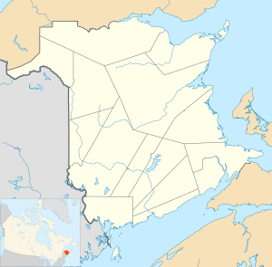
| Country | Canada |
| Province | New Brunswick |
| County | Sunbury County |
| Parish | Burton Parish |
| Founded | March 16, 1693 |
| Incorporated | 1956 |
| Electoral Districts Federal | Fredericton |
| Provincial | Oromocto |
| Government | |
| • Type | Town Council |
| • Mayor | Robert Powell |
| • Deputy Mayor | Kelly Murdock |
| • Councillors | Lorraine Dawe,Jeff Kirkbride,Sheridan Mawhinney,Raymond Henry,alex Zaporzan. |
| • CAO | Steven Hart |
| • Assistant Town Clerk | Cynthia Abbott |
| Area | |
| • Total | 22.44 km2 (8.66 sq mi) |
| Highest elevation | 51 m (167 ft) |
| Lowest elevation | 0 m (0 ft) |
| Population (2016)[1] | |
| • Total | 9,223 |
| • Density | 410/km2 (1,100/sq mi) |
| • Change (2011-2016) | |
| • Dwellings | 3,900 |
| Time zone | UTC−4 (AST) |
| • Summer (DST) | UTC−3 (ADT) |
| Postal code(s) | E2V 2v3 |
| Area code(s) | 506 357-4400 |
| Access Routes Route 2 (TCH) | |
| Telephone Exchange | 357-440 |
| NTS Map | 021G16 |
| GNBC Code | DATWJ |
| Website | oromocto.ca |
This town is located on the west bank of the Saint John River at the mouth of the Oromocto River, approximately 20 kilometres southeast of Fredericton. The town's name is derived from the name of the Oromocto River; "oromocto" is thought to have originated from the Maliseet word welamukotuk which means "deep water".
It is the administrative headquarters of the Oromocto First Nation band government[2] and the site of Canadian Forces Base Gagetown, which dominates its economy and modern history.
History
The village was initially an Acadian village. During the Expulsion of the Acadians, the village was burned in the St. John River Campaign (1758). During the American Revolution, Fort Hughes was built in the community after the rebellion at Maugerville, New Brunswick. (A replica of Fort Hughes was built at Sir Douglas Hazen Park.) In 1783 Oromocto saw a large influx of settlers with the arrival of United Empire Loyalists, with a steady stream of new blood arriving in the area. Many of the Loyalists also moved into surrounding areas, establishing smaller communities such as Lincoln and Geary.[3][4]
Oromocto was originally a shipbuilding town in the 19th century, but went into decline after the industry closed. During its shipbuilding days, Oromocto produced about 22 ships. This was made possible by a vast abundance of timber and sawmills, which continued to provide economic stability to Oromocto, even after the shipbuilding business had died out.[3][4] It remained a small hamlet until it was selected as the headquarters for a large military training area, in the early 1950s. The Gagetown Military Camp (Camp Gagetown) opened in 1955 as the largest military reservation in the Commonwealth of Nations at the time.[5]
Oromocto underwent a transformation during this time as it was designed to be a "model town". It was considered to be at the forefront of such efforts in Canada. Today, Oromocto's entire economy is dominated by CFB Gagetown.
The town's location in the Saint John River valley provides lush vegetation and an attractive waterfront on both rivers. A small park and marina occupy an area on the Oromocto River waterfront near the downtown. The nightlife attraction is Griffon's Pub and Eatery. The town's shopping mall features a Pizza Delight, Tim Hortons, Dollarama, Shopper's Drug Mart, a barber shop as well as an Atlantic Superstore location. A business district in the area of Restigouche Road has become moderately successful, and the town features a small hospital, track and field facilities, and churches. The town is home to a distribution centre for Sobeys grocery stores, a funeral home, library and recreation centre. Where the town borders on CFB Gagetown, there is also a Canex with a salon and barbershop, hockey/squash arenas, swimming pool, and a credit union, along with military vehicles and aircraft on outdoor display.
Adjacent to the town on the eastern limits is the Oromocto First Nations reserve, a small Mi'kmaq/Maliseet community.
Canadian National Railway abandoned its railway line, which ran through the town to CFB Gagetown, in March 1996. Today, this railway right-of-way has been developed as a recreational trail and is part of the "Sentier NB Trail" network. This particular portion of the Sentier NB Trail between Fredericton-Oromocto-Burton also hosts the Trans Canada Trail.
Education
- Oromocto High School
- Harold Peterson Middle School
- Ridgeview Middle School
- Hubbard Avenue Elementary School
- Summerhill Street Elementary School
- Gesner Street Elementary School
Notable people
References
- "Census Profile, 2016 Census: Oromocto, New Brunswick". Statistics Canada. Retrieved August 15, 2019.
- "Welcome". Oromocto First Nation. Retrieved August 15, 2019.
- "History". Town of Oromocto. Retrieved August 15, 2019.
- Cogswell, Dale R. "Oromocto". The Canadian Encyclopedia. Retrieved August 15, 2019.
- "New Neighbours in New Brunswick". The Canadian Military Engineers Association. Retrieved August 15, 2019.
External links
| Subdivisions |
|
|---|---|
| Cities | |
| Towns | |
| |