Pitt River Bridge
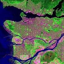
The Pitt River Bridge is a cable-stayed bridge that spans the Pitt River between Port Coquitlam and Pitt Meadows in British Columbia, Canada. The bridge is part of Highway 7, carrying Lougheed Highway across the river. The current bridge opened on October 4, 2009. The bridge includes a 380 m cable stay bridge structure, 126 m of multi-span approaches, a 50 m interchange structure and approximately 2 km of grade construction. Total project cost for the bridge was $200 million[2]
Pitt River Bridge (2009) | |
|---|---|
 | |
| Coordinates | 49.2482°N 122.7297°W |
| Carries | Seven lanes of British Columbia Highway 7, pedestrians and bicycles |
| Crosses | Pitt River |
| Locale | Port Coquitlam Pitt Meadows |
| Maintained by | British Columbia Ministry of Transportation |
| Preceded by | Pitt River Bridge (1957, 1978) |
| Characteristics | |
| Design | Cable-stayed bridge |
| History | |
| Opened | October 4, 2009 |
| Statistics | |
| Daily traffic | 79,000[1] |

| |
Original bridge
Pitt River Bridge (1957, 1978) | |
|---|---|
 | |
| Coordinates | 49.2748°N 122.7301°W |
| Carries | Four lanes of British Columbia Highway 7, Lougheed Highway |
| Crosses | Pitt River |
| Locale | Port Coquitlam Pitt Meadows |
| Maintained by | British Columbia Ministry of Transportation |
| Followed by | Pitt River Bridge (second, 2009) |
| Characteristics | |
| Design | swing bridge |
| History | |
| Opened | 1957 (Westbound span), 1978 (Eastbound span) |
| Closed | October 4, 2009 (demolished November 2010) |
|
| |
The original Pitt River Bridge (southern) span opened in 1957 by Premier W. A. C. Bennett. The second (northern) span was built in the 1978. The mid-swing span of the south span sometimes did not seat properly in the closed position, becoming stuck and causing very long traffic line-ups (especially before the north span was built), but this problem was fixed many years ago. The control house also operated the lane control system.
Each of the two spans had two lanes. During the morning and evening commute times, a counterflow lane was opened so that the traffic was three lanes in one direction and one lane in the other.
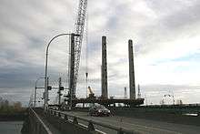
New bridge and Mary Hill Interchange Project
The original bridges were replaced with a cable-stayed bridge and a free-flowing interchange to replace the Mary-Hill Bypass–Lougheed intersection. On October 4, 2009, four lanes of the new bridge opened to general traffic, soon expanding to three lanes for westbound traffic and four for eastbound traffic. The new span has been engineered to allow for different lane allocations in the future, including an 8th lane and possible rapid transit. It also allows for up to 16 meters of vertical clearance for marine traffic. The new bridge structure was built between the two earlier bridges, which were subsequently demolished; all demolition was completed on November 22, 2010.
See also
- Gateway Program