West Point Grey
West Point Grey is a neighbourhood in the northwest of the city of Vancouver, British Columbia, Canada. It is located on Point Grey and is bordered by 16th Avenue to the south, Alma Street to the east, English Bay to the north, and Blanca Street to the west. Notable beaches within the West Point Grey boundary include Spanish Banks, Locarno and Jericho. Immediately to the south is Pacific Spirit Regional Park and to the east is Kitsilano.
West Point Grey | |
|---|---|
Neighbourhood | |
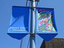 Street banners along 10th Avenue, near Sasamat Street | |
 Location of West Point Grey (in red) in Vancouver | |
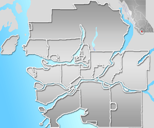 West Point Grey Location of West Point Grey in Metro Vancouver | |
| Coordinates: 49°15′52.48″N 123°11′59.08″W | |
| Country | Canada |
| Province | British Columbia |
| City | Vancouver |
| Government | |
| • Mayor | Kennedy Stewart |
| • City Council | Vancouver City Council |
| Area | |
| • Total | 4.45 km2 (1.72 sq mi) |
| Population (2016)[2] | |
| • Total | 13,065 |
| • Density | 2,935/km2 (7,600/sq mi) |
| Time zone | UTC−08:00 (PST) |
| • Summer (DST) | UTC−07:00 (PDT) |
| Postal Code | V6R |
| Area code(s) | 604, 778, 236, 672 |
| Website | City of Vancouver neighbourhood profile |
In 2016, West Point Grey had an estimated population] of 13,065 of the total 631,485 residents in the City of Vancouver.[3] Its population has remained relatively stable from 2011, when it was 12,795. The 2016 Canadian Census reported a median household income of $84,951 in the neighbourhood, which was nearly $20,000 higher than the City of Vancouver median income of $65,423.[4] The most common mother tongue in 2016 was English at 63.6 percent, with Chinese second at 18.9 percent. In 2001, English was at 75.1 percent and Chinese second at 9.3 percent.
Schools within the West Point Grey Boundary include Lord Byng Secondary School, Our Lady of Perpetual Help, Queen Elizabeth Elementary School, Queen Mary Elementary School, École Jules Quesnel and the private pre-kindergarten to Grade 12 school West Point Grey Academy.
The main commercial strip with shops and restaurants is along West 10th Avenue between Tolmie Street and Discovery Street. North of West 4th Avenue, the area slopes steeply downhill where it meets English Bay at Locarno Beach and the Spanish Banks.
Fiesta Days, a family oriented carnival, is held along 10th Avenue and at Trimble Park in June, with rides, games, performances and a parade.
References
- "West Point Grey" (PDF). vancouver.ca. Government of the City of Vancouver. Retrieved 12 March 2020.
- "West Point Grey" (PDF). vancouver.ca. Government of the City of Vancouver. Retrieved 12 March 2020.
- https://vancouver.ca/files/cov/West%20Point%20Grey-census-data.pdf
- "West Point Grey Census Data" (PDF). The City of Vancouver. 2016. Retrieved June 12, 2020.
- "Canada Lands Company- Jericho Lands". Canada Lands Company. 2020. Retrieved June 12, 2020.
- "Inspire Jericho". Inspire Jericho. 2020. Retrieved June 12, 2020.
- "Jericho Lands Planning Program". The City of Vancouver. 2020. Retrieved June 12, 2020.
- Legends of Vancouver E. Pauline Johnson [aka Tekahionwake] (1862-1913). Vancouver & Victoria, B.C.: David Spencer, Limited, 1911, p. 83
External links
- City of Vancouver Neighbourhood Profile

Places adjacent to West Point Grey | |
|---|---|