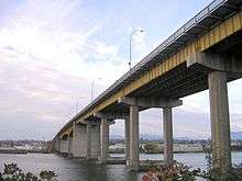
Oak Street Bridge
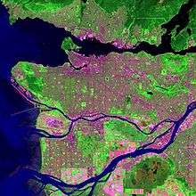
The Oak Street Bridge is a crossing over the north arm of the Fraser River, the Canada Line, and several roads, in Metro Vancouver.
Oak Street Bridge | |
|---|---|
 | |
| Coordinates | 49°11′59″N 123°07′32″W |
| Carries | Four lanes of British Columbia Highway 99, and pedestrians/bicycles |
| Crosses | North Arm Fraser River |
| Locale | Vancouver-Richmond |
| Maintained by | British Columbia Ministry of Transportation and Infrastructure |
| Characteristics | |
| Design | girder bridge |
| History | |
| Opened | 1 July 1957 |

| |
History
Infrastructure
During the planning stage, it was known as the New Marpole Bridge,[1] and steel plate girders salvaged from the second Granville Street Bridge made barges for constructing the foundations of the Oak St. Bridge.[2]
Opened in July 1957, the same date as the Moray Bridge, these links replaced the Marpole Bridge (road). The new configuration created a more circuitous route between Vancouver and Vancouver International Airport (YVR), not restored until the Arthur Laing Bridge opened in 1975.[3] Initially, the highway ended at No. 4 Rd,[4] short of connecting with No. 5 Rd. and the Ladner Ferry. A primary objective was to create a fast route to the U.S. border, partially realized on the 1959 opening of the Deas Tunnel, and fully with the 1962 opening of Highway 99 to the border. A branch connected to the new Tsawwassen ferry terminal.[5]
Vancouver regarded the bridge as a source of unwanted traffic.[6] Despite federal promises to share construction costs, the province ended up wholly financing the project.[7] Costing about $9m, the structure is 1,839.2 metres (6,034 ft) long.[8] The main spans comprise haunched (deeper at supports) steel girders and the approaches are steel or concrete girders. The central heavy steel deck plate girders, continuous over three spans, measure 60.9 metres (200 ft), 91.4 metres (300 ft), and 60.9 metres (200 ft).[9] The freeway standard of Highway 99 ends where the bridge joins the Vancouver surface street grid. Average daily crossings were 85,000 cars in 2000.[10] Averaging 18,000 cars on opening,[8] summer daily averages were 70,000 in 1970,[11] 74,000 in 1975,[12] and 71,000 in 1980.[13]
The Ministry of Transportation and Infrastructure for BC owns and maintains[14] this high-level four-lane bridge. Cyclists are legally required to ride on the sidewalks.[15]
Tolls
The premier announced that the 25-cent toll would remain for 12½ years[16] to cover construction costs for both the Oak St. and Moray bridges.[17] A week later, he revised this to two years, a promise not fulfilled. Initially to avoid tolls, most traffic used the Fraser Street Bridge, causing massive congestion, leaving Oak St. Bridge underused.[16] Toll plazas existed on Sea Island Way and on the highway south off the bridge.[18][19]
On opening, the Deas Tunnel toll was 50 cents, but a combined tunnel/bridge ticket was 60 cents.[20][21]
However, weekly tickets offered huge savings. A book of 24 tickets usable at each crossing cost $1.25, amended to $1 for 20 tickets from June 1960.[22]
The premier announced that tolls would be lifted from all highways on April 1, 1964,[23] but were removed at 7:30 pm the previous evening.[24] George Massey, after whom the tunnel was renamed, and an outspoken opponent of the tolls, paid the final toll at the bridge that evening.[16] The toll booths were removed and the roadway narrowed accordingly.[25]
Later, the Coquihalla Highway had staffed toll booths (1986–2008), and electronic tolling operated on the new Golden Ears (2009–2017), and Port Mann (2012–2017) bridges.
Maintenance, upgrades and incidents
During the morning rush hour of November 27, 1959, heavy fog and road ice caused pileups that damaged 150 cars. The largest involved 35 cars, the next 23 and the third 18. Seven people went to hospital.[26]
In 1964, a driver, who suffered stroke, plunged off the south end. Sustaining minor injuries from the accident, he died in hospital.[27]
The Oak St. Bridge/Highway 99 interchange with Bridgeport Rd./Sea Island Way was modified in 1969–70,[28] and 2001.[29] Despite extensive work on the bridge deck expansion joints in 1973–74,[30] they were rebuilt during 1976–78, and the deck repaved.[31][32] In 1980–81, major pier protection occurred.[13]
In 1995, owing to extensive deterioration of the bridge deck and precast sidewalk panels, two lanes were closed alternately[33] for resurfacing the deck with a high performance concrete, followed by a waterproof membrane, and asphalt. Recent traffic accidents that highlighted important safety deficiencies prompted the installation of no-posts at the median and curbs. The deck joints were again replaced, and deteriorated concrete on the bridge underside removed and patched.[34]
The cast-in-place concrete girders of the southern approach were vulnerable to collapse from movements during soil liquefaction. To strengthen the under-reinforced girders, glass fibre reinforced polymer wraps, the most flexible of possible composites, were chosen. Installed over four separate contracts, the seismic retrofit was completed in 2002.[35]
Neighbourhood redevelopment

Oak St. Bridge in background
After the bridge opened, more than 50 stores at Hudson and Marine Drive closed from lost business. Low-rise stucco apartments replaced older houses. Once the Arthur Laing Bridge opened, Granville Street developed as the commercial centre.[36]
At the south end of the Oak St. Bridge, construction started in 1960 on the first hotel at the highway interchange. Opening in 1962, the 62-room motor inn, initially called Delport Inn, then Airport Inn, was the birth of the Delta Hotels chain.[37][38] Construction beginning in 1971, the 14-storey tower that opened the next year was the tallest building in Richmond. The project added 144 new suites, and included renovating and expanding the existing amenities. The property is now branded the Sandman Signature Hotel.[39]
Other hotels built in the immediate vicinity, and their current branding, are the Abercorn Inn (1981),[40] Travelodge Hotel (1984),[41] Accent Inn (1988),[42] and Sandman Hotel Airport (1999).[43]
On cleared land hugging the east side of the southern approach, two midrise office buildings and two hotels are under construction.[44] The Courtyard by Marriott and Residence Inn by Marriott brand hotels will provide 201 rooms.[45]
Transit
The following TransLink service continues to use the bridge:[46]
- 480 UBC / Bridgeport Station (since Apr 2011)[47]
480 UBC / Richmond–Brighouse Station) (Sep 2009–Apr 2011)[48]
480 Richmond (Centre) / UBC (Sep 2000–Sep 2009)[49]
480 Steveston / UBC (peak period service Sep–Apr; Sep 1990–Apr 2000;[50] then spring/summer 2000)[51]
480 Richmond (Centre) / UBC (peak period service Sep–Apr; Sep 1980–Mar 1981)[52][53]
The following routes once used the bridge:
- 60 Richmond Express (Feb 1958;[54][55] Aug 1977 replaced by renumbered Richmond routes that continued to Vancouver)[56]
- 61 No. 1 Rd. (Jan 1974 for peak period express service;[57] Aug 1977 renumbered 401)
- 62 No. 2 Rd. (Jan 1974 for peak period express service;[57] Aug 1977 renumbered 402)
- 63 No. 3 Rd. (Jan 1974 for peak period express service;[57] Aug 1977 renumbered 403)
- 66 Railway (Jan 1974 for peak period express service;[57] Aug 1977 renumbered 406)
- 68 Garden City (Jan 1974 for peak period express service;[57] possibly Aug 1977 when renumbered 408)
- 71 Airport Rd. (Jul 1957 after Marpole Bridge closure;[58][59] Feb 1958 renamed 71 Airport and terminated at Sexsmith Loop)[55]
- 72 Grauer Rd. (Jul 1957 after Marpole Bridge closure;[58][59] Feb 1958 renamed 72 Miller and terminated at Sexsmith Loop)[55]
- 73 No. 2 Rd-No. 5 Rd. (Jul 1957 after Marpole Bridge closure;[58][59] Feb 1958 replaced by 62 No. 2 Rd that terminated at Sexsmith Loop, and 65 No. 5 Rd that terminated at No. 4 Rd./Steveston Hwy)[55]
- 74 No. 3 Rd-No. 4 Rd. (Jul 1957 after Marpole Bridge closure;[58][59] Feb 1958 replaced by 63 No. 3 Rd. and 64 No. 4 Rd. that both terminated at Sexsmith Loop)[55]
- 310 Scottsdale Mall / Vancouver (Apr 1987;[60] Sep 1990 rerouted)[61]
- 311 Scottsdale Mall / Vancouver (Apr 1987;[60] Sep 2009 terminated at Bridgeport Station)[48]
- 351 North Bluff / Vancouver (formerly 650; Aug 1977;[56] renamed Crescent Beach in Jun 1987;[62] Sep 2009 terminated at Bridgeport station)[48]
- 352 Crescent Road / Vancouver (pre-Jan 1979 peak period express renumbered from 652;[63] Jun 1987 renamed White Rock Centre;[62] in the 2000s renamed Ocean Park / Vancouver;[64] Sep 2009 terminated at Bridgeport station)[48]
- 353 Marine Drive / Vancouver (c.1980 peak period express renumbered from 653;[65] by Jun 1987 renamed Ocean Park / 22nd Street station, the new terminus)[62][66]
- 354 White Rock South / Vancouver (Mar 1985 peak period express;[67] c. 2000 renamed White Rock / Vancouver;[68] Sep 2009 terminated at Bridgeport station)[48]
- 401 No. One Road / Vancouver (formerly 61; Aug 1977 initially for peak periods;[56] May 1984 renamed 401 One Road / Vancouver;[69] became all day service;[70] April 2001 renamed 401 One Road / Garden City)[71][72]
- 402 No. Two Road / Vancouver (formerly 62; Aug 1977 initially for peak periods;[56] May 1984 renamed 402 Two Road / Vancouver;[69] May 1986 during peak periods rerouted over Arthur Laing Bridge;[73] April 2001 renamed 402 Two Road / Bridgeport)[71][72]
- 403 No. Three Road / Vancouver (formerly 63; Aug 1977 initially for peak periods;[56] May 1984 renamed 403 Three Road / Vancouver;[69] became all day service;[74] April 2001 renamed 403 Three Road / Richmond Centre)[71][72]
- 406 Railway / Vancouver (formerly 66; Aug 1977 initially for peak periods;[56] became all day service;[75] April 2001 renamed 410 22nd St Station / Railway)[71][72]
- 407 Gilbert / Vancouver (Aug 1977 peak periods;[56] May 1986 during peak periods rerouted over Arthur Laing Bridge May 1986;[73] became all day service;[76] April 2001 renamed 407 Gilbert / Richmond Centre)[71][72]
- 408 Garden City / Richmond Exchange / Vancouver (formerly 68; peak periods possibly Aug 1977;[77] May 1986 during peak periods rerouted over Arthur Laing Bridge;[73] April 2001 discontinued)[71][72]
- 488 Garden City / Burrard Station (Apr 2002 peak period express;[78] Sep 2009 discontinued)[48]
- 490 Steveston / Burrard Station (Sep 1986 peak period express;[79] Sep 2009 discontinued)[48]
- 492 Two Road / Burrard Station (Apr 2002 peak period express;[78] Sep 2009 discontinued)[48]
- 601 South Delta / Boundary Bay / Vancouver (c.1977;[80][81][82] Sep 2009 terminated at Bridgeport Station)[48]
- 602 Tsawwassen Heights / Vancouver (Apr 1975 peak period express;[83] Sep 2009 terminated at Bridgeport station)[48]
- 603 Tsawwassen Ring / Vancouver (May 1975 peak period express;[80][84] Mar 1985 split into 603 Beach Grove / Vancouver and 604;[85] Sep 2009 terminated at Bridgeport station)[48]
- 604 English Bluff / Vancouver (Mar 1985 peak period;[85] Sep 2009 terminated at Bridgeport station)[48]
- 606 Ladner Ring / Vancouver (formerly from Vancouver leg of 608; Mar 1985 peak period express;[85] c.2007 became local service only)[86]
- 608 Ladner Ring / Vancouver (May 1975 peak period express;[84][80] Mar 1985 became to Vancouver leg of 608;[85] c.2007 became local service only)[86][87]
- 610 North Delta / Vancouver (May 1975 peak period express;[80][88] possibly 1986 opening of Alex Fraser Bridge when discontinued)
- 614 Sunbury / Vancouver (Oct 1975 peak period express;[80][89] possibly[65]1986 opening of Alex Fraser Bridge when discontinued as 314 extension)
- 650 Deas Island / Vancouver (Apr 1975 peak period express;[83][89] Aug 1977 replaced by 351)
- 652 Crescent Road / Vancouver (May 1976 peak period express;[90] renumbered as existing local route 352)
- 653 Marine Drive / Vancouver (May 1976 peak period express;[90] renumbered as existing local route 353)
The following bus stops on SW Marine Dve., beside the north approach to the bridge, are nearest:[46]
- 10 Granville (since Aug 2009)[91]
- 17 Oak (existed before the bridge)[92]
- 100 22nd Street Station / Marpole Loop (since Sep 2009)[48]
100 22nd Street Station / Airport Station (Aug 2001–Sep 2009)[71]
100 New Westminster Station/Airport (Oct 1984–Apr 2001)[93]
100/800 Midway Connector (renumbered by 1979)[94]
800 Midway Connector (1970s)[95]
W3 Marpole-8th Ave-2nd St (1960s)[96]
W5 Marpole-New Westminster (existed before the bridge)[97][98] - 480 UBC / Bridgeport station (see above)
The following bus stops on Bridgeport Rd., beside the south approach to the bridge, are nearest:[46]
Footnotes
- "The Daily Colonist, 13 Jan 1954". www.archive.org.
- "Image: Oak St, Bridge piers". www.archives.richmond.ca.
- Dawe 1996, p. 47.
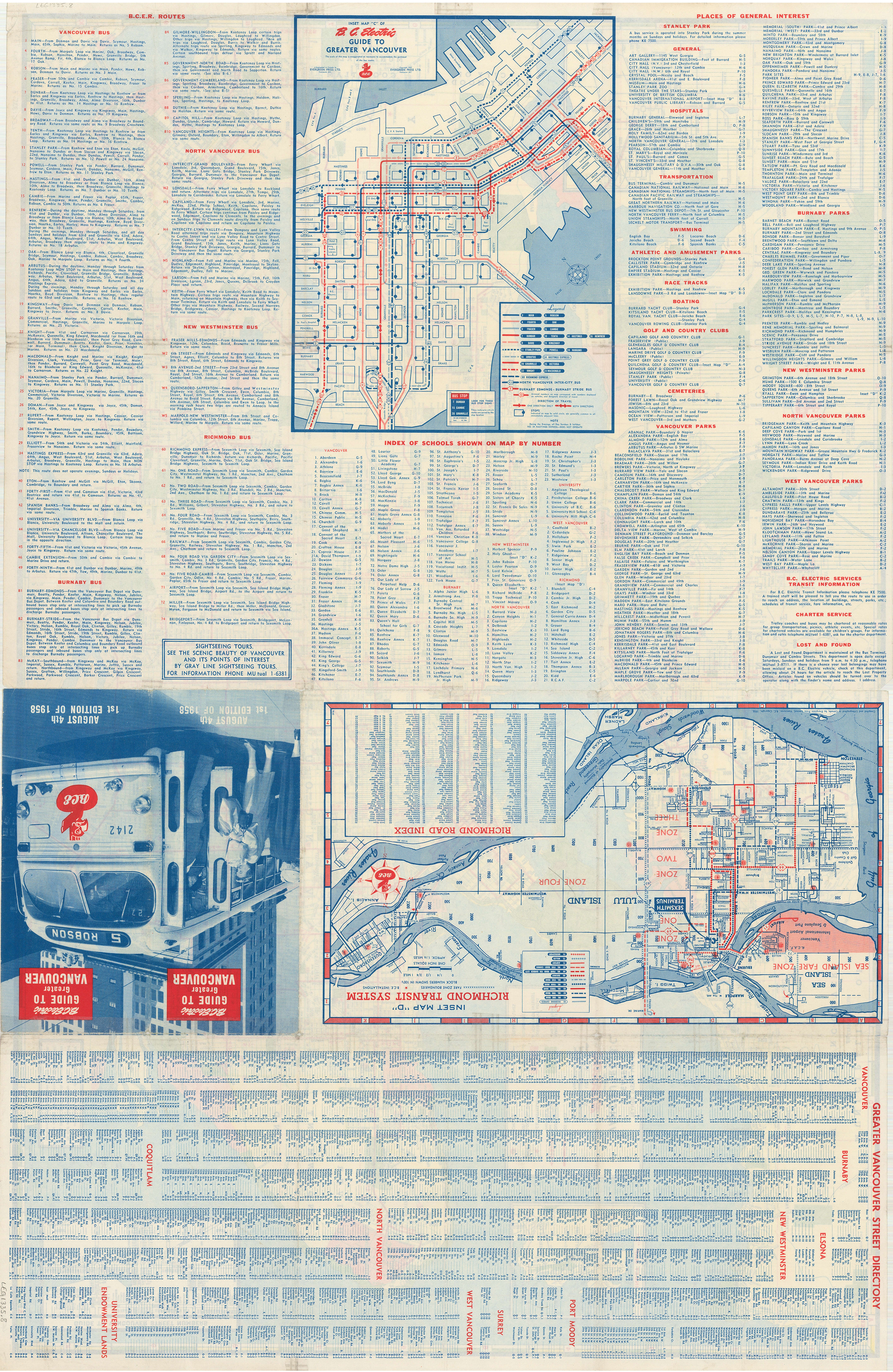
- "Image: Transit route map, 1957". www.vancouver.ca. Evergreen Press for BCER.
- Dawe 1996, p. 48.
- "The Daily Colonist, 6 Mar 1955". www.archive.org.
- Dawe 1996, p. 49.
- "The Daily Colonist, 20 Jul 1971". www.archive.org.
- "Structure of the Oak St. Bridge". www.structurae.net.
- "Frontier to Freeway" (PDF). www2.gov.bc.ca. p. 29.
- "Highways Annual Report 1970–71". www.open.library.ubc.ca. p. B71.
- "Highways and Public Works Annual Report 1975–76". www.open.library.ubc.ca. p. B58.
- "Transportation and Highways Annual Report 1980–81". www.open.library.ubc.ca. pp. 270 & 419.
- "Transportation Agencies". www.richmond.ca.
- "Cycling: Bridge Crossings". www.richmond.ca.
- Dawe 1996, p. 50.
- "The Daily Colonist, 22 Jul 1955". www.archive.org.
- "Vancouver street map, 1962". www.vancouver.ca.
- "Image: Southeastward showing toll plaza, Delport Inn, and Cambie Rd. underpass, c.1963". www.reddit.com.
- "The Daily Colonist, 21 May 1959". www.archive.org.
- "The Daily Colonist, 26 May 1960". www.archive.org.
- "The Daily Colonist, 29 Jun 1960". www.archive.org.
- "The Daily Colonist, 22 Aug 1963". www.archive.org.
- "The Daily Colonist, 1 Apr 1964". www.archive.org.
- "Highways Annual Report 1964–65". www.open.library.ubc.ca. p. C153.
- "The Daily Colonist, 28 Nov 1959". www.archive.org.
- "The Daily Colonist, 2 Jun 1964". www.archive.org.
- "Highways Annual Report 1969–70". www.open.library.ubc.ca. pp. C102 & C189.
- "Airport Connector bridge opening". www.canadianshipper.com.
- "Highways Annual Report 1973–74". www.open.library.ubc.ca. p. B115.
- "Highways and Public Works Annual Report 1976–77". www.open.library.ubc.ca. p. B98.
- "Highways and Public Works Annual Report 1977–78". www.open.library.ubc.ca. p. I27.
- Dawe 1996, p. 52.
- Hamersley, B.; Jennings, D. "Oak St. Bridge deck rehabilitation". Cite journal requires
|journal=(help) - "Seismic upgrade of Oak St. Bridge" (PDF). www.semanticscholar.org.
- "Marpole history". www.marpolehistorical.ca.
- "The Daily Colonist, 8 Mar 1968". www.archive.org.
- "Kelowna Daily Courier, 28 Jan 2015". www.kelownadailycourier.ca.
- "Reach for the Sky – The Dawn of the High-Rise in Richmond, 28 Nov 2019". www.richmondarchives.ca.
- "Abercorn Inn profile". www.travelweekly.com.
- "Travelodge Hotel profile". www.travelweekly.com.
- "Accent Inn profile". www.travelweekly.com.
- "Sandman Hotel Airport profile". www.travelweekly.com.
- "Two Marriot hotels coming to Richmond, 25 Apr 2019". www.westerninvestor.com.
- "Daily Hive, 6 Dec 2019". www.dailyhive.com.
- "Bus routes". www.translink.ca.
- "The Buzzer, 1 Apr 2011". www.translink.ca. TransLink.
- "The Buzzer, Canada Line opening, 4 Sep 2009". www.translink.ca. TransLink.
- "The Buzzer, 18 Aug 2000" (PDF). www.translink.ca. TransLink.
- "The Buzzer, 24 Aug 1990" (PDF). www.translink.ca. BC Transit.
- "The Buzzer, 31 Mar 2000" (PDF). www.translink.ca. TransLink.
- "The Buzzer, 19 Sep 1980" (PDF). www.translink.ca. Metro Transit.
- "The Buzzer, 18 Sep 1981" (PDF). www.translink.ca. Metro Transit.
- "The Buzzer, 21 Feb 1958" (PDF). www.translink.ca. BCER.
- "Image: Transit route maps, 1958". www.vancouver.ca. Evergreen Press for BCER.
- "The Buzzer, 12 Aug 1977" (PDF). www.translink.ca. BC Hydro.
- "The Buzzer, 4 Jan 1974" (PDF). www.translink.ca. BC Hydro.
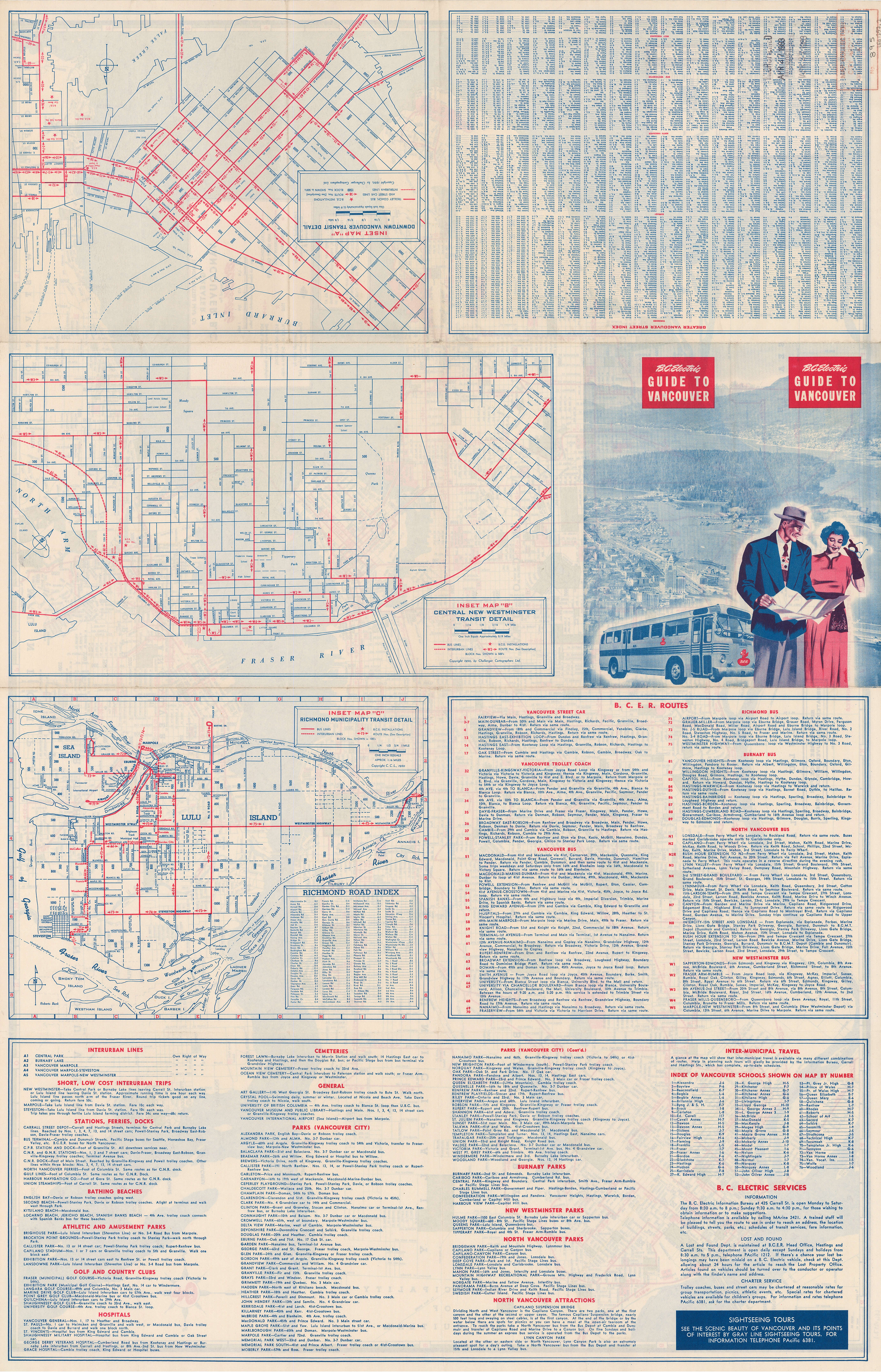
- "Image: Transit route maps, 1950". www.vancouver.ca. Challenger Cartographers for BCER.
- "The Buzzer, 8 Nov 1957" (PDF). www.translink.ca. BCER.
- "The Buzzer, 10 Apr 1987". www.translink.ca. BC Transit.
- "The Buzzer, 24 Aug 1990" (PDF). www.translink.ca. BC Transit.
- "The Buzzer, 19 Jun 1987" (PDF). www.translink.ca. BC Transit.
- "The Buzzer, 12 Jan 1979" (PDF). www.translink.ca. BC Hydro.
- "The Buzzer, 20 Jun 2008" (PDF). www.translink.ca. BC Transit.
- "The Buzzer, 3 Sep 1982" (PDF). www.translink.ca. Metro Transit.
- "The Buzzer, 27 Mar 1987" (PDF). www.translink.ca. BC Transit.
- "The Buzzer, 1 Mar 1985" (PDF). www.translink.ca. Metro Transit.
- "The Buzzer, 18 Apr 2003" (PDF). www.translink.ca. TransLink.
- "The Buzzer, 25 May 1984" (PDF). www.translink.ca. Metro Transit.
- "401 One Road / Vancouver". www.cmbuslink.com. Archived from the original on 2000-01-18.
- "The Buzzer, 30 Mar 2001" (PDF). www.translink.ca. TransLink.
Bus strike Apr–Aug
- "Implementation of 98 B-line" (PDF). www.richmond.ca.
- "The Buzzer, 30 Apr 1986" (PDF). www.translink.ca. BC Transit.
- "403 Three Road / Vancouver". www.cmbuslink.com. Archived from the original on 2001-01-08.
- "406 Railway / Vancouver". www.cmbuslink.com. Archived from the original on 2001-01-06.
- "407 Gilbert / Vancouver". www.cmbuslink.com. Archived from the original on 2001-01-08.
- "The Buzzer, 1 Jun 1979" (PDF). www.translink.ca. BC Hydro.
- "The Buzzer, 5 Apr 2002" (PDF). www.translink.ca. TransLink.
- "The Buzzer, 14 Aug 1986" (PDF). www.translink.ca. BC Transit.
- "The Buzzer, 24 Oct 1975" (PDF). www.translink.ca. BC Hydro.
- "The Buzzer, 15 Dec 1978" (PDF). www.translink.ca. BC Hydro.
- "The Buzzer, 11 Jan 1980" (PDF). www.translink.ca. BC Hydro.
- "The Buzzer, 28 Mar 1975" (PDF). www.translink.ca. BC Hydro.
- "The Buzzer, 9 May 1975" (PDF). www.translink.ca. BC Hydro.
- "The Buzzer, 15 Mar 1985" (PDF). www.translink.ca. Metro Transit.
- "The Buzzer, 25 Nov 2005" (PDF). www.translink.ca. TransLink.
- "The Buzzer, 13 Apr 2007" (PDF). www.translink.ca. TransLink.
- "The Buzzer, 23 May 1975" (PDF). www.translink.ca. BC Hydro.
- "The Buzzer, 28 Oct 1975" (PDF). www.translink.ca. BC Hydro.
- "The Buzzer, 7 May 1976" (PDF). www.translink.ca. BC Hydro.
- "The Buzzer, 7 Aug 2009" (PDF). www.translink.ca. TransLink.
- "The Buzzer, 20 Mar 1953" (PDF). www.translink.ca. BCER.
- "The Buzzer, 12 Oct 1984" (PDF). www.translink.ca. Metro Transit.
- "The Buzzer, 9 Feb 1979" (PDF). www.translink.ca. BC Hydro.
- "The Buzzer, 24 Sep 1976" (PDF). www.translink.ca. BC Hydro.
- "The Buzzer, 27 Dec 1963" (PDF). www.translink.ca. BC Hydro.
- "Image: Transit route map, 1950". www.vancouver.ca. Challenger Cartographers for BCER.
- "Image: Transit route map, 1958". www.vancouver.ca. Evergreen Press for BCER.
- "The Buzzer, 24 Dec 2004". www.translink.ca. TransLink.
References
- Dawe, Alan (1996). Richmond and its Bridges. City of Richmond Archives. ISBN 0-9690031-2-9.CS1 maint: ref=harv (link)