Phu Khiao District
Phu Khiao (Thai: ภูเขียว, pronounced [pʰūː kʰǐa̯w]) is a district (amphoe) in the northern part of Chaiyaphum Province, northeastern Thailand.
Phu Khiao ภูเขียว | |
|---|---|
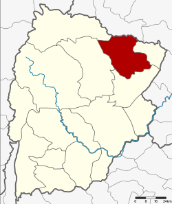 District location in Chaiyaphum Province | |
| Coordinates: 16°22′35″N 102°7′43″E | |
| Country | Thailand |
| Province | Chaiyaphum |
| Seat | Phak Pang |
| Area | |
| • Total | 801.8 km2 (309.6 sq mi) |
| Population (2000) | |
| • Total | 120,792 |
| • Density | 150.7/km2 (390/sq mi) |
| Time zone | UTC+7 (ICT) |
| Postal code | 36110 |
| Geocode | 3610 |
History
Phu Khiao was a city (mueang) in the early years of the Rattanakosin Kingdom era at the end of the 18th century. The center of the city was in Ban Mueang Kao (which now is in Kaset Sombun District). The governor was Phraya Krai Singhanat. When the city grew, Phraya Krai Singhanat (Ruecha) moved the center of the city to Ban Kut Chueak. His son, the next governor Phraya Krai Singhanat (Bunma), was promoted by the government in Bangkok to be Phraya Phakdi Ruechai Changwang. Again he moved the city center to Ban Non Salao.
During the Thesaphiban administrative reforms Mueang Phu Khiao was downgraded to be a district of Chaiyaphum Province in 1899.
It was later renamed Phak Pang after the central tambon, and changed back to Phu Khiao in 1939.[1]
Geography
Neighboring districts are (from the north clockwise): Chum Phae of Khon Kaen Province; Ban Thaen, Kaeng Khro, Kaset Sombun, and Khon San of Chaiyaphum Province.
Administration
The district is divided into 11 sub-districts (tambons).
| 1. | Phak Pang | ผักปัง | |
| 2. | Kwang Chon | กวางโจน | |
| 3. | Nong Khon Thai | หนองคอนไทย | |
| 4. | Ban Kaeng | บ้านแก้ง | |
| 5. | Kut Yom | กุดยม | |
| 6. | Ban Phet | บ้านเพชร | |
| 7. | Khok Sa-at | โคกสะอาด | |
| 8. | Nong Tum | หนองตูม | |
| 9. | O Lo | โอโล | |
| 10. | That Thong | ธาตุทอง | |
| 11. | Ban Don | บ้านดอน |
References
- พระราชกฤษฎีกาเปลี่ยนนามอำเภอ กิ่งอำเภอ และตำบลบางแห่ง พุทธศักราช ๒๔๘๒ (PDF). Royal Gazette (in Thai). 56 (0 ก): 354–364. 17 April 1939.