Sap Yai District
Sap Yai (Thai: ซับใหญ่, pronounced [sáp jàj]) is a district (amphoe) of Chaiyaphum Province, northeastern Thailand.
Sap Yai ซับใหญ่ | |
|---|---|
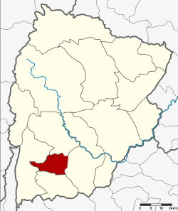 District location in Chaiyaphum Province | |
| Coordinates: 15°38′30″N 101°37′48″E | |
| Country | Thailand |
| Province | Chaiyaphum |
| Seat | Sap Yai |
| Area | |
| • Total | 171.0 km2 (66.0 sq mi) |
| Population (2005) | |
| • Total | 13,466 |
| • Density | 78.8/km2 (204/sq mi) |
| Time zone | UTC+7 (ICT) |
| Postal code | 36130 |
| Geocode | 3616 |
History
The minor district was separated from Chatturat District on 1 July 1997.[1]
On 15 May 2007, all 81 minor districts were upgraded to full districts.[2] On 24 August the upgrade became official.[3]
Geography
Neighboring districts are (from the north clockwise): Nong Bua Rawe, Chatturat, Bamnet Narong, and Thep Sathit.
Administration
The district is divided into three subdistricts (tambons), which are further subdivided into 33 villages (mubans). There are no municipal (thesaban) areas, and three tambon administrative organizations (TAO).
| No. | Name | Thai name | Villages | Pop. | |
|---|---|---|---|---|---|
| 1. | Sap Yai | ซับใหญ่ | 12 | 6,097 | |
| 2. | Tha Kup | ท่ากูบ | 11 | 4,177 | |
| 3. | Tako Thong | ตะโกทอง | 10 | 3,192 |
References
- ประกาศกระทรวงมหาดไทย เรื่อง แบ่งเขตท้องที่อำเภอจัตุรัส จังหวัดชัยภูมิ ตั้งเป็นกิ่งอำเภอซับใหญ่ (PDF). Royal Gazette (in Thai). 114 (Special 51 ง): 6. 25 June 1997.
- แถลงผลการประชุม ครม. ประจำวันที่ 15 พ.ค. 2550 (in Thai). Manager Online.
- พระราชกฤษฎีกาตั้งอำเภอฆ้องชัย...และอำเภอเหล่าเสือโก้ก พ.ศ. ๒๕๕๐ (PDF). Royal Gazette (in Thai). 124 (46 ก): 14–21. 24 August 2007.
This article is issued from Wikipedia. The text is licensed under Creative Commons - Attribution - Sharealike. Additional terms may apply for the media files.