National Register of Historic Places listings in York County, Maine
This is a list of the National Register of Historic Places listings in York County, Maine.
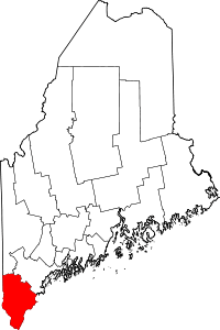
Location of York County in Maine
This is intended to be a complete list of the properties and districts on the National Register of Historic Places in York County, Maine, United States. Latitude and longitude coordinates are provided for many National Register properties and districts; these locations may be seen together in a map.[1]
There are 181 properties and districts listed on the National Register in the county, including 5 National Historic Landmarks. Another two properties were once listed but have been removed.
- This National Park Service list is complete through NPS recent listings posted June 19, 2020.[2]
| Androscoggin - Aroostook - Cumberland - Franklin - Hancock - Kennebec - Knox - Lincoln - Oxford - Penobscot - Piscataquis - Sagadahoc - Somerset - Waldo - Washington - York |
Current listings
| [3] | Name on the Register[4] | Image | Date listed[5] | Location | City or town | Description |
|---|---|---|---|---|---|---|
| 1 | Alfred Historic District | 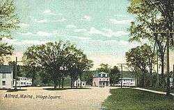 Alfred Historic District |
April 28, 1983 (#83000479) |
Kennebunk and Saco Rds. 43°28′24″N 70°42′58″W |
Alfred | |
| 2 | Alfred Shaker Historic District | 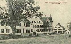 Alfred Shaker Historic District |
April 11, 2001 (#01000371) |
Both sides of Shaker Hill Rd. 43°29′55″N 70°42′41″W |
Alfred | |
| 3 | Arundel Golf Club |  Arundel Golf Club |
November 4, 2009 (#09000879) |
19 River Rd. 43°22′26″N 70°28′40″W |
Kennebunkport | |
| 4 | Austin-Hennessey Homestead |  Austin-Hennessey Homestead |
December 27, 1979 (#79000171) |
433 Branch Rd., at Burnt Mill Rd. 43°20′44″N 70°37′09″W |
Wells | Also known as the Storer-Hennessey Homestead |
| 5 | Caleb R. Ayer House |  Caleb R. Ayer House |
October 31, 2002 (#02001270) |
7 Main St. 43°48′16″N 70°48′15″W |
Cornish | |
| 6 | Samuel Badger Monument |  Samuel Badger Monument |
January 7, 1998 (#97001640) |
in a small graveyard behind 16 Otis Ave 43°05′12″N 70°44′42″W |
Kittery Foreside | |
| 7 | Barrell Homestead |  Barrell Homestead |
December 12, 1976 (#76000195) |
71 Beech Ridge Rd. 43°08′41″N 70°42′28″W |
York Beach | |
| 8 | Berwick Academy | 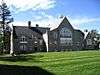 Berwick Academy |
March 29, 1978 (#78000336) |
Academy St.; also along the eastern side of Academy St., 0.15 miles (0.24 km) south of its junction with State Route 236 43°13′48″N 70°48′18″W |
South Berwick | Second set of addresses represents a boundary increase March 22, 1996 |
| 9 | Berwick High School | 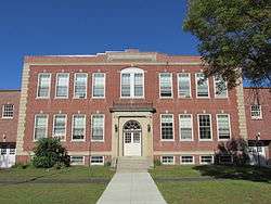 Berwick High School |
January 27, 2012 (#11001059) |
45 School St. 43°16′08″N 70°51′39″W |
Berwick | Berwick's high school 1928-2001. |
| 10 | Biddeford City Hall | 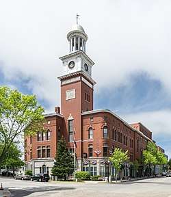 Biddeford City Hall |
April 24, 1973 (#73000156) |
205 Main St. 43°29′36″N 70°27′26″W |
Biddeford | Rebuilt 1895-96, John Calvin Stevens, architect. |
| 11 | Biddeford Main Street Historic District |  Biddeford Main Street Historic District |
December 24, 2009 (#09001146) |
29 to 316 Main St., and portions of Elm, Jefferson, Adams, Washington, Franklin, Alfred and Water Sts. 43°29′36″N 70°27′19″W |
Biddeford | |
| 12 | Biddeford-Saco Mills Historic District | 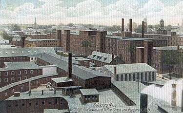 Biddeford-Saco Mills Historic District |
December 30, 2008 (#08001258) |
Bounded by Pearl, Lincoln, York and Main Sts., Biddeford, Gooch and Saco Sts. 43°29′38″N 70°27′18″W |
Biddeford | Detailed aerial map |
| 13 | Blazo-Leavitt House | 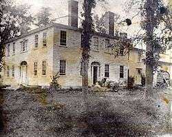 Blazo-Leavitt House |
February 19, 1982 (#82000791) |
State Route 160 43°45′43″N 70°56′24″W |
Parsonsfield | |
| 14 | Boon Island Light Station | 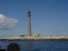 Boon Island Light Station |
March 14, 1988 (#88000153) |
Boon Island 43°07′03″N 70°28′06″W |
York | |
| 15 | Bourne Mansion | 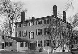 Bourne Mansion |
January 24, 1980 (#80000381) |
8 Bourne St. 43°23′12″N 70°32′26″W |
Kennebunk | |
| 16 | Brave Boat Harbor Farm | October 30, 2007 (#07001153) |
110 Raynes Neck Rd. 43°06′15″N 70°39′03″W |
York | ||
| 17 | Bray House | 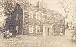 Bray House |
October 9, 1979 (#79000271) |
Pepperell Rd. 43°04′58″N 70°42′10″W |
Kittery Point | |
| 18 | Isabella Breckinridge House | April 28, 1983 (#83000480) |
201 U.S. Route 1 43°08′27″N 70°41′18″W |
York | ||
| 19 | Royal Brewster House | 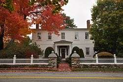 Royal Brewster House |
June 5, 1975 (#75000116) |
Buxton Lower Corner 43°36′22″N 70°32′09″W |
Buxton | |
| 20 | Buxton Powder House | 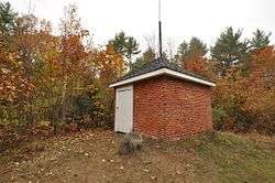 Buxton Powder House |
January 2, 1976 (#76000120) |
State Route 22 43°38′54″N 70°32′47″W |
Buxton Center | |
| 21 | Cape Arundel Summer Colony Historic District | 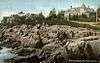 Cape Arundel Summer Colony Historic District |
August 16, 1984 (#84001549) |
Roughly bounded by Chick's Creek, Ocean Ave., S. Main St., Endcliff Rd., and Walkers Point 43°20′41″N 70°28′04″W |
Kennebunkport | |
| 22 | Cape Neddick Light Station | Cape Neddick Light Station |
April 16, 1985 (#85000844) |
Cape Neddick 43°09′55″N 70°35′30″W |
York | |
| 23 | Capt. Josiah E. Chase Octagon House |  Capt. Josiah E. Chase Octagon House |
March 25, 1987 (#87000431) |
Chase's Mill Rd. 43°43′39″N 70°39′40″W |
East Limington | |
| 24 | George F. Clifford House |  George F. Clifford House |
April 22, 2010 (#10000230) |
17 High Rd. 43°48′16″N 70°48′10″W |
Cornish | |
| 25 | Clock Farm |  Clock Farm |
February 19, 1982 (#82000792) |
State Route 9 and Goose Rocks Rd. 43°24′20″N 70°25′39″W |
Kennebunkport | |
| 26 | Colonial Inn |  Colonial Inn |
July 31, 2012 (#12000454) |
145 Shore Rd. 43°14′41″N 70°35′48″W |
Ogunquit | |
| 27 | Conant-Sawyer Cottage |  Conant-Sawyer Cottage |
March 26, 1992 (#92000279) |
14 Kendall Rd. 43°10′22″N 70°35′59″W |
York Beach | |
| 28 | Conway Junction Railroad Turntable Site |  Conway Junction Railroad Turntable Site |
January 5, 1989 (#88003001) |
Fife Ln. and State Route 236 43°12′33″N 70°47′22″W |
South Berwick | |
| 29 | Cummings' Guest House |  Cummings' Guest House |
July 28, 2004 (#04000744) |
110 Portland Ave. 43°31′06″N 70°22′31″W |
Old Orchard Beach | |
| 30 | Cummings Shoe Factory |  Cummings Shoe Factory |
December 31, 2001 (#01001420) |
2 Railroad Ave. 43°14′14″N 70°49′18″W |
South Berwick | |
| 31 | Benjamin and Abigail Dalton House | 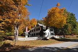 Benjamin and Abigail Dalton House |
April 14, 1997 (#97000311) |
Middle Rd east of the intersection with Merrill Hill Rd.[6] 43°43′37″N 70°55′42″W |
North Parsonsfield | Listed as "Address Restricted" in NRHP |
| 32 | J.G. Deering House |  J.G. Deering House |
February 17, 1982 (#82000793) |
371 Main St. 43°30′08″N 70°26′36″W |
Saco | |
| 33 | Dennett Garrison |  Dennett Garrison |
December 22, 1978 (#78000334) |
100 Dennett Rd. 43°06′03″N 70°45′35″W |
Kittery | |
| 34 | District No. 5 School |  District No. 5 School |
February 4, 2009 (#09000015) |
781 Gore Rd. 43°31′27″N 70°45′56″W |
Alfred | |
| 35 | Division No. 9 School | 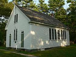 Division No. 9 School |
December 14, 1995 (#95001463) |
1760 N. Berwick Rd; southern side of State Route 9, 0.15 miles (0.24 km) east of its junction with Bragdon Rd. 43°18′23″N 70°41′27″W |
Wells | |
| 36 | Dorfield Farm | 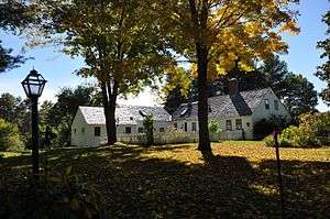 Dorfield Farm |
December 27, 1979 (#79000172) |
16 Dorfield Lane, off Harrisecket Rd. 43°21′29″N 70°34′02″W |
Wells | |
| 37 | Dudley Block | 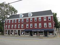 Dudley Block |
November 12, 1982 (#82000428) |
28-34 Water St. 43°29′32″N 70°27′01″W |
Biddeford | |
| 38 | Early Post Office | 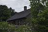 Early Post Office |
December 27, 1979 (#79000173) |
88 Crossing Road (Bragdon's Crossing) 43°19′15″N 70°36′13″W |
Wells | Also known as the Bragdon House |
| 39 | Eaton House | 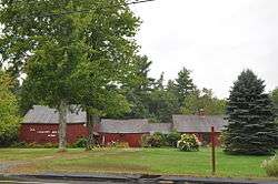 Eaton House |
December 27, 1979 (#79000174) |
Sanford Rd. 43°21′33″N 70°39′49″W |
Wells | Listed as being in the North Berwick vicinity. |
| 40 | Elden's Store | 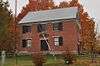 Elden's Store |
April 28, 1983 (#83000481) |
State Route 22 43°38′55″N 70°32′31″W |
Buxton | |
| 41 | Elder Grey Meetinghouse | 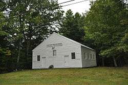 Elder Grey Meetinghouse |
October 9, 1979 (#79000175) |
North of North Waterboro 43°38′10″N 70°42′50″W |
North Waterboro | |
| 42 | Emery Homestead | 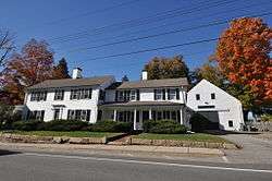 Emery Homestead |
June 22, 1980 (#80000379) |
1 and 3 Lebanon St. 43°26′26″N 70°46′43″W |
Sanford | |
| 43 | Emery House | 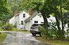 Emery House |
December 27, 1979 (#79000176) |
2449 Sanford Rd. 43°21′56″N 70°40′10″W |
Wells (Highpine) | |
| 44 | Emery School |  Emery School |
November 18, 2011 (#11000819) |
116 Hill St. 43°29′19″N 70°27′15″W |
Biddeford | |
| 45 | First Baptist Church | 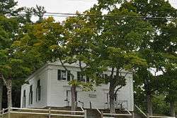 First Baptist Church |
June 28, 1988 (#88000886) |
Western side of the junction of West Rd. and Federal St. 43°32′16″N 70°44′12″W |
Waterboro | |
| 46 | First Congregational Church and Parsonage | 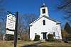 First Congregational Church and Parsonage |
December 18, 1978 (#78000333) |
Pepperrell Rd.; also along both sides of Whipple (Pepperell) Rd., 2.3 miles (3.7 km) east of its junction with U.S. Route 1 43°04′54″N 70°42′56″W |
Kittery Point | Second set of addresses represents a boundary increase |
| 47 | First Congregational Church of Buxton | 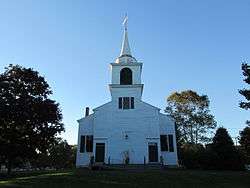 First Congregational Church of Buxton |
June 22, 1980 (#80000259) |
State Route 112 43°36′23″N 70°32′14″W |
Buxton | |
| 48 | First Congregational Church, Former | 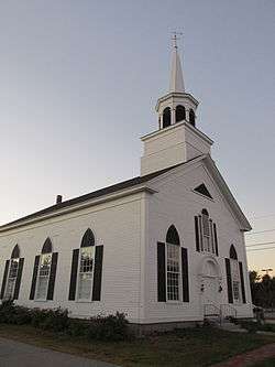 First Congregational Church, Former |
June 21, 1991 (#91000768) |
938 Post Road; southwestern corner of U.S. Route 1 and Buzzell Rd. 43°18′05″N 70°35′12″W |
Wells | Now a historical society museum. |
| 49 | First Parish Meetinghouse | 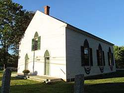 First Parish Meetinghouse |
October 26, 1972 (#72000080) |
Old Pool Rd. 43°28′31″N 70°24′56″W |
Biddeford | |
| 50 | James Montgomery Flagg House |  James Montgomery Flagg House |
April 23, 1980 (#80000260) |
St. Martin's Lane 43°27′00″N 70°20′38″W |
Biddeford | |
| 51 | Fletcher's Neck Lifesaving Station | 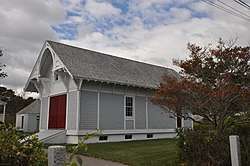 Fletcher's Neck Lifesaving Station |
November 1, 1974 (#74000195) |
Ocean Ave. 43°26′33″N 70°20′33″W |
Biddeford Pool | |
| 52 | William Fogg Library | 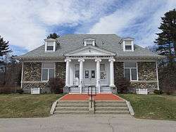 William Fogg Library |
December 21, 1991 (#91001817) |
Old Rd. 43°07′42″N 70°47′53″W |
Eliot | |
| 53 | Fort McClary | 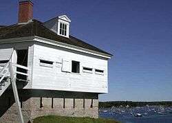 Fort McClary |
October 1, 1969 (#69000025) |
Off State Route 103 near Fort McClary State Park 43°04′54″N 70°42′39″W |
Kittery Point | |
| 54 | Levi Foss House |  Levi Foss House |
March 22, 1984 (#84001550) |
State Route 35 43°30′40″N 70°34′54″W |
Goodwins Mills | |
| 55 | Frank C. Frisbee Elementary School | 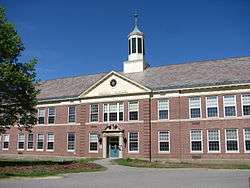 Frank C. Frisbee Elementary School |
April 25, 2012 (#12000229) |
120 Rogers Rd. 43°05′51″N 70°44′11″W |
Kittery | |
| 56 | Frost Garrison and House |  Frost Garrison and House |
June 27, 1971 (#71000045) |
Frost's Hill (Garrison Dr.) 43°09′42″N 70°44′56″W |
Eliot | |
| 57 | Goat Island Light Station | 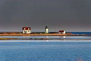 Goat Island Light Station |
March 23, 1988 (#87002268) |
Goat Island in Cape Porpoise Harbor 43°21′28″N 70°25′33″W |
Cape Porpoise | |
| 58 | Goodale-Bourne Farm |  Goodale-Bourne Farm |
December 27, 1979 (#79000177) |
N. Village Rd. 43°15′48″N 70°38′05″W |
Ogunquit | |
| 59 | Goodale-Stevens Farm |  Goodale-Stevens Farm |
December 27, 1979 (#79000178) |
N. Village Rd. 43°15′49″N 70°37′54″W |
Ogunquit | |
| 60 | Louis B. Goodall Memorial Library | 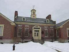 Louis B. Goodall Memorial Library |
January 24, 2008 (#07001448) |
952 Main St. 43°26′10″N 70°46′24″W |
Sanford | |
| 61 | Thomas Goodall House | 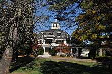 Thomas Goodall House |
April 28, 1975 (#75000207) |
232 Main St. 43°26′15″N 70°46′24″W |
Sanford | |
| 62 | Edmund E. Goodwin House | 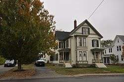 Edmund E. Goodwin House |
November 9, 2015 (#15000770) |
503 Main St. 43°27′48″N 70°47′45″W |
Sanford | |
| 63 | Grant Family House | 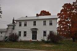 Grant Family House |
June 21, 1990 (#90000927) |
72 Grant Rd. 43°34′47″N 70°30′15″W |
Saco | |
| 64 | Abbott Graves House |  Abbott Graves House |
April 23, 1980 (#80000261) |
Ocean Ave. 43°21′14″N 70°28′22″W |
Kennebunkport | |
| 65 | Great Falls Manufacturing Company Newichawannock Canal Historic District |  Great Falls Manufacturing Company Newichawannock Canal Historic District |
August 6, 2014 (#14000460) |
Between Great East Lake and Horn Pond 43°34′10″N 70°58′16″W |
Acton | Extends into Wakefield in Carroll County, New Hampshire |
| 66 | Grist Mill Bridge | 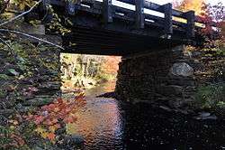 Grist Mill Bridge |
December 27, 1990 (#90001905) |
Little River Rd. across the Little River 43°23′30″N 70°51′06″W |
Lebanon | |
| 67 | Jonathan Hamilton House |  Jonathan Hamilton House |
December 30, 1970 (#70000082) |
Vaughan's Lane and Old South Rd. 43°12′48″N 70°48′47″W |
South Berwick | |
| 68 | John Hancock Warehouse |  John Hancock Warehouse |
December 2, 1969 (#69000029) |
136 Lindsay Rd. 43°08′12″N 70°39′28″W |
York | |
| 69 | Harper Family House |  Harper Family House |
October 8, 1998 (#98001236) |
State Route 5, approximately 0.95 miles (1.53 km) south of its junction with E. Range Rd. 43°40′07″N 70°46′33″W |
Limerick | |
| 70 | Hatch House |  Hatch House |
December 27, 1979 (#79000179) |
2104 Sanford Rd. 43°21′32″N 70°39′53″W |
Wells | Listed as being in the "North Berwick vicinity". |
| 71 | Hawkes Pharmacy |  Hawkes Pharmacy |
October 14, 1993 (#93001111) |
6 Main St. 43°10′33″N 70°36′40″W |
York Beach | Also known as the Rockaway Hotel |
| 72 | Hedden Site | October 16, 1991 (#91001515) |
Address Restricted |
Kennebunk | ||
| 73 | Thomas Hobbs, Jr., House | 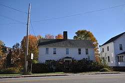 Thomas Hobbs, Jr., House |
February 11, 1982 (#82000794) |
Wells St. 43°18′19″N 70°44′17″W |
North Berwick | |
| 74 | Sen. John Holmes House | 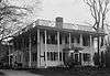 Sen. John Holmes House |
April 24, 1975 (#75000117) |
U.S. Route 202 43°28′39″N 70°43′04″W |
Alfred | |
| 75 | William Dean Howells House | 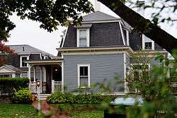 William Dean Howells House |
October 25, 1979 (#79000270) |
Pepperrell Rd. 43°04′51″N 70°42′45″W |
Kittery Point | |
| 76 | Mary R. Hurd House | 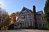 Mary R. Hurd House |
September 11, 1979 (#79000180) |
Elm St. 43°18′19″N 70°44′22″W |
North Berwick | |
| 77 | Hussey Plow Company Building | 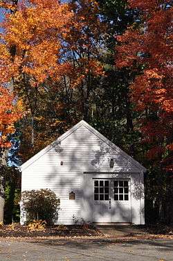 Hussey Plow Company Building |
December 19, 1979 (#79000181) |
Dyer St. 43°18′15″N 70°43′45″W |
North Berwick | |
| 78 | Isles of Shoals |  Isles of Shoals |
May 16, 1974 (#74000325) |
6.5 miles (10.5 km) southeast of Kittery 42°59′43″N 70°36′23″W |
Kittery | |
| 79 | Jacobs Houses and Store | 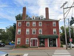 Jacobs Houses and Store |
March 2, 1982 (#82000795) |
9-17 Elm St. 43°29′56″N 70°27′02″W |
Saco | |
| 80 | Sarah Orne Jewett House |  Sarah Orne Jewett House |
June 4, 1973 (#73000248) |
State Routes 4 and 236 43°14′05″N 70°48′13″W |
South Berwick | |
| 81 | Jewett-Eastman House |  Jewett-Eastman House |
December 29, 1983 (#83003700) |
37 Portland St. 43°14′06″N 70°48′33″W |
South Berwick | Now the visitors center for the Sarah Orne Jewett House |
| 82 | Dennis Johnson Lumber Company Mill |  Dennis Johnson Lumber Company Mill |
May 8, 2007 (#07000409) |
Northeastern side of State Route 5, 0.3 miles (0.48 km) north of Silas Brown Rd. 43°37′09″N 70°43′56″W |
Waterboro | |
| 83 | John Paul Jones Memorial Park |  John Paul Jones Memorial Park |
January 7, 1998 (#97001639) |
Bounded by Newmarch St. and Hunter Ave. 43°05′06″N 70°45′02″W |
Kittery Foreside | |
| 84 | Kennebunk High School |  Kennebunk High School |
August 24, 2011 (#11000584) |
14 Park St. 43°23′07″N 70°32′06″W |
Kennebunk | The town's old high school, built 1921-22. |
| 85 | Kennebunk Historic District |  Kennebunk Historic District |
June 5, 1974 (#74000324) |
Both sides of State Route 35 from the Kennebunk River to U.S. Route 1, radiating streets at intersection 43°22′55″N 70°31′24″W |
Kennebunk | |
| 86 | Kennebunk River Club |  Kennebunk River Club |
September 9, 1975 (#75002169) |
Ocean Ave. 43°21′01″N 70°28′24″W |
Kennebunkport | Frederick W. Stickney, architect. |
| 87 | Kennebunkport Historic District | 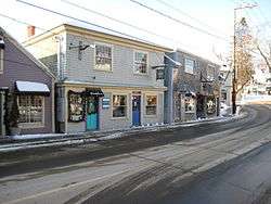 Kennebunkport Historic District |
May 6, 1976 (#76000121) |
Bounded roughly by South, Maine, North, and Locke Sts., and the Kennebunk River 43°21′46″N 70°28′33″W |
Kennebunkport | Contributing properties include Melville Walker House |
| 88 | Lady Pepperrell House | 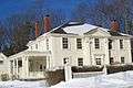 Lady Pepperrell House |
October 15, 1966 (#66000094) |
State Route 103 43°04′53″N 70°43′00″W |
Kittery Point | |
| 89 | Laudholm Farm | 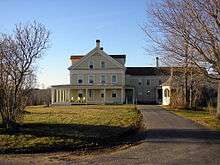 Laudholm Farm |
October 20, 1983 (#83003702) |
342 Laudholm Rd. 43°20′14″N 70°33′05″W |
Wells | |
| 90 | James Leavitt House | 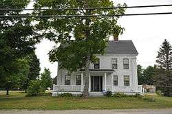 James Leavitt House |
September 22, 2004 (#04001051) |
6 Old Alfred Rd. 43°35′20″N 70°42′34″W |
Waterboro Center | |
| 91 | Libby's Colonial Tea Room | 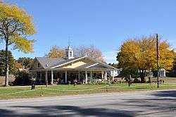 Libby's Colonial Tea Room |
January 19, 2001 (#99000769) |
Junction of U.S. Route 1 and Harrisecket Rd. 43°21′26″N 70°33′32″W |
Wells | Now houses the Johnson Hall Museum. |
| 92 | Libby-MacArthur House | 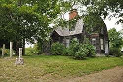 Libby-MacArthur House |
April 20, 1988 (#88000397) |
State Route 11 43°43′54″N 70°42′39″W |
Limington | |
| 93 | Limerick Upper Village Historic District | 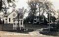 Limerick Upper Village Historic District |
April 5, 1984 (#84001557) |
State Route 5 43°41′17″N 70°47′43″W |
Limerick | |
| 94 | Limington Academy | 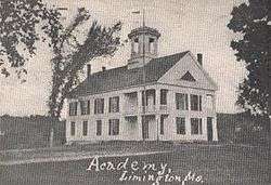 Limington Academy |
June 23, 1980 (#80000380) |
State Route 117 43°44′N 70°43′W |
Limington | |
| 95 | Limington Historic District |  Limington Historic District |
January 15, 1999 (#98001601) |
Junction of State Routes 11 and 117 43°43′57″N 70°42′33″W |
Limington | |
| 96 | Lincoln School |  Lincoln School |
April 23, 2013 (#13000189) |
8 Orchard Rd. 43°29′29″N 70°54′40″W |
Acton | |
| 97 | Littlefield Homestead |  Littlefield Homestead |
December 27, 1979 (#79000182) |
1458 Branch Rd, near Chick's Crossing Rd. 43°22′30″N 70°35′52″W |
Wells | |
| 98 | Littlefield Tavern |  Littlefield Tavern |
December 27, 1979 (#79000186) |
1107 Littlefield Rd 43°18′N 70°38′W |
Wells | |
| 99 | Littlefield-Chase Farmstead | 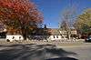 Littlefield-Chase Farmstead |
December 27, 1979 (#79000183) |
State Route 9, 1485 N. Berwick Rd. 43°18′28″N 70°40′44″W |
Wells | |
| 100 | Littlefield-Dustin Farm | 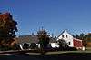 Littlefield-Dustin Farm |
December 27, 1979 (#79000184) |
41 Dodge Rd. 43°18′33″N 70°41′15″W |
Wells | |
| 101 | Littlefield-Keeping House |  Littlefield-Keeping House |
December 27, 1979 (#79000185) |
1673 Littlefield Rd. 43°18′27″N 70°39′52″W |
Wells | |
| 102 | Lord Farm | 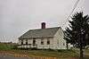 Lord Farm |
December 27, 1979 (#79000187) |
317 Laudholm Rd. 43°20′11″N 70°33′06″W |
Wells | |
| 103 | Lord Mansion | 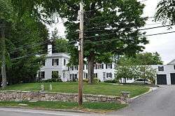 Lord Mansion |
April 2, 1973 (#73000158) |
20 Summer St. 43°23′12″N 70°32′01″W |
Kennebunk | |
| 104 | Capt. Nathaniel Lord Mansion | 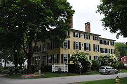 Capt. Nathaniel Lord Mansion |
September 20, 1973 (#73000157) |
Pleasant and Green Sts. 43°21′32″N 70°28′27″W |
Kennebunkport | |
| 105 | Lord-Dane House | 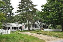 Lord-Dane House |
December 17, 1992 (#92001708) |
Western side of Federal St., 2 miles (3.2 km) north of its junction with U.S. Route 202 43°29′57″N 70°43′47″W |
Alfred | |
| 106 | Lower Alewive Historic District | 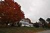 Lower Alewive Historic District |
March 24, 1994 (#94000178) |
Northern side of Winnow Hill Ln, Emmons Rd. Ext., Russell Farm Rd., east of its junction with State Route 35 43°25′51″N 70°33′49″W |
Kennebunk | |
| 107 | Maine Trolley Cars | 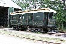 Maine Trolley Cars |
November 14, 1980 (#80000262) |
Seashore Trolley Museum 43°24′28″N 70°29′22″W |
Kennebunkport | Includes ten cars in the collection of the Seashore Trolley Museum. |
| 108 | McIntire Garrison House | 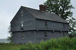 McIntire Garrison House |
November 24, 1968 (#68000017) |
280 Cider Hill Rd. 43°10′05″N 70°42′49″W |
York | |
| 109 | Memorial Chapel |  Memorial Chapel |
June 20, 2018 (#100002594) |
55 Cemetery Rd. 43°17′14″N 70°51′28″W |
Berwick | In Evergreen Cemetery |
| 110 | Mill House | 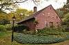 Mill House |
December 27, 1979 (#79000188) |
502 Post Rd. 43°17′16″N 70°35′39″W |
Wells | Listed as being in Ogunquit. |
| 111 | Moody Homestead | 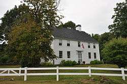 Moody Homestead |
April 28, 1975 (#75000209) |
100 Ridge Rd. 43°09′23″N 70°38′02″W |
York | |
| 112 | Capt. James Morison House | 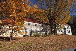 Capt. James Morison House |
July 12, 1978 (#78000335) |
Southeast of Parsonsfield on South Rd. 43°41′30″N 70°52′49″W |
Parsonsfield | |
| 113 | Morrell House | 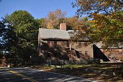 Morrell House |
September 29, 1976 (#76000194) |
North of N. Berwick on Bauneg Beg Pond Rd. 43°21′21″N 70°44′20″W |
North Berwick | |
| 114 | Newfield (Willowbrook) Historic District | 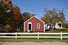 Newfield (Willowbrook) Historic District |
February 14, 1985 (#85000275) |
Elm St. 43°39′18″N 70°51′07″W |
Newfield | |
| 115 | North Berwick Woolen Mill | 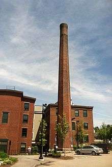 North Berwick Woolen Mill |
July 21, 1983 (#83000482) |
Canal St. 43°18′16″N 70°44′15″W |
North Berwick | |
| 116 | Ocean Park Historic Buildings |  Ocean Park Historic Buildings |
March 2, 1982 (#82000796) |
Temple Ave. 43°30′20″N 70°23′22″W |
Ocean Park | |
| 117 | Odd Fellows-Rebekah Hall | 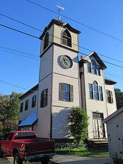 Odd Fellows-Rebekah Hall |
December 29, 1983 (#83003704) |
High St. 43°48′14″N 70°48′12″W |
Cornish | |
| 118 | Ogunquit Memorial Library |  Ogunquit Memorial Library |
December 29, 1983 (#83003706) |
166 Shore Rd. 43°14′38″N 70°35′48″W |
Ogunquit | |
| 119 | Ogunquit Playhouse | 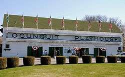 Ogunquit Playhouse |
December 14, 1995 (#95001458) |
10 Main Street (U.S. Route 1) 43°14′20″N 70°36′02″W |
Ogunquit | |
| 120 | Old Grist Mill | 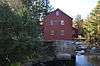 Old Grist Mill |
June 5, 1975 (#75000118) |
Little River Rd. 43°23′31″N 70°51′05″W |
East Lebanon | |
| 121 | Old Schoolhouse | 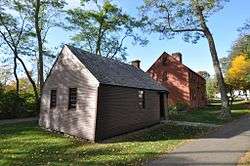 Old Schoolhouse |
April 2, 1973 (#73000247) |
3 Lindsay Rd. (on the Village Green) 43°08′38″N 70°39′13″W |
York | |
| 122 | Old Town House | 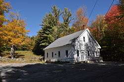 Old Town House |
July 15, 2002 (#02000785) |
Merrill Hill Rd., north of its junction with Middle Rd. 43°43′42″N 70°55′47″W |
Parsonsfield | |
| 123 | Old York Gaol | 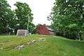 Old York Gaol |
November 24, 1968 (#68000016) |
193 York St 43°08′38″N 70°39′10″W |
York | |
| 124 | Parsons-Piper-Lord-Roy Farm | 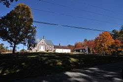 Parsons-Piper-Lord-Roy Farm |
February 15, 2005 (#05000054) |
309 Cramm Rd. 43°42′34″N 70°50′47″W |
Parsonsfield | |
| 125 | Parsonsfield Seminary | 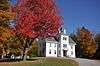 Parsonsfield Seminary |
June 20, 1986 (#86001339) |
State Route 160 43°45′46″N 70°56′20″W |
Parsonsfield | |
| 126 | Paul Family Farm | 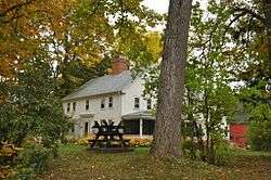 Paul Family Farm |
October 20, 1998 (#98001232) |
106 Depot Rd. 43°09′22″N 70°47′25″W |
Eliot | |
| 127 | Pebbledene | 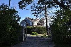 Pebbledene |
October 14, 1993 (#93001110) |
99 Freeman St. 43°10′51″N 70°36′19″W |
York Beach | |
| 128 | William Pepperrell House |  William Pepperrell House |
August 14, 1973 (#73000159) |
On State Route 103 43°04′59″N 70°42′13″W |
Kittery Point | |
| 129 | Perkins Tide Mill | 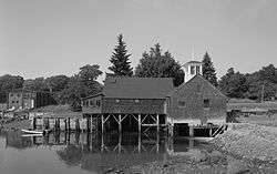 Perkins Tide Mill |
September 7, 1973 (#73000160) |
Mill Lane 43°22′01″N 70°28′28″W |
Kennebunkport | |
| 130 | Charles Perkins House | 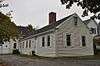 Charles Perkins House |
December 27, 1979 (#79000189) |
Scotch Hill 43°15′13″N 70°36′08″W |
Ogunquit | |
| 131 | LeRoy F. Pike Memorial Building | 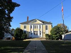 LeRoy F. Pike Memorial Building |
February 7, 2007 (#07000010) |
17 Maple St. 43°48′21″N 70°48′22″W |
Cornish | |
| 132 | Porter-Parsonfield Bridge | 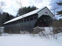 Porter-Parsonfield Bridge |
February 16, 1970 (#70000058) |
0.5 miles (0.80 km) south of Porter over the Ossipee River 43°47′30″N 70°56′18″W |
Parsonsfield | Extends into Oxford County |
| 133 | Portsmouth Company Cotton Mills: Counting House | 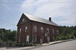 Portsmouth Company Cotton Mills: Counting House |
October 10, 1975 (#75000208) |
State Route 4 at the Salmon Falls River 43°13′37″N 70°48′41″W |
South Berwick | Now the museum for the Old Berwick Historical Society. |
| 134 | Portsmouth Naval Shipyard |  Portsmouth Naval Shipyard |
November 17, 1977 (#77000141) |
Seavey's Island 43°04′59″N 70°44′18″W |
Kittery | |
| 135 | J.L. Prescott House |  J.L. Prescott House |
June 20, 1985 (#85001268) |
High St. 43°18′39″N 70°44′19″W |
North Berwick | |
| 136 | Rice Public Library |  Rice Public Library |
October 1, 1979 (#79000190) |
8 Wentworth St. 43°05′12″N 70°44′34″W |
Kittery | |
| 137 | Rock Rest |  Rock Rest |
January 24, 2008 (#07001449) |
167 Brave Boat Harbor Rd. 43°06′20″N 70°40′34″W |
Kittery | |
| 138 | Robert Rose Tavern | 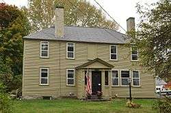 Robert Rose Tavern |
October 10, 1975 (#75000206) |
298 Long Sands Rd. 43°09′14″N 70°37′40″W |
York | |
| 139 | Saco Central Fire Station | 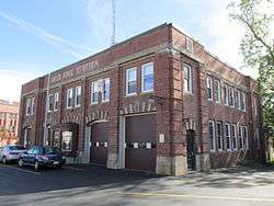 Saco Central Fire Station |
April 16, 2013 (#13000168) |
14 Thornton Ave. 43°29′56″N 70°26′47″W |
Saco | |
| 140 | Saco City Hall | 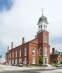 Saco City Hall |
October 9, 1979 (#79000192) |
300 Main St. 43°29′57″N 70°26′44″W |
Saco | |
| 141 | Saco High School (old) | 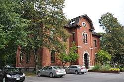 Saco High School (old) |
July 14, 1983 (#83000483) |
Spring St. 43°30′09″N 70°26′21″W |
Saco | |
| 142 | Saco Historic District | .jpg) Saco Historic District |
June 12, 1998 (#98000594) |
Roughly bounded by Elm, North, Beach, and Main Sts. 43°30′10″N 70°26′51″W |
Saco | |
| 143 | St. Andre's Parish |  St. Andre's Parish |
November 10, 2015 (#15000771) |
73, 77 Bacon & 39, 41 Sullivan Sts. 43°29′25″N 70°27′02″W |
Biddeford | |
| 144 | St. Joseph's School |  St. Joseph's School |
December 29, 1983 (#83003708) |
Birch St. 43°29′25″N 70°27′31″W |
Biddeford | |
| 145 | St. Peter's By-The-Sea Protestant Episcopal Church |  St. Peter's By-The-Sea Protestant Episcopal Church |
July 1, 1999 (#99000773) |
529 Shore Rd. 43°13′04″N 70°35′03″W |
York (Cape Neddick) | |
| 146 | Salmon Falls (East) Historic District |  Salmon Falls (East) Historic District |
October 15, 1987 (#87001859) |
Portions of State Route 117 and Simpson Rd. 43°35′34″N 70°33′04″W |
Buxton | |
| 147 | Salmon Falls (West) Historic District |  Salmon Falls (West) Historic District |
October 30, 1987 (#87001858) |
Salmon Falls Rd. and portion of U.S. Route 202 43°35′53″N 70°33′24″W |
Hollis | |
| 148 | Sanford Mills Historic District |  Sanford Mills Historic District |
November 4, 2009 (#09000880) |
Bounded by Washington St., Pioneer Ave., Emery St., and Weaver Dr. 43°26′24″N 70°46′17″W |
Sanford | |
| 149 | Sanford Naval Air Station Administration Building-Control Tower, Former |  Sanford Naval Air Station Administration Building-Control Tower, Former |
June 20, 1997 (#97000603) |
Southwestern corner of Sanford Municipal Airport, southwest of the junction of State Routes 99 and 109 43°23′25″N 70°43′00″W |
South Sanford | Demolished c. 2006-7.[7] |
| 150 | Sanford Town Hall (Former) |  Sanford Town Hall (Former) |
January 9, 2007 (#06001225) |
505 Main St. 43°27′48″N 70°47′44″W |
Springvale | |
| 151 | A. B. Seavey House |  A. B. Seavey House |
March 31, 1978 (#78000332) |
90 Temple St. 43°30′03″N 70°27′00″W |
Saco | |
| 152 | John Sedgley Homestead |  John Sedgley Homestead |
January 2, 1976 (#76000192) |
44 Chases Pond Rd. 43°09′53″N 70°40′02″W |
York Beach | |
| 153 | James Smith Homestead |  James Smith Homestead |
February 4, 1982 (#82001887) |
State Route 35 43°25′56″N 70°33′54″W |
Kennebunk | |
| 154 | Smith-Emery House |  Smith-Emery House |
October 8, 1998 (#98001233) |
253 Main St. 43°28′07″N 70°48′07″W |
Springvale | |
| 155 | South Berwick Village Historic District | 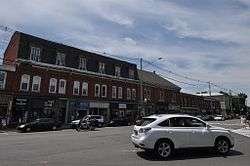 South Berwick Village Historic District |
March 2, 2010 (#10000058) |
Portions of Main, Portland, Highland and Academy 43°13′57″N 70°48′31″W |
South Berwick | |
| 156 | Spiller Farm Paleoindian Site | 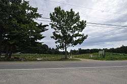 Spiller Farm Paleoindian Site |
September 12, 2003 (#03000922) |
on the Spiller Farm property[8] 43°21′54″N 70°36′18″W |
Wells | |
| 157 | Stage Island Monument | 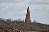 Stage Island Monument |
August 28, 2019 (#100004341) |
NE of Hills Beach on Stage Island , .6 mi. N of mouth of Biddeford Pool 43°27′24″N 70°21′05″W |
Biddeford | |
| 158 | Staples Inn | 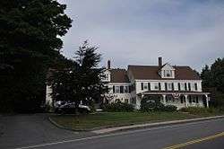 Staples Inn |
June 26, 1987 (#86002422) |
8 Portland Ave. 43°31′03″N 70°22′42″W |
Old Orchard Beach | |
| 159 | Sunnycroft |  Sunnycroft |
November 8, 1984 (#84000335) |
Locust Hill 43°41′22″N 70°47′40″W |
Limerick | |
| 160 | John Tarr House |  John Tarr House |
April 23, 1980 (#80000263) |
29 Ferry Lane 43°28′09″N 70°23′54″W |
Biddeford | |
| 161 | The Temple |  The Temple |
April 28, 1975 (#75000119) |
Temple Ave. in Ocean Park 43°30′08″N 70°23′22″W |
Old Orchard Beach | |
| 162 | Thacher-Goodale House |  Thacher-Goodale House |
November 21, 1976 (#76000193) |
121 North St. 43°30′19″N 70°26′47″W |
Saco | |
| 163 | Timber Point | 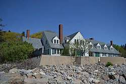 Timber Point |
November 15, 2016 (#16000786) |
2 Timber Point Rd., Rachel Carson National Wildlife Refuge 43°23′56″N 70°23′51″W |
Biddeford | |
| 164 | Robert and Louisa Traip House | 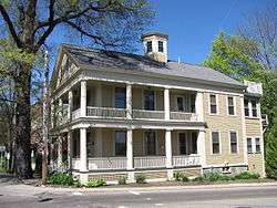 Robert and Louisa Traip House |
January 7, 1998 (#97001641) |
2 Wentworth St. 43°05′11″N 70°44′35″W |
Kittery Foreside | |
| 165 | U.S. Customhouse | 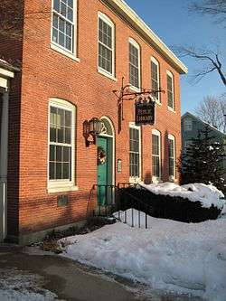 U.S. Customhouse |
January 18, 1974 (#74000323) |
Main St. 43°21′42″N 70°28′32″W |
Kennebunkport | Now Graves Library. |
| 166 | U.S. Post Office | 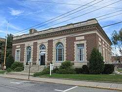 U.S. Post Office |
May 7, 1973 (#73000161) |
35 Washington St. 43°29′32″N 70°27′21″W |
Biddeford | |
| 167 | US Post Office-Sanford Maine | 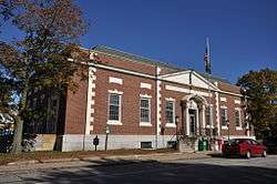 US Post Office-Sanford Maine |
May 2, 1986 (#86000882) |
28 School St. 43°26′16″N 70°46′22″W |
Sanford | |
| 168 | Wallingford Hall | 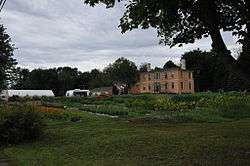 Wallingford Hall |
April 28, 2004 (#04000372) |
21 York St. 43°22′57″N 70°32′48″W |
Kennebunk | |
| 169 | Waterboro Grange, No. 432 | 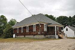 Waterboro Grange, No. 432 |
April 24, 2012 (#12000230) |
31 West Rd. 43°32′12″N 70°43′04″W |
Waterboro | |
| 170 | Way Way General Store | 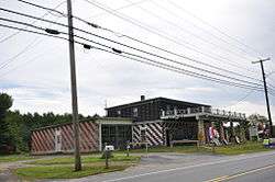 Way Way General Store |
December 14, 1995 (#95001462) |
93 Buxton Rd. 43°31′57″N 70°28′21″W |
Saco | |
| 171 | Andrew Welch Homestead |  Andrew Welch Homestead |
April 11, 2002 (#02000352) |
1286 Middle Rd. 43°42′47″N 70°53′22″W |
Parsonsfield | |
| 172 | Wells Baptist Church Parsonage |  Wells Baptist Church Parsonage |
December 27, 1979 (#79000191) |
1384 Branch Rd (State Route 9A) 43°22′27″N 70°35′58″W |
Wells | |
| 173 | Wells Homestead | .jpg) Wells Homestead |
December 27, 1979 (#79000193) |
232 Sanford Rd. 43°19′21″N 70°35′10″W |
Wells | |
| 174 | Mark F. and Eliza J. Wentworth House |  Mark F. and Eliza J. Wentworth House |
January 7, 1998 (#97001643) |
9 Wentworth St. 43°05′12″N 70°44′36″W |
Kittery Foreside | |
| 175 | West Lebanon Historic District |  West Lebanon Historic District |
June 5, 1975 (#75000210) |
Irregular pattern along W. Lebanon, Rochester, Milton, Shapleigh, and Meeting House Rds. 43°23′03″N 70°57′04″W |
West Lebanon | |
| 176 | Whaleback Light Station | 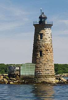 Whaleback Light Station |
March 23, 1988 (#87002278) |
Portsmouth Harbor 43°03′31″N 70°41′48″W |
Kittery Point | |
| 177 | Kate Douglas Wiggin House | 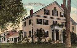 Kate Douglas Wiggin House |
September 16, 1977 (#77000142) |
East of Hollis Center on Salmon Falls Rd. 43°35′50″N 70°33′20″W |
Hollis Center | |
| 178 | Winn House |  Winn House |
December 27, 1979 (#79000194) |
Obed's Lane[9] 43°14′41″N 70°36′01″W |
Ogunquit | Moved in the 1980s; now a local museum |
| 179 | Wood Island Light Station | 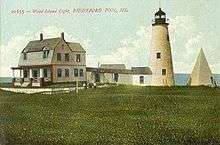 Wood Island Light Station |
January 21, 1988 (#87002274) |
Eastern side of Wood Island 43°27′24″N 70°19′47″W |
Biddeford Pool | |
| 180 | York Cliffs Historic District |  York Cliffs Historic District |
July 26, 1984 (#84001560) |
Agamenticus Ave. 43°11′31″N 70°35′56″W |
York | A series of summer "cottages" on Agamenticus Ave. |
| 181 | York Historic District |  York Historic District |
July 16, 1973 (#73000249) |
Roughly U.S. Route 1, U.S. Route 1A, State Route 103, and Woodbridge Rd. 43°08′18″N 70°39′03″W |
York |
Former listings
| [3] | Name on the Register | Image | Date listed | Date removed | Location | City or town | Summary |
|---|---|---|---|---|---|---|---|
| 1 | First Parish Congregational Church | June 14, 1990 (#90000921) | January 15, 2004 | 12 Beach Street 43°30′03″N 70°26′33″W |
Saco | Destroyed by fire in 2000.[10] | |
| 2 | Gerrish Warehouse |  Gerrish Warehouse |
May 26, 1977 (#77000140) | September 29, 2015 | Pepperrell Cove off State Route 103 43°04′52″N 70°43′06″W |
Kittery | Demolished. |
See also
| Wikimedia Commons has media related to National Register of Historic Places in York County, Maine. |
References
- The latitude and longitude information provided in this table was derived originally from the National Register Information System, which has been found to be fairly accurate for about 99% of listings. Some locations in this table may have been corrected to current GPS standards.
- "National Register of Historic Places: Weekly List Actions". National Park Service, United States Department of the Interior. Retrieved on June 19, 2020.
- Numbers represent an ordering by significant words. Various colorings, defined here, differentiate National Historic Landmarks and historic districts from other NRHP buildings, structures, sites or objects.
- "National Register Information System". National Register of Historic Places. National Park Service. April 24, 2008.
- The eight-digit number below each date is the number assigned to each location in the National Register Information System database, which can be viewed by clicking the number.
- "The "Old Dalton House" on Middle Road". Parsonsfield Historical Society. Retrieved 2013-10-01.
- "2006-7 Sanford Town Report". Town of Sanford. Retrieved 2014-10-02.
- "Town of Wells Comprehensive Plan" (PDF). Town of Wells. Archived from the original (PDF) on 2013-10-04. Retrieved 2013-10-03.
- "Historical and Archaeological Resources, October 2004" (PDF). Town of Ogunquit. Retrieved 2015-05-14.
- Gotthelf, Liz (19 September 2014). "First Parish to mark 10 years in new building". Portland Press Herald. Retrieved 24 December 2019.
| Topics | |
|---|---|
| Lists by state |
|
| Lists by insular areas | |
| Lists by associated state | |
| Other areas | |
| Related | |
| |
Municipalities and communities of York County, Maine, United States | ||
|---|---|---|
| Cities | York County map | |
| Towns | ||
| CDPs | ||
| Other villages | ||
This article is issued from Wikipedia. The text is licensed under Creative Commons - Attribution - Sharealike. Additional terms may apply for the media files.