National Register of Historic Places listings in Sagadahoc County, Maine
This is a list of the National Register of Historic Places listings in Sagadahoc County, Maine.
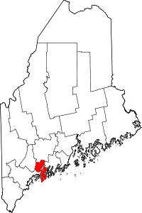
Location of Sagadahoc County in Maine
This is intended to be a complete list of the properties and districts on the National Register of Historic Places in Sagadahoc County, Maine, United States. Latitude and longitude coordinates are provided for many National Register properties and districts; these locations may be seen together in a map.[1]
There are 60 properties and districts listed on the National Register in the county. One property was once listed, but has since been removed.
- This National Park Service list is complete through NPS recent listings posted June 19, 2020.[2]
| Androscoggin - Aroostook - Cumberland - Franklin - Hancock - Kennebec - Knox - Lincoln - Oxford - Penobscot - Piscataquis - Sagadahoc - Somerset - Waldo - Washington - York |
Current listings
| [3] | Name on the Register[4] | Image | Date listed[5] | Location | City or town | Description |
|---|---|---|---|---|---|---|
| 1 | Arnold Trail to Quebec |  Arnold Trail to Quebec |
October 1, 1969 (#69000018) |
Along the Kennebec River, through Wayman and Flagstaff Lakes along the Dead River and Chain of Ponds to Quebec Canada 43°45′08″N 69°46′45″W |
Popham Beach | Extends through Franklin, Kennebec, Sagadahoc, and Somerset counties |
| 2 | Bath Historic District |  Bath Historic District |
May 17, 1973 (#73000261) |
Roughly bounded by High, Beacon, and Court Sts., U.S. Route 1, and the Kennebec River 43°55′07″N 69°49′00″W |
Bath | |
| 3 | Butterfield-Sampson House |  Butterfield-Sampson House |
October 24, 1996 (#96001190) |
18 River Rd. 44°00′28″N 69°53′51″W |
Bowdoinham | |
| 4 | Robert P. Carr House | 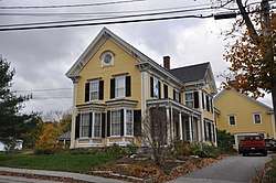 Robert P. Carr House |
December 18, 1990 (#90001904) |
Main St. 44°00′36″N 69°53′53″W |
Bowdoinham | |
| 5 | Cathance Water Tower | 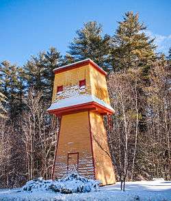 Cathance Water Tower |
January 22, 2001 (#00001637) |
Cathance Rd. at its junction with Beechwood Dr. 43°57′06″N 69°55′50″W |
Topsham | |
| 6 | Clarke and Lake Company Archeological Site | November 21, 1978 (#78000329) |
Address Restricted |
Arrowsic | Site of a major colonial settlement; destroyed during King Philip's War and abandoned. Listed as being in the Bath vicinity. | |
| 7 | Cold Spring Farm |  Cold Spring Farm |
February 14, 1985 (#85000274) |
Off Fiddler's Reach Rd. 43°51′12″N 69°48′00″W |
Phippsburg | |
| 8 | Viola Coombs House | 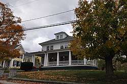 Viola Coombs House |
December 13, 1991 (#91001816) |
Main St. 44°00′36″N 69°53′52″W |
Bowdoinham | |
| 9 | Cornish House | 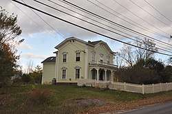 Cornish House |
January 15, 1980 (#80000250) |
Main St. 44°00′34″N 69°54′08″W |
Bowdoinham | |
| 10 | W.D. Crooker House | 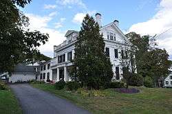 W.D. Crooker House |
July 10, 1979 (#79000165) |
71 South St. 43°54′28″N 69°49′08″W |
Bath | |
| 11 | Days Ferry Historic District | 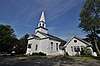 Days Ferry Historic District |
February 20, 1975 (#75000109) |
North of Bath along State Route 128 43°56′47″N 69°48′24″W |
Woolwich | Listed as being in Bath vicinity. |
| 12 | William T. Donnell House | 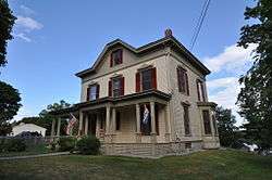 William T. Donnell House |
July 13, 1989 (#89000840) |
279 Washington St. 43°53′42″N 69°49′03″W |
Bath | Owned by the Maine Maritime Museum. |
| 13 | Doubling Point Light Station | 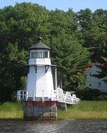 Doubling Point Light Station |
January 21, 1988 (#87002271) |
Western side of Arrowsic Island 43°52′57″N 69°48′27″W |
Arrowsic | Listed as being in Bath vicinity. |
| 14 | Fiddler's Reach Fog Signal | 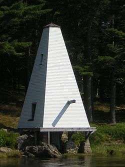 Fiddler's Reach Fog Signal |
August 5, 2009 (#09000594) |
Northern shore of the Kennebec River, east of the Doubling Point Light Station 43°52′54″N 69°47′57″W |
Arrowsic | |
| 15 | First Baptist Church of Bowdoin and Coombs Cemetery | 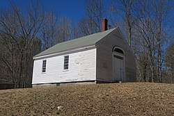 First Baptist Church of Bowdoin and Coombs Cemetery |
June 20, 1997 (#97000604) |
Off the western side of U.S. Route 201, 0.65 miles north of its junction with State Route 125 44°02′22″N 69°56′44″W |
Bowdoin Center | |
| 16 | Fort Baldwin Historic Site |  Fort Baldwin Historic Site |
August 3, 1979 (#79000166) |
Sabino Hill 43°45′01″N 69°47′23″W |
Phippsburg | |
| 17 | Fort Popham Memorial | Fort Popham Memorial |
October 1, 1969 (#69000012) |
North of Popham on Hunnewell Point 43°45′19″N 69°47′04″W |
Popham Beach | |
| 18 | Grey Havens Inn | 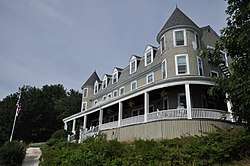 Grey Havens Inn |
March 21, 1985 (#85000614) |
Reid Park Rd. 43°48′39″N 69°43′16″W |
Georgetown | |
| 19 | Harward Family House | September 27, 1996 (#96001038) |
Western side of Pork Point Rd., 0.4 miles south of its junction with State Route 24 44°01′48″N 69°49′35″W |
Bowdoinham | Listed as being in Richmond vicinity. | |
| 20 | Lt. Richard Hathorn House | 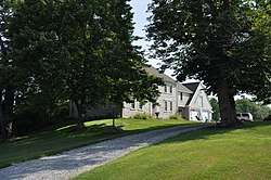 Lt. Richard Hathorn House |
February 26, 1980 (#80000251) |
State Route 127 43°57′39″N 69°47′07″W |
Woolwich | |
| 21 | Heal Family House | 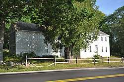 Heal Family House |
October 28, 1994 (#94001243) |
Western side of State Route 127, 1.2 miles south of its junction with Robinhood Rd. 43°49′44″N 69°45′18″W |
Georgetown | |
| 22 | Hunter Site |  Hunter Site |
January 26, 1984 (#84001493) |
Address Restricted |
Topsham | |
| 23 | John E.L. Huse Memorial School | 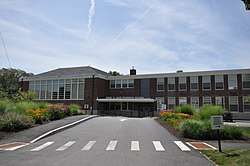 John E.L. Huse Memorial School |
July 11, 2016 (#16000438) |
39 Andrews Rd. 43°54′51″N 69°49′33″W |
Bath | |
| 24 | Hyde Mansion | 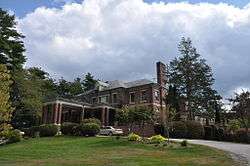 Hyde Mansion |
November 21, 1978 (#78000197) |
616 High St. 43°54′19″N 69°49′23″W |
Bath | |
| 25 | Charles H. Ingraham Cottage | 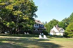 Charles H. Ingraham Cottage |
December 29, 1986 (#86003512) |
Off State Route 209 43°44′53″N 69°47′17″W |
Phippsburg | |
| 26 | Kennebec River Light Station | 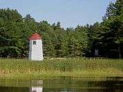 Kennebec River Light Station |
January 21, 1988 (#87002263) |
Fiddler Reach, Arrowsic Island 43°52′59″N 69°47′46″W |
Arrowsic | Listed as being in Bath vicinity. |
| 27 | Gov. William King House |  Gov. William King House |
May 24, 1976 (#76000112) |
Whiskeag Rd. 43°55′58″N 69°49′25″W |
Bath | |
| 28 | Joseph and Susan Manley Summer Cottage | 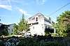 Joseph and Susan Manley Summer Cottage |
January 7, 1998 (#97001642) |
Eastern side of Club Rd., 0.1 miles south of its junction with State Route 216 and Club Rd. 43°43′24″N 69°50′14″W |
Small Point | |
| 29 | Mary E. (Schooner) | September 30, 2019 (#100004471) |
271 Washington St. (Maine Maritime Museum) 43°53′41″N 69°48′54″W |
Bath | ||
| 30 | McCobb-Hill-Minott House | 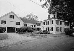 McCobb-Hill-Minott House |
November 23, 1977 (#77000083) |
Parker Head Rd. 43°49′10″N 69°48′43″W |
Phippsburg | |
| 31 | Captain Merritt House | 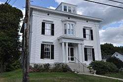 Captain Merritt House |
February 8, 1985 (#85000243) |
619 High St. 43°54′25″N 69°49′13″W |
Bath | |
| 32 | Mill Cove School | 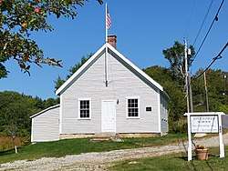 Mill Cove School |
July 5, 2000 (#00000763) |
Western side of Berrys Mill Rd., 0.1 miles south of its junction with Hill Rd. 43°52′52″N 69°51′03″W |
West Bath | Listed as being in Bath vicinity. |
| 33 | Peacock Tavern | April 4, 1986 (#86000675) |
U.S. Route 201 44°09′33″N 69°51′42″W |
Richmond | ||
| 34 | Pejepscot Paper Company |  Pejepscot Paper Company |
September 17, 1974 (#74000192) |
Off U.S. Route 201 at the Androscoggin River 43°55′18″N 69°57′53″W |
Topsham | Also known as Bowdoin Mill |
| 35 | Pejepscot Site | June 12, 1987 (#87000922) |
Address Restricted |
Pejepscot | ||
| 36 | Percy and Small Shipyard | 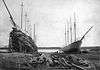 Percy and Small Shipyard |
July 27, 1971 (#71000043) |
451 Washington St. 43°53′41″N 69°49′08″W |
Bath | This is now the main campus of the Maine Maritime Museum. |
| 37 | Percy District School House, (Former) | 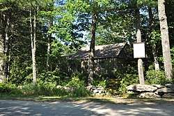 Percy District School House, (Former) |
March 25, 1999 (#99000377) |
Junction of Parker Head Rd. and Cox Head Rd. 43°46′04″N 69°48′06″W |
Parker Head | |
| 38 | Perkins Island Light Station | 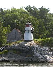 Perkins Island Light Station |
January 21, 1988 (#87002282) |
Perkins Island 43°47′12″N 69°47′09″W |
Georgetown | |
| 39 | Popham Colony Site | 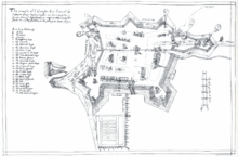 Popham Colony Site |
February 16, 1970 (#70000063) |
near Fort Popham on Fort Baldwin Rd. 43°45′12″N 69°47′18″W |
Popham Beach | |
| 40 | Purinton Family Farm | 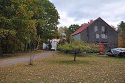 Purinton Family Farm |
July 13, 1989 (#89000842) |
65 Elm St. 43°55′27″N 69°57′05″W |
Topsham | |
| 41 | Randall-Hildreth House | .jpg) Randall-Hildreth House |
September 22, 2004 (#04001048) |
806 Foreside Rd. 43°56′58″N 69°53′42″W |
Topsham | |
| 42 | Robert Reed House |  Robert Reed House |
February 11, 1982 (#82000777) |
State Route 128 and Chop Point Rd. 44°00′16″N 69°48′34″W |
Woolwich | |
| 43 | Richmond Historic District |  Richmond Historic District |
November 12, 1973 (#73000146) |
Roughly bounded by South, High, and Kimbal Sts., and the Kennebec River 44°05′08″N 69°48′15″W |
Richmond | |
| 44 | Benjamin Riggs House |  Benjamin Riggs House |
December 22, 1988 (#88003008) |
14 Knubble Rd. 43°51′13″N 69°44′12″W |
Georgetown | |
| 45 | Riggs-Zorach House |  Riggs-Zorach House |
December 30, 1988 (#88003007) |
Off Robinhood Rd. 43°50′51″N 69°44′11″W |
Georgetown | |
| 46 | Robinhood Free Meetinghouse |  Robinhood Free Meetinghouse |
September 26, 2016 (#16000677) |
210 Robinhood Rd. 43°51′05″N 69°44′36″W |
Georgetown | |
| 47 | Ropes End | 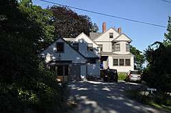 Ropes End |
December 31, 2001 (#01001421) |
36 Hyde Rd. 43°43′24″N 69°50′12″W |
Phippsburg | |
| 48 | Seguin Island Light Station | 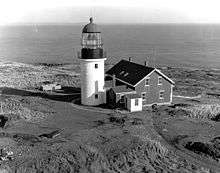 Seguin Island Light Station |
March 8, 1977 (#77000084) |
South of Georgetown 43°42′32″N 69°45′29″W |
Georgetown | |
| 49 | Small Point Club | 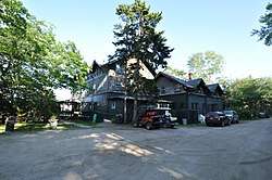 Small Point Club |
March 25, 1999 (#99000376) |
Club Rd., 0.3 miles south of its junction with State Route 216 and Club Rd. 43°43′16″N 69°50′14″W |
Small Point | |
| 50 | Southard Block |  Southard Block |
February 23, 1972 (#72000079) |
25 Front St. 44°05′13″N 69°48′01″W |
Richmond | |
| 51 | Squirrel Point Light Station | 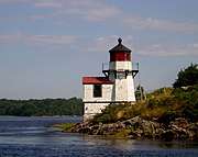 Squirrel Point Light Station |
January 21, 1988 (#87002281) |
Squirrel Point, Arrowsic Island 43°48′59″N 69°48′10″W |
Arrowsic | |
| 52 | Stone Schoolhouse | 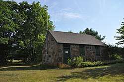 Stone Schoolhouse |
August 12, 1977 (#77000085) |
South of Georgetown on Bay Point Rd. 43°46′45″N 69°45′54″W |
Georgetown | |
| 53 | Swan Island Historic District |  Swan Island Historic District |
December 14, 1995 (#95001461) |
Kennebec River between Richmond and Dresden 44°03′32″N 69°47′59″W |
Perkins Township | |
| 54 | Topsham Fairgrounds Grandstand | 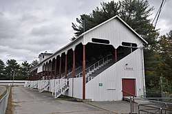 Topsham Fairgrounds Grandstand |
March 26, 1992 (#92000277) |
Off the northern side of Elm St., east of its junction with Fair Cir. 43°55′38″N 69°57′12″W |
Topsham | |
| 55 | Topsham Historic District | 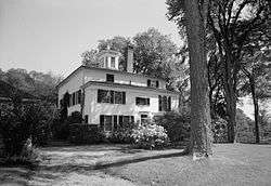 Topsham Historic District |
January 9, 1978 (#78000198) |
Elm, Main, and Green Sts. 43°55′35″N 69°57′30″W |
Topsham | |
| 56 | Trufant Historic District |  Trufant Historic District |
January 15, 2004 (#03001402) |
Portions of Corliss, Highland, Middle, Pine, and Washington Sts. 43°54′02″N 69°49′05″W |
Bath | |
| 57 | U.S. Customhouse and Post Office |  U.S. Customhouse and Post Office |
October 6, 1970 (#70000064) |
1 Front St. 43°54′44″N 69°48′48″W |
Bath | |
| 58 | Wallace-Haskell Homestead |  Wallace-Haskell Homestead |
January 17, 2017 (#100000526) |
268 W. Point Rd. 43°45′05″N 69°51′32″W |
Phippsburg | |
| 59 | Winter Street Church |  Winter Street Church |
July 27, 1971 (#71000044) |
Corner of Washington and Winter Sts. 43°54′58″N 69°49′07″W |
Bath | |
| 60 | Woolwich Town House | 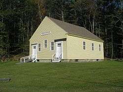 Woolwich Town House |
February 17, 1978 (#78000199) |
Northeast of Bath at Old Stage and Dana Mills Rds. 43°58′10″N 69°46′12″W |
Woolwich |
Former listing
| [3] | Name on the Register | Image | Date listed | Date removed | Location | City or town | Summary |
|---|---|---|---|---|---|---|---|
| 1 | SEGUIN (tugboat) | 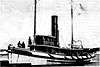 SEGUIN (tugboat) |
December 2, 1969 (#69000013) | September 29, 2015 | Maine Maritime Museum 43°53′39″N 69°48′59″W |
Bath | Remnants stored at museum after failed restoration attempt.[6] |
See also
| Wikimedia Commons has media related to National Register of Historic Places in Sagadahoc County, Maine. |
References
- The latitude and longitude information provided in this table was derived originally from the National Register Information System, which has been found to be fairly accurate for about 99% of listings. Some locations in this table may have been corrected to current GPS standards.
- "National Register of Historic Places: Weekly List Actions". National Park Service, United States Department of the Interior. Retrieved on June 19, 2020.
- Numbers represent an ordering by significant words. Various colorings, defined here, differentiate National Historic Landmarks and historic districts from other NRHP buildings, structures, sites or objects.
- "National Register Information System". National Register of Historic Places. National Park Service. April 24, 2008.
- The eight-digit number below each date is the number assigned to each location in the National Register Information System database, which can be viewed by clicking the number.
- "Cultural Resource Management Bulletin (PDF pages 15-16)" (PDF). National Park Service. Retrieved 2014-09-17.
| Topics | |
|---|---|
| Lists by state |
|
| Lists by insular areas | |
| Lists by associated state | |
| Other areas | |
| Related | |
| |
Municipalities and communities of Sagadahoc County, Maine, United States | ||
|---|---|---|
| City | Sagadahoc County map | |
| Towns | ||
| Unorganized territory | ||
| CDPs | ||
| Other villages | ||
This article is issued from Wikipedia. The text is licensed under Creative Commons - Attribution - Sharealike. Additional terms may apply for the media files.