National Register of Historic Places listings in North and Northwest Baltimore
National Register of Historic Places listings in the city of Baltimore, Maryland
The locations of the National Register properties and districts listed below (at least for all showing latitude and longitude coordinates below) may be seen in a map by clicking on "Map of all coordinates".[1]
This list covers some of the properties in the independent city of Baltimore, but not those in the county of Baltimore surrounding the city. The county actually does not include the city; the city is an independent county equivalent.
- This National Park Service list is complete through NPS recent listings posted June 19, 2020.[2]
Current listings
| [3] | Name on the Register | Image | Date listed[4] | Location | District[5] | Description |
|---|---|---|---|---|---|---|
| 1 | Louisa May Alcott School |  Louisa May Alcott School |
March 29, 1990 (#90000544) |
2702 Keyworth Ave. 39°19′58″N 76°39′49″W |
Northwest | |
| 2 | American Ice Company Baltimore Plant No. 2 | 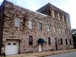 American Ice Company Baltimore Plant No. 2 |
December 27, 2002 (#02001589) |
330 W. 23rd St. 39°18′55″N 76°37′19″W |
North | |
| 3 | Auchentoroly Terrace Historic District | September 17, 2015 (#15000604) |
Roughly bounded by Auchentoroly Terrace, Reisterstown Rd., Liberty Heights & Fulton Aves. 39°19′03″N 76°38′57″W |
Northwest | ||
| 4 | Bellona-Gittings Historic District |  Bellona-Gittings Historic District |
December 24, 2008 (#08001217) |
Bounded by E. Lake, Melrose, and Gittings Aves. and York, Charles, Charlesbrooke, and Overbrook Rds. 39°22′09″N 76°37′21″W |
North | |
| 5 | Brick Hill |  Brick Hill |
July 1, 1988 (#88000743) |
Seneca St., Oakington St., and Parkden Ave. 39°19′49″N 76°38′38″W |
North | |
| 6 | Cedar Grove |  Cedar Grove |
November 15, 1996 (#96001349) |
301 Kendall Rd. 39°20′43″N 76°37′46″W |
North | |
| 7 | Cedarcroft Historic District | 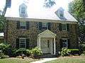 Cedarcroft Historic District |
December 24, 2003 (#03001332) |
Bounded by Gittings Ave., York Rd., E. Lake Ave., and Bellona Ave. 39°22′17″N 76°36′52″W |
North | |
| 8 | Charlcote House |  Charlcote House |
October 17, 1988 (#88001858) |
15 Charlcote Pl. 39°20′37″N 76°37′08″W |
North | |
| 9 | Charles Village-Abell Historic District |  Charles Village-Abell Historic District |
December 15, 1983 (#83003629) |
Roughly bounded by University Parkway, Guilford Ave., and 25th, Mace, Charles, and Barclay Sts. 39°19′27″N 76°36′55″W |
North | See also Charles Village and Abell |
| 10 | Cylburn House and Park District |  Cylburn House and Park District |
May 4, 1972 (#72001493) |
4915 Green Spring Ave. 39°21′09″N 76°39′10″W |
North | |
| 11 | Dickeyville Historic District |  Dickeyville Historic District |
July 12, 1972 (#72001494) |
Both sides of Forest Park Ave. in Gwynn's Falls area 39°19′00″N 76°42′18″W |
Northwest | |
| 12 | Druid Hill Park Historic District |  Druid Hill Park Historic District |
May 22, 1973 (#73002183) |
Druid Hill Park 39°19′23″N 76°38′41″W |
North | |
| 13 | Eastern High School | 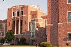 Eastern High School |
August 16, 2000 (#00000870) |
1101 E. 33rd St. 39°19′40″N 76°36′08″W |
North | |
| 14 | Ednor Gardens Historic District |  Ednor Gardens Historic District |
March 30, 2004 (#03001373) |
Roughly bounded by Ellerslie Ave., 36th St., The Alameda, Andover Rd. and Chestnut Hill Ave. 39°20′09″N 76°36′01″W |
North | |
| 15 | Evergreen House |  Evergreen House |
January 17, 1983 (#83002932) |
4545 N. Charles St. 39°20′54″N 76°37′16″W |
North | |
| 16 | Evergreen on the Falls |  Evergreen on the Falls |
July 30, 1975 (#75002095) |
3300 Falls Rd. 39°19′37″N 76°38′06″W |
North | |
| 17 | First Church of Christ, Scientist | 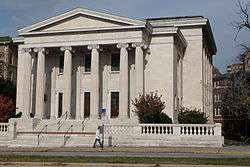 First Church of Christ, Scientist |
December 27, 1982 (#82001584) |
102 W. University Parkway 39°20′06″N 76°37′16″W |
North | |
| 18 | Gallagher Mansion and Outbuilding |  Gallagher Mansion and Outbuilding |
September 15, 1983 (#83002934) |
431-435 Notre Dame Lane 39°21′05″N 76°36′39″W |
North | |
| 19 | Grace-Hampden Methodist Episcopal Church |  Grace-Hampden Methodist Episcopal Church |
August 2, 2001 (#01000809) |
1014 W. 36th St. 39°19′52″N 76°38′01″W |
North | |
| 20 | Greater Homeland Historic District |  Greater Homeland Historic District |
December 28, 2001 (#01001377) |
Roughly bounded by Charles St. Homeland Ave., York Rd., and Melrose Ave. 39°21′34″N 76°37′08″W |
North | |
| 21 | Guilford Historic District |  Guilford Historic District |
July 19, 2001 (#01000745) |
Roughly bounded by N. Charles St., Warrenton Rd., Linkwood Rd., Cold Spring Ln., York Rd., Southway, University Parkway, and Bishops Rd. 39°20′31″N 76°37′00″W |
North | |
| 22 | Hampden Historic District |  Hampden Historic District |
December 29, 2004 (#04001405) |
Roughly bounded by Jones Falls, W. 40th St. and Wyman Park 39°19′57″N 76°37′57″W |
North | |
| 23 | Highfield House |  Highfield House |
September 12, 2007 (#07000942) |
4000 N. Charles St. 39°20′18″N 76°37′08″W |
North | |
| 24 | Hochschild, Kohn Belvedere and Hess Shoes |  Hochschild, Kohn Belvedere and Hess Shoes |
December 18, 2003 (#03001296) |
5911 York Rd. and 510 Belvedere Ave. 39°21′57″N 76°36′35″W |
North | |
| 25 | Homewood | 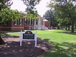 Homewood |
September 10, 1971 (#71001033) |
N. Charles and 34th Sts. 39°19′46″N 76°37′09″W |
North | |
| 26 | James E. Hooper House | 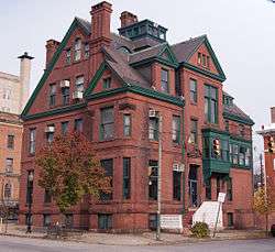 James E. Hooper House |
March 15, 1982 (#82004746) |
100 E. 23rd St. 39°18′56″N 76°36′56″W |
North | |
| 27 | Howard Park P.S. 218 |  Howard Park P.S. 218 |
September 27, 2000 (#00001084) |
4801 Liberty Heights Ave. 39°19′53″N 76°41′54″W |
Northwest | |
| 28 | Lake Drive Apartments | 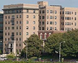 Lake Drive Apartments |
December 28, 2001 (#01001368) |
903 Druid Park Lake Dr. 39°19′00″N 76°38′13″W |
North | |
| 29 | Lake-Evesham Historic District |  Lake-Evesham Historic District |
December 23, 2003 (#03001323) |
Roughly bounded by East Lake Ave., York Rd., Evesham Ave., and Bellona Ave. 39°22′06″N 76°36′49″W |
North | |
| 30 | Lake Roland Historic District | October 15, 1992 (#92001285) |
Robert E. Lee Memorial Park 39°23′13″N 76°38′49″W |
North | ||
| 31 | Lombard Street Bridge | September 27, 1972 (#75002093) |
Over Gwynns Falls off Wetheredsville Rd. 39°19′00″N 76°42′01″W |
Northwest | dismantled and placed into storage in 1975.[6] | |
| 32 | Londontown Manufacturing Company, Inc. | 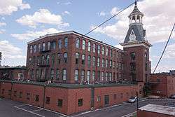 Londontown Manufacturing Company, Inc. |
January 12, 1973 (#73002188) |
3600 Clipper Mill Rd. 39°19′53″N 76°38′34″W |
North | |
| 33 | Lovely Lane Methodist Church |  Lovely Lane Methodist Church |
May 25, 1973 (#73002189) |
2200 St. Paul St. 39°18′52″N 76°36′57″W |
North | |
| 34 | Elmer V. McCollum House | 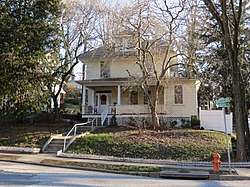 Elmer V. McCollum House |
January 7, 1976 (#76002182) |
2301 Monticello Rd. 39°18′49″N 76°41′06″W |
Northwest | |
| 35 | H.F. Miller & Son Tin Box and Can Manufacturing Plant |  H.F. Miller & Son Tin Box and Can Manufacturing Plant |
December 10, 2003 (#03001268) |
2601 N. Howard St. 39°19′10″N 76°37′12″W |
North | |
| 36 | Mount Vernon Mill No. 1 |  Mount Vernon Mill No. 1 |
April 19, 2001 (#01000388) |
3000 Falls Rd. 39°19′23″N 76°37′52″W |
North | |
| 37 | Mount Washington Mill Historic District |  Mount Washington Mill Historic District |
May 4, 1990 (#90000727) |
1405-1407 Forge Ave.; also 1330-1340 Smith Ave. 39°22′05″N 76°39′01″W |
North | Smith Ave. addresses represent a boundary increase. |
| 38 | Northern District Police Station |  Northern District Police Station |
December 28, 2001 (#01001372) |
3355 Keswick Rd. 39°19′42″N 76°37′39″W |
North | |
| 39 | Northwood Historic District | _1.jpg) Northwood Historic District |
June 15, 1998 (#98000596) |
Loch Raven Boulevard, The Almeda, and Cold Spring Ln. 39°20′26″N 76°35′48″W |
North | |
| 40 | Oakenshawe Historic District |  Oakenshawe Historic District |
December 18, 2003 (#03001293) |
Roughly bounded by York Rd., University Parkway, Calvert St., and Southway 39°19′55″N 76°36′48″W |
North | |
| 41 | Old Goucher College Buildings |  Old Goucher College Buildings |
August 25, 1978 (#78003143) |
Roughly bounded by 24th, N. Calvert, and 23rd Sts., and Maryland Ave. 39°18′57″N 76°37′02″W |
North | |
| 42 | Park Circle Historic District |  Park Circle Historic District |
December 4, 2008 (#08001124) |
Roughly bounded by Overview Ave., Shirley Ave., Cottage Ave., and Henry G. Parks Jr. Circle 39°19′40″N 76°39′36″W |
Northwest | |
| 43 | Poole and Hunt Company Buildings |  Poole and Hunt Company Buildings |
July 2, 1973 (#73002194) |
3500 Clipper Rd. 39°19′53″N 76°38′45″W |
North | |
| 44 | Radnor-Winston Historic District |  Radnor-Winston Historic District |
December 29, 2003 (#03001327) |
Roughly bounded by Notre Dame Ln., College of Notre Dame, Radnor Ave. and York Rd. 39°21′04″N 76°36′45″W |
North | |
| 45 | Remington Historic District | January 17, 2017 (#100000530) |
Roughly bounded by W. 22nd & Sisson Sts., Wyman Park Dr., Mace Alley 39°19′15″N 76°37′20″W |
North | ||
| 46 | Riviera Apartments |  Riviera Apartments |
August 12, 1999 (#99000985) |
901 Druid Park Lake Dr. 39°19′07″N 76°38′11″W |
North | |
| 47 | Roland Park Historic District |  Roland Park Historic District |
December 23, 1974 (#74002213) |
Irregular pattern between Belvedere Ave., Falls Rd., 39th St., and Stoney Run 39°20′57″N 76°38′05″W |
North | |
| 48 | Ruscombe |  Ruscombe |
December 20, 2007 (#07001033) |
4901 Springarden Dr. 39°20′59″N 76°39′30″W |
North | |
| 49 | St. John's Protestant Episcopal Church | _01.JPG) St. John's Protestant Episcopal Church |
March 27, 1974 (#74002214) |
3009 Greenmount Ave. 39°19′31″N 76°36′32″W |
North | |
| 50 | Samester Parkway Apartments |  Samester Parkway Apartments |
September 9, 1998 (#98001157) |
7000-7022 Park Heights Ave. 39°21′58″N 76°42′23″W |
Northwest | |
| 51 | Senator Theatre |  Senator Theatre |
August 24, 1989 (#89001153) |
5904-5906 York Rd. 39°21′49″N 76°36′39″W |
North | |
| 52 | Stieff Silver Company Factory |  Stieff Silver Company Factory |
June 30, 2000 (#00000744) |
800 Wyman Park Dr. 39°19′08″N 76°37′42″W |
North | |
| 53 | Stone Hill Historic District | 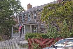 Stone Hill Historic District |
December 26, 2001 (#01001370) |
Pacific, Puritan, Bay, Field, and Worth Sts. 39°19′24″N 76°37′46″W |
North | |
| 54 | Tivoli | 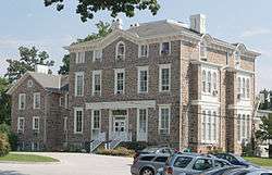 Tivoli |
October 9, 1980 (#80001791) |
1301 Woodbourne Ave. 39°21′12″N 76°35′33″W |
North | |
| 55 | Tuscany-Canterbury Historic District | 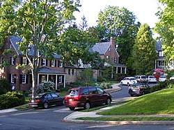 Tuscany-Canterbury Historic District |
October 28, 2001 (#01001182) |
Roughly bounded by Charles St., University Parkway, Stony Run, and Warrenton Rd. 39°20′16″N 76°37′18″W |
North | |
| 56 | Waverly Main Street Historic District | 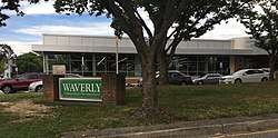 Waverly Main Street Historic District |
December 31, 2013 (#13001020) |
Roughly bounded by E. 29th & E. 35th Sts., Old York Rd., Greenmount Ave. 39°19′42″N 76°36′32″W |
Northwest | |
| 57 | Woodberry Historic District |  Woodberry Historic District |
December 29, 2003 (#03001326) |
Roughly Clipper Ave, Druid Park Dr., and Girard, Hooper, Keystone, Malden, Parkdale, and Rockrose Aves. 39°20′05″N 76°38′52″W |
North |
See also
| Wikimedia Commons has media related to National Register of Historic Places in Baltimore, Maryland. |
References
- The latitude and longitude information provided in this table was derived originally from the National Register Information System, which has been found to be fairly accurate for about 99% of listings. Some locations in this table may have been corrected to current GPS standards.
- "National Register of Historic Places: Weekly List Actions". National Park Service, United States Department of the Interior. Retrieved on June 19, 2020.
- Numbers represent an ordering by significant words. Various colorings, defined here, differentiate National Historic Landmarks and historic districts from other NRHP buildings, structures, sites or objects.
- The eight-digit number below each date is the number assigned to each location in the National Register Information System database, which can be viewed by clicking the number.
- Official Baltimore neighborhoods, defined here
- Maryland Historic Trust
| Topics |  | |
|---|---|---|
| Lists by county | ||
| Lists by city | ||
| Other lists | ||
| ||
This article is issued from Wikipedia. The text is licensed under Creative Commons - Attribution - Sharealike. Additional terms may apply for the media files.