National Register of Historic Places listings in Baltimore County, Maryland
This is a list of the National Register of Historic Places listings in Baltimore County, Maryland.

Location of Baltimore County in Maryland
This is intended to be a complete list of the properties and districts on the National Register of Historic Places in Baltimore County, Maryland, United States. Latitude and longitude coordinates are provided for many National Register properties and districts; these locations may be seen together in a map.[1]
There are 89 properties and districts listed on the National Register in the county, including 2 National Historic Landmarks. As an independent city, the city of Baltimore is entirely separate from Baltimore County; its National Register-listed properties and districts are listed separately.
| Allegany - Anne Arundel - Baltimore (city) - Baltimore County - Calvert - Caroline - Carroll - Cecil - Charles - Dorchester - Frederick - Garrett - Harford - Howard - Kent - Montgomery - Prince George's - Queen Anne's - Somerset - St. Mary's - Talbot - Washington - Wicomico - Worcester |
- This National Park Service list is complete through NPS recent listings posted June 19, 2020.[2]
Current listings
| [3] | Name on the Register[4] | Image | Date listed[5] | Location | City or town | Description |
|---|---|---|---|---|---|---|
| 1 | Anneslie Historic District |  Anneslie Historic District |
March 12, 2012 (#12000097) |
Roughly bounded by York, Maplewood, and Windwood Rds., and Regester Ave. 39°22′33″N 76°36′16″W |
Towson | |
| 2 | Auburn House |  Auburn House |
March 17, 1975 (#75000869) |
Osler Dr. between Towsontown Boulevard and Stevenson Lane 39°23′10″N 76°36′49″W |
Towson | |
| 3 | Ballestone Mansion |  Ballestone Mansion |
June 18, 1975 (#75000866) |
East of Essex on Back River Neck Rd. in Rocky Point Park 39°15′08″N 76°25′03″W |
Essex | Now known as the Ballestone-Stansbury House. |
| 4 | Baltimore County Courthouse |  Baltimore County Courthouse |
October 27, 1972 (#72000569) |
Washington Ave. between Pennsylvania and Chesapeake Aves. 39°23′59″N 76°36′24″W |
Towson | |
| 5 | Baltimore County Jail |  Baltimore County Jail |
August 26, 2009 (#09000644) |
222 Courthouse Court 39°23′52″N 76°36′29″W |
Towson | |
| 6 | Baltimore County School No. 7 | 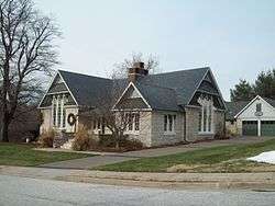 Baltimore County School No. 7 |
August 31, 2000 (#00001007) |
200 Ashland Rd. 39°29′43″N 76°38′32″W |
Cockeysville | |
| 7 | Bare Hills Historic District |  Bare Hills Historic District |
November 22, 2011 (#11000852) |
Falls Rd. between Light Rail and north of Coppermine Terrace 39°23′14″N 76°39′34″W |
Towson | |
| 8 | Bare Hills House |  Bare Hills House |
August 6, 1980 (#80001793) |
North of Baltimore at 6222 Falls Rd. 39°22′55″N 76°39′19″W |
Towson | |
| 9 | Brooklandville House |  Brooklandville House |
November 23, 1977 (#77000682) |
South of Brooklandville at Falls and Hillside Rds. 39°24′40″N 76°40′03″W |
Brooklandville | |
| 10 | Brooklandwood |  Brooklandwood |
February 11, 1972 (#72000567) |
Falls Rd. 39°25′50″N 76°40′36″W |
Brooklandville | |
| 11 | Old Catonsville Historic District |  Old Catonsville Historic District |
December 27, 2002 (#02001573) |
Between Edmondson, Frederick, Melvin, and Smithwood Aves. 39°16′20″N 76°44′40″W |
Catonsville | |
| 12 | Caves Valley Historic District | 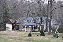 Caves Valley Historic District |
October 20, 1988 (#88001859) |
Caves and Garrison Forest Rds., and Park Heights Ave. 39°26′30″N 76°44′53″W |
Owings Mills | |
| 13 | Central Catonsville and Summit Park Historic District |  Central Catonsville and Summit Park Historic District |
December 27, 2006 (#06001186) |
Between Frederick Rd., S. Rolling Rd., and Mellor Ave. 39°16′00″N 76°44′15″W |
Catonsville | |
| 14 | Choate House |  Choate House |
July 20, 1989 (#89000807) |
9600 Liberty 39°22′35″N 76°48′52″W |
Randallstown | |
| 15 | The Cloisters |  The Cloisters |
August 7, 1979 (#79001115) |
West of Lutherville at 10440 Falls Rd. 39°24′39″N 76°40′17″W |
Lutherville | |
| 16 | Corbett Historic District | September 12, 1985 (#85002245) |
1615-1827 Corbett Rd. and 16200-16225 Corbett Village Ln. 39°34′09″N 76°37′03″W |
Monkton | ||
| 17 | Craighill Channel Lower Range Front Light Station |  Craighill Channel Lower Range Front Light Station |
December 2, 2002 (#02001420) |
3.5 miles southeast of Fort Howard 39°11′19″N 76°23′39″W |
Fort Howard | |
| 18 | Craighill Channel Lower Range Rear Light Station |  Craighill Channel Lower Range Rear Light Station |
December 2, 2002 (#02001418) |
Edgemere area 39°13′45″N 76°23′40″W |
Edgemere | |
| 19 | Cut-off Channel Range Front Light Station |  Cut-off Channel Range Front Light Station |
December 2, 2002 (#02001415) |
Southwest of Fort Howard 39°11′49″N 76°26′55″W |
Fort Howard | |
| 20 | Cut-off Channel Range Rear Light Station | .jpg) Cut-off Channel Range Rear Light Station |
December 2, 2002 (#02001423) |
Sparrows Point 39°12′58″N 76°27′47″W |
Edgemore | |
| 21 | Day Village Historic District | March 27, 2020 (#100005133) |
511 Avondale Rd. 39°14′20″N 76°30′17″W |
Dundalk | ||
| 22 | Dumbarton Historic District |  Dumbarton Historic District |
December 30, 2009 (#09001172) |
Roughly bounded by Park Heights Ave., Slade Ave., Seven Mile La., and Old Court Rd. 39°22′37″N 76°42′37″W |
Pikesville | |
| 23 | Dundalk Historic District |  Dundalk Historic District |
December 8, 1983 (#83003630) |
Roughly bounded by Liberty Parkway, Dunman, Willow Spring and Sunship Rds., and Chesapeake and Patapsco Aves. 39°15′35″N 76°31′26″W |
Dundalk | |
| 24 | Dundalk-Liberty-Cornwall Gardens |  Dundalk-Liberty-Cornwall Gardens |
September 23, 2011 (#11000700) |
7003 Dunmanway 39°15′27″N 76°31′06″W |
Dundalk | |
| 25 | Eagle's Nest |  Eagle's Nest |
July 25, 1974 (#74000942) |
Jarrettsville Pike 39°28′15″N 76°34′32″W |
Phoenix | |
| 26 | Ellicott's Mills Historic District | Ellicott's Mills Historic District |
November 19, 1976 (#76000980) |
Both sides of Maryland Route 144, south of the Patapsco River Bridge 39°16′05″N 76°47′32″W |
Oella | |
| 27 | Fort Carroll |  Fort Carroll |
April 14, 2015 (#14000955) |
Soller's Flats, in the Patapsco River 39°12′53″N 76°31′09″W |
Curtis Bay | |
| 28 | Fort Garrison |  Fort Garrison |
January 25, 1971 (#71000368) |
South of Stevenson at Garrison Farms Ct. 39°23′55″N 76°42′29″W |
Stevenson | |
| 29 | Glencoe |  Glencoe |
May 9, 1983 (#83002942) |
1314 Glencoe Rd. 39°33′04″N 76°38′06″W |
Glencoe | |
| 30 | Glyndon Historic District |  Glyndon Historic District |
September 20, 1973 (#73000902) |
Town of Glyndon and its environs along Maryland Route 128 39°28′30″N 76°48′38″W |
Glyndon | |
| 31 | Goucher College | 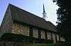 Goucher College |
August 28, 2007 (#07000885) |
1021 Dulaney Valley Rd. 39°24′39″N 76°36′01″W |
Towson | |
| 32 | Granite Historic District |  Granite Historic District |
September 22, 1994 (#94001091) |
Roughly the area surrounding Old Court Rd. and St. Paul Ave. 39°20′36″N 76°50′51″W |
Granite | |
| 33 | Green Spring Valley Historic District |  Green Spring Valley Historic District |
October 3, 1980 (#80001797) |
Maryland Routes 25 and 140 39°24′55″N 76°42′46″W |
Lutherville and Owings Mills | |
| 34 | Half-Way House |  Half-Way House |
September 8, 1980 (#89000809) |
1.3 miles south of Parkton at 18200 York Rd.; also York Rd. and Weisburg Rd 39°37′24″N 76°39′31″W |
Parkton | Second address represents a boundary increase, added on July 12, 1989 |
| 35 | Hampton National Historic Site |  Hampton National Historic Site |
October 15, 1966 (#66000389) |
535 Hampton Lane 39°25′02″N 76°35′17″W |
Towson | |
| 36 | Hill House | March 6, 1986 (#86000415) |
19301 York Rd. 39°39′12″N 76°39′10″W |
Parkton | ||
| 37 | Hilton | 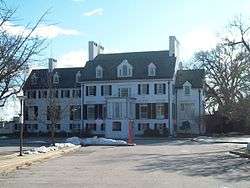 Hilton |
October 31, 1980 (#80001794) |
800 S. Rolling Rd. 39°15′09″N 76°44′01″W |
Catonsville | |
| 38 | Hull Memorial Christian Church |  Hull Memorial Christian Church |
September 15, 1977 (#77000684) |
101 Clyde Ave. 39°14′41″N 76°39′48″W |
Lansdowne | |
| 39 | Jericho Covered Bridge |  Jericho Covered Bridge |
September 13, 1978 (#78001444) |
East of Kingsville on Franklinville Rd. 39°27′34″N 76°23′16″W |
Kingsville | |
| 40 | Jericho Farm |  Jericho Farm |
September 7, 1984 (#84001352) |
12230 Jericho Rd. 39°27′23″N 76°23′17″W |
Kingsville | |
| 41 | James Lawrence Kernan Hospital |  James Lawrence Kernan Hospital |
September 24, 1979 (#79003275) |
Windsor Mill Rd. and Forest Park Ave. 39°18′48″N 76°42′34″W |
Wetheredsville | |
| 42 | Lime Kiln Bottom | April 17, 2019 (#100003655) |
2177 Cromwell Bridge Rd. 39°25′02″N 76°32′32″W |
Parkville | ||
| 43 | Long Green Valley Historic District | December 30, 1982 (#82001589) |
Glen Arm, Baldwin Mill, Manor, and Hartford Rds. areas 39°28′35″N 76°29′23″W |
Baldwin, Glen Arm, Hydes | ||
| 44 | Long Island Farm | August 30, 2010 (#10000586) |
220 Cromwell Bridge Rd. 39°25′05″N 76°32′33″W |
Parkville | ||
| 45 | Lorraine Park Cemetery Gate Lodge |  Lorraine Park Cemetery Gate Lodge |
July 25, 1985 (#85001613) |
5608 Dogwood Rd. 39°18′47″N 76°43′05″W |
Woodlawn | |
| 46 | Lutherville Historic District | 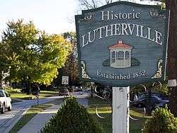 Lutherville Historic District |
November 9, 1972 (#72000568) |
Roughly bounded by Interstate 695, York and Ridgely Rds., and Lutherville Dr. 39°25′19″N 76°38′41″W |
Lutherville | |
| 47 | The Meadows |  The Meadows |
March 23, 1988 (#88000203) |
302 Meadows Ln. 39°24′05″N 76°47′52″W |
Owings Mills | |
| 48 | Mettam Memorial Baptist Church |  Mettam Memorial Baptist Church |
April 24, 1975 (#75000867) |
Old Court Rd. between Sudbrook and Reisterstown Rds. 39°22′41″N 76°43′10″W |
Pikesville | |
| 49 | Montrose Mansion and Chapel | March 19, 1990 (#90000354) |
13700 Hanover Rd. 39°29′52″N 76°51′09″W |
Reisterstown | ||
| 50 | Mount de Sales Academy |  Mount de Sales Academy |
May 30, 1986 (#86001187) |
700 Academy Rd. 39°17′06″N 76°43′17″W |
Catonsville | |
| 51 | Mt. Gilboa Chapel | _Church_2012.jpg) Mt. Gilboa Chapel |
October 21, 1976 (#76000978) |
Oella and Westchester Aves. 39°16′27″N 76°46′45″W |
Oella | |
| 52 | My Lady's Manor | 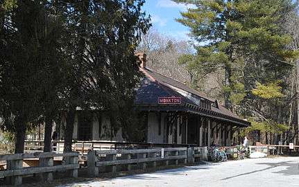 My Lady's Manor |
April 15, 1978 (#78001445) |
Maryland Route 138 39°35′15″N 76°34′16″W |
Monkton | |
| 53 | Oella Historic District |  Oella Historic District |
November 7, 1976 (#76000979) |
Oella Ave., Glen Rd., Hollow Rd. 39°16′49″N 76°47′09″W |
Oella | |
| 54 | Old Catonsville High School | 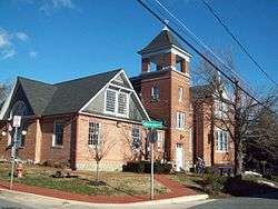 Old Catonsville High School |
September 10, 1987 (#87001568) |
20 Winters Ln. 39°16′22″N 76°44′10″W |
Catonsville | |
| 55 | Old National Pike Milestones |  Old National Pike Milestones |
November 27, 1975 (#75002107) |
U.S. Route 40, U.S. Route 40 Alternate, and U.S. Route 40 Scenic, and Maryland Routes 144 and 165 39°16′23″N 76°43′37″W |
Catonsville | |
| 56 | Old Salem Church and Cemetery |  Old Salem Church and Cemetery |
December 13, 1977 (#77000683) |
Ingleside Ave. and Calverton St. 39°17′05″N 76°43′53″W |
Catonsville | |
| 57 | Owings Upper Mill |  Owings Upper Mill |
September 13, 1978 (#78001446) |
Reisterstown Rd. and Groff Ln. 39°25′19″N 76°46′59″W |
Owings Mills | |
| 58 | Parkton Hotel | December 8, 1983 (#83003634) |
18848 York Rd. (MD 45) 39°38′30″N 76°39′34″W |
Parkton | ||
| 59 | Patterson Viaduct Ruins |  Patterson Viaduct Ruins |
June 3, 1976 (#76002221) |
South of Catonsville at the Patapsco River 39°15′00″N 76°45′51″W |
Catonsville | |
| 60 | Perry Hall | 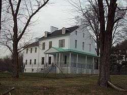 Perry Hall |
April 23, 1980 (#80001796) |
North of Perry Hall on Perry Hall Rd. 39°25′43″N 76°27′33″W |
Perry Hall | |
| 61 | Pikesville Armory | 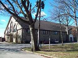 Pikesville Armory |
September 25, 1985 (#85002674) |
610 Reisterstown Rd. 39°22′08″N 76°43′18″W |
Pikesville | |
| 62 | Plinlimmon Farm |  Plinlimmon Farm |
May 19, 1983 (#83002943) |
9401 Lyons Mill Rd. 39°23′35″N 76°47′59″W |
Owings Mills | |
| 63 | Prospect Hill |  Prospect Hill |
July 26, 1973 (#73000903) |
Northeast of Long Green on Kane's Rd. 39°28′48″N 76°30′47″W |
Long Green | |
| 64 | Ravenshurst | August 14, 1978 (#78001443) |
12915 Dulaney Valley Rd. 39°28′48″N 76°31′50″W |
Glen Arm | ||
| 65 | Reisterstown Historic District | 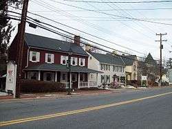 Reisterstown Historic District |
November 15, 1979 (#79001118) |
Maryland Routes 30 and 140 39°27′49″N 76°49′32″W |
Reisterstown | |
| 66 | Rockland |  Rockland |
February 2, 1983 (#83002944) |
10214 Falls Rd. 39°24′11″N 76°40′15″W |
Brooklandville | |
| 67 | Rockland Historic District |  Rockland Historic District |
April 11, 1973 (#73000899) |
Both sides of Falls Rd. (Maryland Route 25) at its junction with Old Court Rd. (Maryland Route 133) 39°24′03″N 76°40′06″W |
Brooklandville | |
| 68 | Rodgers Forge Historic District |  Rodgers Forge Historic District |
September 24, 2009 (#09000783) |
Roughly bounded by Stanmore Rd., Stevenson La., York Rd., Regester Ave., and Bellona Ave. 39°22′52″N 76°37′02″W |
Towson | |
| 69 | Sheppard and Enoch Pratt Hospital and Gatehouse |  Sheppard and Enoch Pratt Hospital and Gatehouse |
November 11, 1971 (#71000369) |
Charles St. 39°23′28″N 76°37′09″W |
Towson | |
| 70 | St. Charles College Historic District | 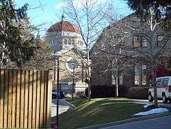 St. Charles College Historic District |
September 30, 1983 (#83002945) |
711 Maiden Choice Lane 39°16′07″N 76°42′46″W |
Catonsville | |
| 71 | St. James Church |  St. James Church |
September 12, 1974 (#74000941) |
Southeast of Monkton off Manor Rd. 39°33′41″N 76°34′11″W |
Monkton | |
| 72 | St. John's Church | 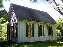 St. John's Church |
March 15, 1982 (#82002807) |
7538 Bellona Ave. 39°23′41″N 76°38′39″W |
Ruxton | |
| 73 | St. Mary's Episcopal Church |  St. Mary's Episcopal Church |
March 14, 1985 (#85000583) |
5610 Dogwood Rd. 39°18′47″N 76°43′16″W |
Woodlawn | |
| 74 | St. Michael's Church | 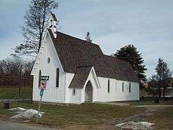 St. Michael's Church |
October 22, 1979 (#79003273) |
Academy Lane and Reisterstown Rd. 39°27′04″N 76°49′08″W |
Reisterstown | |
| 75 | St. Thomas Church | 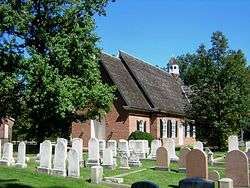 St. Thomas Church |
May 24, 1979 (#79001117) |
St. Thomas Lane and Garrison Forest Rd. 39°25′19″N 76°45′43″W |
Owings Mills | |
| 76 | Stone Hall | 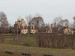 Stone Hall |
July 26, 1973 (#73000900) |
North of Cockeysville off Maryland Route 25 on Cuba Rd. 39°30′34″N 76°41′58″W |
Cockeysville | |
| 77 | Stoneleigh Historic District |  Stoneleigh Historic District |
November 8, 2003 (#03001113) |
Roughly bounded by Regester Ave., York Rd., Hatherleigh Rd., and Kenleigh Rd. 39°22′46″N 76°36′16″W |
Towson | |
| 78 | Sudbrook Park |  Sudbrook Park |
June 19, 1973 (#73000904) |
South of Pikesville off U.S. Route 40 on Greenwood Rd. 39°21′58″N 76°43′49″W |
Pikesville | |
| 79 | Summit |  Summit |
July 24, 1979 (#79001114) |
10 Stanley Dr. 39°16′06″N 76°44′35″W |
Catonsville | |
| 80 | The Wilderness |  The Wilderness |
September 12, 1985 (#85002173) |
2 Thistle Rd. 39°15′27″N 76°46′03″W |
Catonsville | |
| 81 | Thomas Viaduct, Baltimore & Ohio Railroad |  Thomas Viaduct, Baltimore & Ohio Railroad |
October 15, 1966 (#66000388) |
Over the Patapsco River between Relay and Elkridge 39°13′19″N 76°42′49″W |
Relay | |
| 82 | Todd Farmhouse |  Todd Farmhouse |
October 18, 1973 (#73000901) |
9000 Old North Point Rd. (Maryland Route 20) 39°12′49″N 76°26′18″W |
Fort Howard | |
| 83 | Towson Academy |  Towson Academy |
September 25, 1985 (#85002675) |
Washington St. and Chesapeake Ave. 39°23′57″N 76°36′20″W |
Towson | |
| 84 | Tyrconnell | 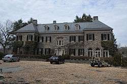 Tyrconnell |
March 14, 1985 (#85000582) |
120 Woodbrook Lane 39°22′50″N 76°38′08″W |
Towson | |
| 85 | Villa Anneslie |  Villa Anneslie |
December 13, 1977 (#77000685) |
529 Dunkirk Rd. 39°22′34″N 76°36′20″W |
Towson | |
| 86 | Wester Ogle |  Wester Ogle |
January 11, 1985 (#85000058) |
8948-8950 Reisterstown Rd. 39°23′31″N 76°45′01″W |
Pikesville | |
| 87 | Western Run-Belfast Road Historic District |  Western Run-Belfast Road Historic District |
January 23, 1979 (#79001116) |
Northwest of Lutherville 39°31′45″N 76°41′39″W |
Lutherville | |
| 88 | Winters Lane Historic District |  Winters Lane Historic District |
December 21, 2007 (#07001285) |
Winters Ln. between Frederick Rd. and Baltimore National Pike. 39°16′45″N 76°44′31″W |
Catonsville | |
| 89 | Worthington Valley Historic District |  Worthington Valley Historic District |
December 12, 1976 (#76000977) |
Bounded by Falls and Shawan Rds., Tufton and Worthington Aves., and the Baltimore Gas and Electric Right-of-Way 39°29′59″N 76°45′19″W |
Glyndon |
Former listing
| [3] | Name on the Register | Image | Date listed | Date removed | Location | City or town | Summary |
|---|---|---|---|---|---|---|---|
| 1 | Belle Field | October 29, 1975 (#75000868) | May 12, 1986 | Timonium Rd. |
Timonium |
See also
| Wikimedia Commons has media related to National Register of Historic Places in Baltimore County, Maryland. |
References
- The latitude and longitude information provided in this table was derived originally from the National Register Information System, which has been found to be fairly accurate for about 99% of listings. Some locations in this table may have been corrected to current GPS standards.
- "National Register of Historic Places: Weekly List Actions". National Park Service, United States Department of the Interior. Retrieved on June 19, 2020.
- Numbers represent an ordering by significant words. Various colorings, defined here, differentiate National Historic Landmarks and historic districts from other NRHP buildings, structures, sites or objects.
- "National Register Information System". National Register of Historic Places. National Park Service. April 24, 2008.
- The eight-digit number below each date is the number assigned to each location in the National Register Information System database, which can be viewed by clicking the number.
| Topics |  | |
|---|---|---|
| Lists by county | ||
| Lists by city | ||
| Other lists | ||
| ||
Municipalities and communities of Baltimore County, Maryland, United States | ||
|---|---|---|
| CDPs |
| |
| Other communities |
| |
This article is issued from Wikipedia. The text is licensed under Creative Commons - Attribution - Sharealike. Additional terms may apply for the media files.