National Register of Historic Places listings in Caroline County, Maryland
This is a list of the National Register of Historic Places listings in Caroline County, Maryland.
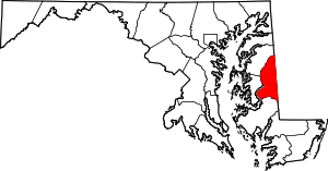
Location of Caroline County in Maryland
This is intended to be a complete list of the properties and districts on the National Register of Historic Places in Caroline County, Maryland, United States. Latitude and longitude coordinates are provided for many National Register properties and districts; these locations may be seen together in a map.[1]
There are 23 properties and districts listed on the National Register in the county.
| Allegany - Anne Arundel - Baltimore (city) - Baltimore County - Calvert - Caroline - Carroll - Cecil - Charles - Dorchester - Frederick - Garrett - Harford - Howard - Kent - Montgomery - Prince George's - Queen Anne's - Somerset - St. Mary's - Talbot - Washington - Wicomico - Worcester |
- This National Park Service list is complete through NPS recent listings posted June 19, 2020.[2]
Current listings
| [3] | Name on the Register[4] | Image | Date listed[5] | Location | City or town | Description |
|---|---|---|---|---|---|---|
| 1 | Athol | June 9, 1989 (#89000485) |
Melville Rd. near Trunk Line Rd. 39°05′15″N 75°47′41″W |
Henderson | ||
| 2 | Brick House Farm | 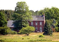 Brick House Farm |
December 2, 2009 (#09000963) |
24870 E. Cherry Ln. 39°00′38″N 75°50′21″W |
Greensboro | |
| 3 | Castle Hall | 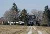 Castle Hall |
December 4, 1975 (#75000872) |
8 miles north of Goldsboro on Maryland Route 311 39°03′05″N 75°47′08″W |
Goldsboro | |
| 4 | Chambers Park Log Cabin | 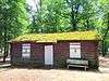 Chambers Park Log Cabin |
June 28, 2016 (#16000408) |
Liberty Rd. 38°41′37″N 75°45′42″W |
Federalsburg | |
| 5 | Daffin House | October 21, 1975 (#75000873) |
3 miles south of Hillsboro on Deep Branch Rd. 38°52′31″N 75°55′47″W |
Hillsboro | ||
| 6 | Denton Armory | 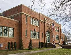 Denton Armory |
September 25, 1985 (#85002665) |
Maple Ave. and Randolph St. 38°53′02″N 75°49′53″W |
Denton | |
| 7 | Denton Historic District | 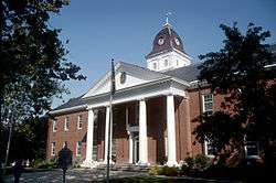 Denton Historic District |
December 1, 1983 (#83003738) |
Roughly bounded by 1st, 10th, Gay, High, Franklin, and Sunnyside Sts. 38°53′07″N 75°49′41″W |
Denton | |
| 8 | Denton Schoolhouse | 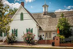 Denton Schoolhouse |
April 19, 1978 (#78001447) |
104 S. 2nd St. 38°53′07″N 75°50′02″W |
Denton | |
| 9 | Exeter | 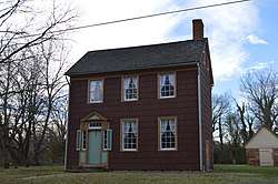 Exeter |
January 3, 1978 (#78001448) |
North of Federalsburg on Maryland Route 630 38°42′10″N 75°46′37″W |
Federalsburg | |
| 10 | Federalsburg West Historic District | 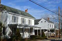 Federalsburg West Historic District |
May 12, 2016 (#16000250) |
Roughly bounded by Railroad, University & Bloomingdale Aves., Denton & Idlewild Rds. & Marshyhope Creek 38°41′55″N 75°46′49″W |
Federalsburg | |
| 11 | Leonard House | 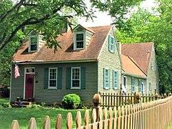 Leonard House |
November 14, 1988 (#88001444) |
Main St. 38°58′43″N 75°48′14″W |
Greensboro | |
| 12 | Jacob and Hannah Leverton House | December 2, 2009 (#09000964) |
3531 Seaman Rd. 38°42′09″N 75°53′29″W |
Preston | ||
| 13 | Linchester Mill | 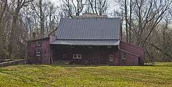 Linchester Mill |
December 23, 2009 (#09001148) |
3395 Linchester Rd. 38°42′03″N 75°53′51″W |
Preston | |
| 14 | Marble Head | 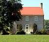 Marble Head |
December 27, 2002 (#02001577) |
24435 Marblehead Rd. 38°59′21″N 75°48′18″W |
Ridgely | |
| 15 | Memory Lane | 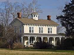 Memory Lane |
October 12, 2000 (#00001200) |
24700 Williston Rd. 38°49′51″N 75°50′54″W |
Denton | |
| 16 | Nanticoke Lodge No. 172, A.F. and A.M. | 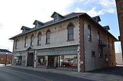 Nanticoke Lodge No. 172, A.F. and A.M. |
June 2, 2014 (#14000270) |
112-116 N. Main St. 38°41′42″N 75°46′26″W |
Federalsburg | |
| 17 | Neck Meetinghouse and Yard | 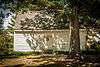 Neck Meetinghouse and Yard |
October 22, 1976 (#76000982) |
Maryland Route 404 38°53′26″N 75°50′29″W |
West Denton | |
| 18 | Oak Lawn | 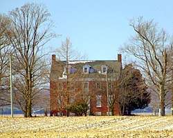 Oak Lawn |
May 28, 1975 (#75000875) |
2.8 miles north of Ridgely on Maryland Route 312 38°58′50″N 75°52′51″W |
Ridgely | |
| 19 | Potter Hall |  Potter Hall |
November 30, 1982 (#82001590) |
Martin Lane 38°49′52″N 75°51′10″W |
Williston | |
| 20 | St. Paul's Episcopal Church |  St. Paul's Episcopal Church |
May 12, 1975 (#75000874) |
South of Maryland Route 404 38°54′56″N 75°56′32″W |
Hillsboro | |
| 21 | West Denton Warehouse-Wharf | 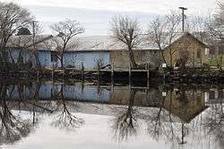 West Denton Warehouse-Wharf |
November 15, 2000 (#00001285) |
10215 River Landing Rd. 38°53′18″N 75°50′23″W |
West Denton | |
| 22 | Williston Mill Historic District |  Williston Mill Historic District |
December 27, 2002 (#02001576) |
24729 Williston Rd. 38°49′46″N 75°50′50″W |
Denton | |
| 23 | Willow Grove | 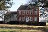 Willow Grove |
June 13, 1972 (#72000573) |
Maryland Route 457 off Maryland Route 213 38°55′34″N 75°46′28″W |
Greensboro |
See also
| Wikimedia Commons has media related to National Register of Historic Places in Caroline County, Maryland. |
References
- The latitude and longitude information provided in this table was derived originally from the National Register Information System, which has been found to be fairly accurate for about 99% of listings. Some locations in this table may have been corrected to current GPS standards.
- "National Register of Historic Places: Weekly List Actions". National Park Service, United States Department of the Interior. Retrieved on June 19, 2020.
- Numbers represent an ordering by significant words. Various colorings, defined here, differentiate National Historic Landmarks and historic districts from other NRHP buildings, structures, sites or objects.
- "National Register Information System". National Register of Historic Places. National Park Service. April 24, 2008.
- The eight-digit number below each date is the number assigned to each location in the National Register Information System database, which can be viewed by clicking the number.
| Topics | 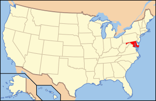 | |
|---|---|---|
| Lists by county | ||
| Lists by city | ||
| Other lists | ||
| ||
Municipalities and communities of Caroline County, Maryland, United States | ||
|---|---|---|
| Towns | | |
| CDPs | ||
| Unincorporated communities | ||
| Footnotes | ‡This populated place also has portions in an adjacent county or counties | |
This article is issued from Wikipedia. The text is licensed under Creative Commons - Attribution - Sharealike. Additional terms may apply for the media files.