National Register of Historic Places listings in Box Elder County, Utah
This is a list of the National Register of Historic Places listings in Box Elder County, Utah.
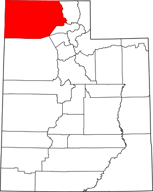
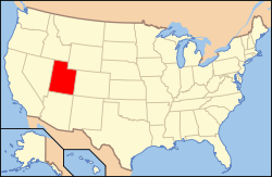
Location of Box Elder County in Utah
This is intended to be a complete list of the properties and districts on the National Register of Historic Places in Box Elder County, Utah, United States. Latitude and longitude coordinates are provided for many National Register properties and districts; these locations may be seen together in a map.[1]
There are 42 properties and districts listed on the National Register in the county. Another 3 sites in the county were once listed, but have since been removed.
- This National Park Service list is complete through NPS recent listings posted June 19, 2020.[2]
Current listings
| [3] | Name on the Register[4] | Image | Date listed[5] | Location | City or town | Description |
|---|---|---|---|---|---|---|
| 1 | George and Mabel Anderson House | 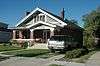 George and Mabel Anderson House |
October 15, 2014 (#14000862) |
63 N. 200 East 41°30′43″N 112°00′46″W |
Brigham City | |
| 2 | Martin Anderson House |  Martin Anderson House |
January 23, 2003 (#02001735) |
105 N. 300 West 41°30′48″N 112°01′12″W |
Brigham City | |
| 3 | Bear River High School Science Building | 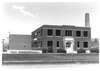 Bear River High School Science Building |
April 1, 1985 (#85000797) |
1450 S. Main St. 41°43′33″N 112°09′43″W |
Garland | |
| 4 | Box Elder County Courthouse | 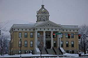 Box Elder County Courthouse |
April 7, 1988 (#88000399) |
1 N. Main St. 41°30′38″N 112°00′51″W |
Brigham City | |
| 5 | Box Elder Flouring Mill | 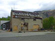 Box Elder Flouring Mill |
January 24, 1990 (#89000452) |
327 E. 200 North 41°30′55″N 112°00′32″W |
Brigham City | |
| 6 | Box Elder Stake Tabernacle | 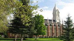 Box Elder Stake Tabernacle |
May 14, 1971 (#71000840) |
Main St. between 2nd and 3rd South Sts. 41°30′20″N 112°00′51″W |
Brigham City | |
| 7 | Brigham City Carnegie Library | 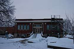 Brigham City Carnegie Library |
October 25, 1984 (#84000143) |
26 E. Forest St. 41°30′39″N 112°00′51″W |
Brigham City | |
| 8 | Brigham City Fire Station/City Hall | 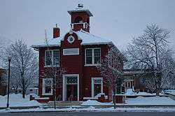 Brigham City Fire Station/City Hall |
April 7, 1988 (#88000389) |
6 N. Main St. 41°30′39″N 112°00′53″W |
Brigham City | |
| 9 | Brigham City Mercantile and Manufacturing Association Mercantile Store | 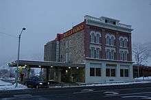 Brigham City Mercantile and Manufacturing Association Mercantile Store |
January 24, 1990 (#89000453) |
5 N. Main St. 41°30′39″N 112°00′56″W |
Brigham City | |
| 10 | Central Pacific Railroad Grade Historic District |  Central Pacific Railroad Grade Historic District |
May 15, 1987 (#87000699) |
87-mile (140 km) segment between the Umbria junction 9 miles (14 km) east of the Nevada border, around the northern end of Great Salt Lake, to the Golden Spike National Historic Site 41°16′31″N 113°20′40″W |
Park Valley | |
| 11 | Alma Compton House | 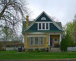 Alma Compton House |
April 7, 1988 (#88000381) |
142 S. 100 East 41°30′25″N 112°00′49″W |
Brigham City | |
| 12 | Corinne Methodist Episcopal Church | 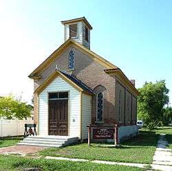 Corinne Methodist Episcopal Church |
May 14, 1971 (#71000842) |
Corner of Colorado St. and 4000 West 41°32′51″N 112°06′40″W |
Corinne | |
| 13 | Cutler Hydroelectric Power Plant Historic District | 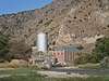 Cutler Hydroelectric Power Plant Historic District |
April 20, 1989 (#89000280) |
Off State Route 30 at the Bear River 41°50′06″N 112°03′08″W |
Beaver Dam | |
| 14 | Elberta Theatre | 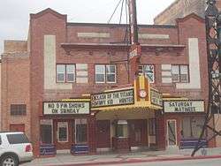 Elberta Theatre |
October 17, 1991 (#91001544) |
53 S. Main St. 41°30′33″N 112°00′52″W |
Brigham City | |
| 15 | Alfred and Marie Fawson House | 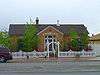 Alfred and Marie Fawson House |
January 27, 2003 (#02001736) |
64 S. 100 West 41°30′33″N 112°01′02″W |
Brigham City | |
| 16 | Peter and Anna Christena Forsgren House | 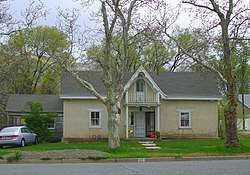 Peter and Anna Christena Forsgren House |
January 23, 2003 (#02001737) |
59 S. 100 East 41°30′33″N 112°00′47″W |
Brigham City | |
| 17 | Fryer Hotel | 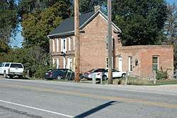 Fryer Hotel |
April 7, 1988 (#88000379) |
3274 W. 11300 North 41°42′56″N 112°05′46″W |
Deweyville | |
| 18 | Garland Carnegie Library | 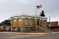 Garland Carnegie Library |
October 25, 1984 (#84000146) |
86 W. Factory St. 41°44′29″N 112°09′46″W |
Garland | |
| 19 | William and Nettie Glover House | 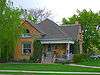 William and Nettie Glover House |
December 28, 2000 (#00001587) |
106 W. 100 North 41°30′48″N 112°01′01″W |
Brigham City | |
| 20 | Golden Spike National Historic Site | 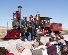 Golden Spike National Historic Site |
October 15, 1966 (#66000080) |
Northeast of the Great Salt Lake 41°36′31″N 112°33′20″W |
Promontory | |
| 21 | Granary of the Relief Society | 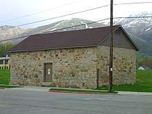 Granary of the Relief Society |
January 24, 1990 (#89000455) |
100 N. 400 East 41°30′46″N 112°00′29″W |
Brigham City | |
| 22 | Hampton's Ford Stage Stop and Barn | 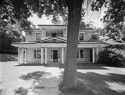 Hampton's Ford Stage Stop and Barn |
August 12, 1971 (#71000841) |
3605 W. Bigler Rd. 41°47′14″N 112°06′18″W |
Collinston | Now the Old Barn Community Theatre |
| 23 | Hogup Cave (42BO36) | 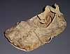 Hogup Cave (42BO36) |
May 8, 1986 (#86001016) |
Address Restricted[6] |
Park Valley | A cave showing signs of human occupation from about 6500 BC to AD 1470 |
| 24 | Holmgren Farmstead | 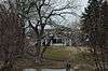 Holmgren Farmstead |
April 5, 2001 (#01000319) |
460 N. 300 East 41°42′59″N 112°09′31″W |
Tremonton | |
| 25 | Christian and Annie Holst House | 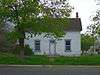 Christian and Annie Holst House |
January 27, 2003 (#02001738) |
495 S. 200 East 41°30′04″N 112°00′42″W |
Brigham City | |
| 26 | Hotel Brigham | 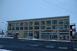 Hotel Brigham |
October 17, 1991 (#91001543) |
13 and 17 W. Forest St. 41°30′37″N 112°00′55″W |
Brigham City | |
| 27 | Howard Hotel | 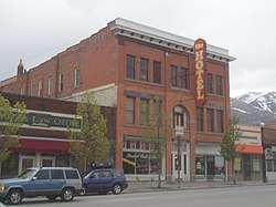 Howard Hotel |
October 7, 1994 (#94001209) |
35 S. Main St. 41°30′35″N 112°00′53″W |
Brigham City | |
| 28 | Nels and Minnie Jenson House | 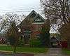 Nels and Minnie Jenson House |
December 28, 2000 (#00001588) |
136 E. 100 South 41°30′28″N 112°00′45″W |
Brigham City | |
| 29 | Jeppson-Reeder House | 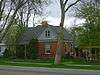 Jeppson-Reeder House |
February 27, 2003 (#03000082) |
631 N. Main 41°31′25″N 112°00′55″W |
Brigham City | |
| 30 | Knudson Brothers Building | 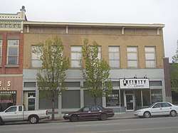 Knudson Brothers Building |
July 16, 1992 (#92000893) |
63 S. Main St. 41°30′34″N 112°00′52″W |
Brigham City | |
| 31 | Jonathan and Jennie Knudson House | 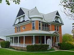 Jonathan and Jennie Knudson House |
December 28, 2000 (#00001583) |
48 S. 100 East 41°30′32″N 112°00′49″W |
Brigham City | |
| 32 | Lower Bear River Archeological Discontiguous District | February 13, 1986 (#86000249) |
Address Restricted[6] |
Brigham City | ||
| 33 | Mountain States Telephone and Telegraph Building | 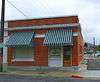 Mountain States Telephone and Telegraph Building |
December 27, 1996 (#96001530) |
20 E. 100 South St. 41°30′28″N 112°00′52″W |
Brigham City | |
| 34 | Oregon Short Line Depot | 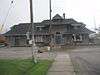 Oregon Short Line Depot |
July 16, 1992 (#92000891) |
800 West and Forest St. 41°30′37″N 112°01′43″W |
Brigham City | |
| 35 | Plymouth School | 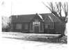 Plymouth School |
April 9, 1986 (#86000733) |
135 S. Main St. 41°52′31″N 112°08′45″W |
Plymouth | |
| 36 | A. N. Tanner House | 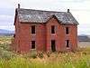 A. N. Tanner House |
February 11, 1982 (#82004107) |
Grouse Creek Rd. 41°42′10″N 113°53′30″W |
Grouse Creek | |
| 37 | Thompson-Hansen House | 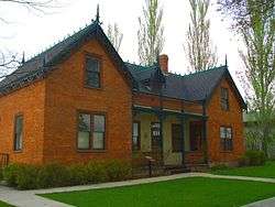 Thompson-Hansen House |
December 23, 1994 (#94001474) |
120 N. Main St. 41°30′54″N 112°00′51″W |
Brigham City | |
| 38 | Transcontinental Railroad Grade | Transcontinental Railroad Grade |
December 8, 1994 (#94001423) |
Roughly from 6 miles (9.7 km) west of Corinne running approximately 13 miles (21 km) along State Route 83 41°36′55″N 112°20′40″W |
Corinne | |
| 39 | Union Block | 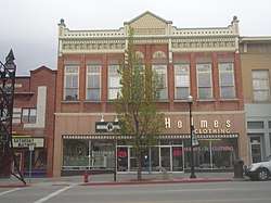 Union Block |
October 17, 1991 (#91001545) |
57 S. Main St. 41°30′32″N 112°00′52″W |
Brigham City | |
| 40 | Washakie LDS Ward Chapel | 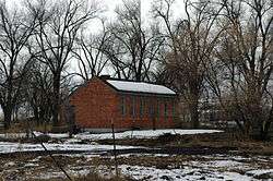 Washakie LDS Ward Chapel |
June 3, 1998 (#98000641) |
Along Samaria Lake Canal 41°56′38″N 112°13′06″W |
Washakie | |
| 41 | William L. and Mary Watkins House | 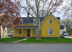 William L. and Mary Watkins House |
May 2, 2001 (#01000471) |
74 N. 100 East 41°30′44″N 112°00′47″W |
Brigham City | |
| 42 | Willard Historic District | 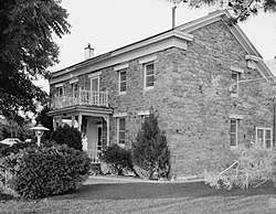 Willard Historic District |
June 25, 1974 (#74001933) |
Roughly bounded by 200 West, 200 North, 100 East, and 200 South Sts. 41°24′33″N 112°02′09″W |
Willard |
Former listings
| [3] | Name on the Register | Image | Date listed | Date removed | Location | City or town | Summary |
|---|---|---|---|---|---|---|---|
| 1 | Box Elder High School Gymnasium | 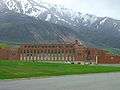 Box Elder High School Gymnasium |
April 1, 1985 (#85000796) | August 27, 2013 | 18 N. 400 East 41°30′39″N 112°00′29″W |
Brigham City | Box Elder School District demolished this building in 2011. |
| 2 | Planing Mill of Brigham City Mercantile and Manufacturing Association | 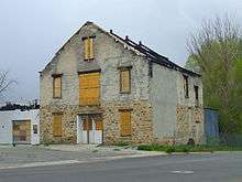 Planing Mill of Brigham City Mercantile and Manufacturing Association |
January 24, 1990 (#89000454) | March 26, 2018 | 547 E. Forest St. 41°30′39″N 112°00′21″W |
Brigham City | A surviving building of the Brigham City Co-op. |
| 3 | Southern Pacific Railroad: Ogden-Lucin Cut-Off Trestle | 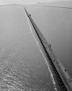 Southern Pacific Railroad: Ogden-Lucin Cut-Off Trestle |
April 14, 1972 (#72001257) | October 23, 2018 | 30 miles (48 km) west of Ogden at the northern arm of the Great Salt Lake 41°13′08″N 112°41′30″W |
Ogden |
See also
References
- The latitude and longitude information provided in this table was derived originally from the National Register Information System, which has been found to be fairly accurate for about 99% of listings. Some locations in this table may have been corrected to current GPS standards.
- "National Register of Historic Places: Weekly List Actions". National Park Service, United States Department of the Interior. Retrieved on June 19, 2020.
- Numbers represent an ordering by significant words. Various colorings, defined here, differentiate National Historic Landmarks and historic districts from other NRHP buildings, structures, sites or objects.
- "National Register Information System". National Register of Historic Places. National Park Service. April 24, 2008.
- The eight-digit number below each date is the number assigned to each location in the National Register Information System database, which can be viewed by clicking the number.
- Some listings on the NRHP are highly sensitive sites and may be subject to looting or vandalism. The NRHP lists this site as "Address Restricted."
External links
![]()
 | |||
| Topics | |
|---|---|
| Lists by state |
|
| Lists by insular areas | |
| Lists by associated state | |
| Other areas | |
| Related | |
| |
Municipalities and communities of Box Elder County, Utah, United States | ||
|---|---|---|
| Cities | Map of Utah highlighting Box Elder County | |
| Towns | ||
| CDPs | ||
| Unincorporated areas | ||
| Ghost towns | ||
| Indian reservation | ||
This article is issued from Wikipedia. The text is licensed under Creative Commons - Attribution - Sharealike. Additional terms may apply for the media files.