National Highway 53 (India)
National Highway 53, combination of old (NH6 Surat-Kolkata), (NH200 Bilaspur-Chandikhole) & (NH5A Chandikhole-Paradeep) is a national highway in India.[1] It connects Hajira in Gujarat and Paradeep port in Odisha. NH-53 traverses the states of Gujarat, Maharashtra, Chhattisgarh and Odisha in India.[2] The road is the part of AH46 network in India and it is officially listed as running over 1949 km (1211mi) from Kolkata to Surat. it is also known as Surat - Kolkata Highway. It passes through Maharashtra,Chhattisgarh and Odisha states.[3]
| ||||
|---|---|---|---|---|
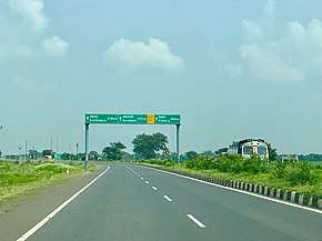 NH 53 in Chhattisgarh | ||||
| Route information | ||||
| Part of | ||||
| Length | 1,795 km (1,115 mi) | |||
| Major junctions | ||||
| West end | Hajira | |||
| East end | Paradeep Port | |||
| Location | ||||
| States | Gujarat, Maharashtra, Chhattisgarh, Odisha | |||
| Highway system | ||||
| ||||
.jpg)
Route
Route of primary national highway 53 passes through four states of India.[1][2]
Maharashtra
Gujarat border - Dhule, Jalgaon, Khamgaon, Akola, Amravati, Nagpur, Bhandara, Deori - Chhattisgarh border.
Chhattisgarh
Maharashtra border - Rajnandgaon, Durg, Bhilai, Raipur, Arang, Ghorari Mahasamund Saraipali - Odisha border.
Odisha
Chhattisgarh border - Bargarh, Sambalpur, Deogarh, Kannah, Talcher, Kamakhyanagar, Sukinda, Dubri, Chandhikhol, Haridaspur, Paradip Port.
Asian Highways
The stretch of National Highway 53 from Dhule in Maharashtra to Deogarh in Odisha is part of Asian Highway 46.[4]
Junctions list
- Gujarat

- Terminal point at Hazira port.


- Maharashtra


- Chhattisgarh

Map with spur routes
References
- "New Numbering of National Highways notification - Government of India" (PDF). The Gazette of India. Retrieved 27 October 2018.
- "State-wise length of National Highways in India". Ministry of Road Transport and Highways. Retrieved 27 October 2018.
- "Rationalisation of Numbering Systems of National Highways" (PDF). New Delhi: Department of Road Transport and Highways. Archived from the original (PDF) on 31 March 2012. Retrieved 3 April 2012.
- "Asian Highway Database - Country wise". UNESCAP. Retrieved 21 June 2019.
External links
| Wikimedia Commons has media related to NH 53 (India). |

Secondary routes of National Highway 53 | ||
|---|---|---|
 | ||
| Secondary Routes of NH 53 | ||
| Indian Highways | ||
| Across the whole continent |  | |
|---|---|---|
| Southeast Asia | ||
| East Asia, Northeast Asia and Southeast Asia | ||
| South Asia | ||
| North Asia, Central Asia and Southwest Asia | ||