National Highway 505 (India)
National Highway 505, commonly called NH 505, is a national highway in India.[1][2] It is a spur road of National Highway 5.[3] NH-505 traverses the state of Himachal Pradesh in India.[2] NH505 a high altitude road, covers Kinnaur and Lahaul and Spiti districts of Himachal Pradesh, mainly running along Spity river in Spity valley. The highway from Kaza to Gramphu remains closed for nine months in a year due to heavy snowfall and closure of Kunzum La pass at an altitude of 4,550 m (14,930 ft).[4][5]
| ||||
|---|---|---|---|---|
 Bridge across Spiti River | ||||
| Route information | ||||
| Auxiliary route of NH 5 | ||||
| Length | 282 km (175 mi) | |||
| Major junctions | ||||
| East end | Khab | |||
| West end | Gramphoo | |||
| Location | ||||
| States | Himachal Pradesh | |||
| Highway system | ||||
| ||||

Overview
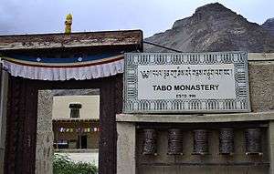
National Highway 505, was designated Himachal state highway 30 prior to its being notified on 4 March 2014 as national highway. The highway runs through high altitude cold desert area of Lahaul and Spity valleys which receive negligible rainfall. The terrain is barren and treacherous, prone to landslides and disruptions. The road is narrow and rough at places and crosses high altitude Kunzum pass, requiring good driving skills in mountains.[6] NH-505 provides connectivity to some major Buddhist monasteries and various interesting places.[7]
Route
- Kinnaur district
The route of NH-505 starts at Khab in Kinnaur district from National Highway 5. It connects Khab Sangam, Nako and Chango, then enters Lahaul and Spiti district at Sumdo.[2] This is the preferred point of entry to Spiti valley which is located at an average elevation of 3350 meters (10,988 feet).[5] This mostly all-weather access point to Spiti valley from Khab is at an elevation of about 2600 meters. Travelling from Shimla to Khab gives a chance for travellers to gradually acclimatize themselves to avoid altitude sickness.
 Entry to Spiti Valley from bridge over Sutlej river
 Enroute Khab to Nako
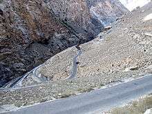 Switchback hairpin bends
 Enroute Khab to Nako
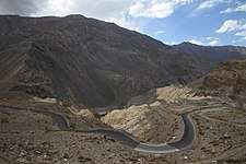 Enroute Nako to Chango
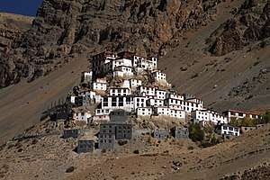
- Lahaul and Spiti district
Tabo, Attargo, Kaza, Morang, Hanse, Losar, Lachu, Chhota Dhara, Gramphu.[1]
 Kaza in Spiti valley
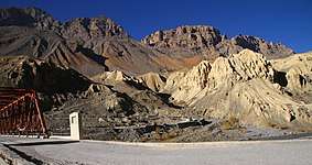 Enroute Kaza to Losar
 Bridge across Spiti river
 Losar-Kunzum Road
 Kunzum La, Elevation 4551 m
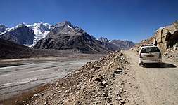 Batal to Chhatru
 Chhatru village
 Chhatru to Gramphu
 Junction with NH3 on left at Gramphu
References
- "New highways notification dated March, 2014" (PDF). The Gazette of India - Ministry of Road Transport and Highways. Retrieved 5 July 2018.
- "State-wise length of National Highways (NH) in India as on 30.06.2017". Ministry of Road Transport and Highways. Retrieved 5 July 2018.
- "New Numbering of National Highways notification - Government of India" (PDF). The Gazette of India. Retrieved 5 July 2018.
- "Access to Lahaul & Spiti district by road". Lahaul and Spiti district website. Retrieved 1 February 2019.
- "Status of roads in Lahaul and Spiti district". Lahaul and Spiti district. Retrieved 1 February 2019.
- "How to drive to Spiti". Condé Nast Traveller. 10 April 2018.
- "15 places to visit in the beautiful valleys of Lahaul-Spiti". The Times of India - Times Travel. Retrieved 2 February 2019.
External links
| Wikimedia Commons has media related to NH 505 (India). |

Secondary routes of National Highway 5 | ||
|---|---|---|
 | ||
| Secondary Routes of NH 5 | ||