Montfort-l'Amaury
Montfort-l'Amaury is a commune in the Yvelines department in the Île-de-France region in north-central France. It is located 20 km (12 mi) north of Rambouillet. The name comes from Amaury I de Montfort, the first count of Montfort.
Montfort-l'Amaury | |
|---|---|
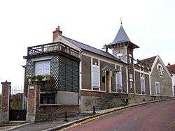
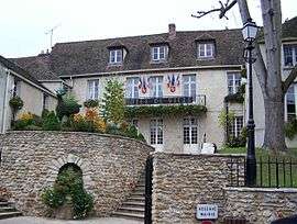 Town hall | |
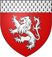 Coat of arms | |
Location of Montfort-l'Amaury 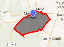
| |
 Montfort-l'Amaury  Montfort-l'Amaury | |
| Coordinates: 48°46′40″N 1°48′36″E | |
| Country | France |
| Region | Île-de-France |
| Department | Yvelines |
| Arrondissement | Rambouillet |
| Canton | Aubergenville |
| Government | |
| • Mayor (2008–14) | Hervé Planchenault |
| Area 1 | 5.71 km2 (2.20 sq mi) |
| Population (2017-01-01)[1] | 2,940 |
| • Density | 510/km2 (1,300/sq mi) |
| Time zone | UTC+01:00 (CET) |
| • Summer (DST) | UTC+02:00 (CEST) |
| INSEE/Postal code | 78420 /78490 |
| Elevation | 98–183 m (322–600 ft) |
| 1 French Land Register data, which excludes lakes, ponds, glaciers > 1 km2 (0.386 sq mi or 247 acres) and river estuaries. | |
Geography
Montfort-l'Amaury lies north of the Rambouillet Forest. It is located at the foot of low hills, at about 130 m above sea level.
History
King Robert II built a castle in 996 in the hills of Montfort. Montfort-l'Amaury was the stronghold of the Montfort family from the start of the 11th century. Amaury I built the ramparts.
The Comté de Montfort was related to the Duchy of Brittany following the marriage of Yolande de Dreux-Montfort with Arthur of Brittany in 1294. It returned to the crown of France when Brittany became a part of France under Francis I. The castle was destroyed by the English during the Hundred Years' War.
Sites of interest
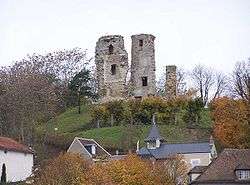
- Ruins of the castle 48°46′36″N 1°48′16″E
- Maison de Maurice Ravel, which is now a museum . Maurice Ravel lived here from 1921 until his death.
- Château de Groussay, built in the 19th century
People
- Jean Anouilh, dramatist
- Colette Darfeuil, actress
- Henri George Doll, scientist
- Jean Monnet, architect of European Unity
- Simon de Montfort, 6th Earl of Leicester (born in the castle, 1208)
- Maurice Ravel, composer
- Charles Aznavour, singer
- Ambroise Roux (1921-1999), CEO of Compagnie générale d'électricité (later known as Alcatel) from 1970 to 1981, lived and died in Montfort-l'Amaury.[2]
Twin towns
- Nickenich, Germany
See also
References
- "Populations légales 2017". INSEE. Retrieved 6 January 2020.
- "Obituary: Ambroise Roux". The Independent. 9 April 1999. Retrieved 16 April 2017.
External links
| Wikimedia Commons has media related to Montfort-l'Amaury. |
- Official website
- Pictures of Castle Montfort l'Amaury
- Photos by Amaury Laporte, free to use for non commercial purposes
- Information about Montfort l'Amaury
| Authority control |
|
|---|