Achères, Yvelines
Achères (French pronunciation: [aʃɛʁ]) is a commune in the Yvelines department in north-central France. It is located 23.7 km (14.7 mi) from the center of Paris.
Achères | |
|---|---|
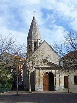
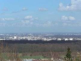 A general view of Achères | |
.svg.png) Coat of arms | |
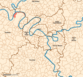 Location (in red) within Paris inner and outer suburbs | |
Location of Achères 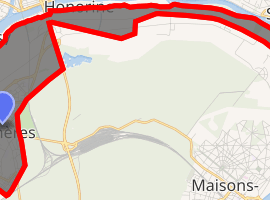
| |
 Achères Location (in red) within Paris inner and outer suburbs  Achères Achères (Île-de-France (region)) | |
| Coordinates: 48°57′37″N 2°04′06″E | |
| Country | France |
| Region | Île-de-France |
| Department | Yvelines |
| Arrondissement | Saint-Germain-en-Laye |
| Canton | Poissy |
| Intercommunality | Grand Paris Seine et Oise |
| Government | |
| • Mayor (2014-2020) | Marc Honoré |
| Area 1 | 9.44 km2 (3.64 sq mi) |
| Population (2016) | 20,823 |
| • Density | 2,200/km2 (5,700/sq mi) |
| Time zone | UTC+01:00 (CET) |
| • Summer (DST) | UTC+02:00 (CEST) |
| INSEE/Postal code | 78005 /78260 |
| Elevation | 18–32 m (59–105 ft) |
| 1 French Land Register data, which excludes lakes, ponds, glaciers > 1 km2 (0.386 sq mi or 247 acres) and river estuaries. | |
The commune of Achères lies on the south bank of the Seine in a loop of the river, on the edge of the Forest of Saint-Germain-en-Laye. It borders Saint-Germain-en-Laye and Poissy on the south, Andrésy and Carrières-sous-Poissy on the west, Conflans-Sainte-Honorine and Herblay on the north, and Maisons-Laffitte and La Frette-sur-Seine on the east.
Population
| Historical population | ||
|---|---|---|
| Year | Pop. | ±% |
| 2006 | 19,850 | — |
| 2007 | 19,789 | −0.3% |
| 2008 | 19,733 | −0.3% |
| 2009 | 19,533 | −1.0% |
| 2010 | 19,626 | +0.5% |
| 2011 | 19,606 | −0.1% |
| 2012 | 19,469 | −0.7% |
| 2013 | 19,985 | +2.7% |
| 2014 | 20,923 | +4.7% |
| 2015 | 21,053 | +0.6% |
| 2016 | 20,823 | −1.1% |
Inhabitants of Achères are called Achérois.
Politics
Presidential Elections 2nd Round [1]
| Election | Winning Candidate | Party | % | |
|---|---|---|---|---|
| 2017 | Emmanuel Macron | EM | 74.47 | |
| 2012 | François Hollande | PS | 59.14 | |
| 2007 | Ségolène Royal | PS | 53.44 | |
| 2002 | Jacques Chirac | RPR | 84.91 | |
Transportation
Achères is served by Achères – Ville and Achères - Grand Cormier stations on Paris RER line ![]()
By road, it is accessible from the N184, the Route de Poissy, and the D30.
See also
External links
| Wikimedia Commons has media related to Achères, Yvelines. |
- Official website (in French)
| Authority control |
|
|---|