Mexico City Metro Line 2
Line 2 is one of the 12 lines of the Mexico City Metro.[2]
| Line 2 / Línea 2 | |
|---|---|
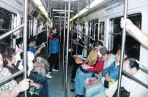 Inside a train on Line 2 | |
| Overview | |
| Type | Rapid transit |
| System | Mexico City Metro |
| Locale | Mexico City |
| Termini | Metro Cuatro Caminos Metro Tasqueña |
| Stations | 24 |
| Ridership | 737,396 passengers per day (2019)[1] |
| Operation | |
| Opened | 1 August 1970 |
| Operator(s) | Sistema de Transporte Colectivo (STC) |
| Rolling stock | 45 NM-02 trains made by Bombardier México in 2004 |
| Technical | |
| Line length | 20.713 km (13 mi) |
| Track length | 23.431 km (15 mi) |
| Track gauge | 1,435 mm (4 ft 8 1⁄2 in) standard gauge with roll ways along track |
| Electrification | Guide bars |
| Operating speed | 36 km/h (22 mph) |
The 2 Line is the second oldest in the network, identified by the color blue and runs from West to East and then North to South, turning at the city center. It starts at the border of the city with Estado de México and ends South of the city.
General information
Line 2 connects with Line 7 at Tacuba, Line 3 at Hidalgo, Line 8 at Bellas Artes, Line 1 at Pino Suárez, Lines 8 and 9 at Chabacano and Line 12 at Ermita. It is linked with the Mexico City Light Rail to Xochimilco at the Tasqueña terminal. It used to be served by NC-82 and some NM-83 trains.
It runs under the following roads: Calzada San Bartolo Naucalpan in the stretch from Cuatro Caminos to Panteones, Calzada México-Tacuba from Panteones to Normal, Av. Ribera de San Cosme, Av. Puente de Alvarado from Revolución to Hidalgo, Av. Hidalgo from Hidalgo to Bellas Artes, Tacuba street, República de Guatemala street, José María Pino Suárez street from Zócalo to Pino Suárez. From San Antonio Abad it runs at ground level over Calzada San Antonio Abad and Calzada de Tlalpan till the terminus of the line in Tasqueña.
This line was temporarily served by an NM-02 train printed with landscapes and images of Mexico City.
History
Line 2 opened on August 1, 1970, in the stretch Tasqueña–Pino Suárez. Pino Suárez station became the first transfer station of the Mexico City Metro, connecting with Line 1, built one year before.
On September 14th, the line was expanded towards Tacuba station.
The last expansion of the line occurred in 1984 when two more stations were built: Panteones and Cuatro Caminos, the latter being the first station of the system to serve the State of Mexico. Cuatro Caminos would remain as the only station to serve the suburbs of Mexico City till 1991, when Line A opened and service reached the municipality of Los Reyes La Paz, in the southeastern part of the State of Mexico.
1975 train crash
This line has seen the worst accident in Mexico City history when on October 20, 1975 when there was a crash between two trains at Metro Viaducto. One train was parked at the station picking up passengers when it was hit by another train that did not stop in time. At least 27 people were killed and several wounded. After this accident, automatic traffic lights were installed in all lines.
Chronology
- August 1, 1970: from Tasqueña to Pino Suárez.
- September 14, 1970: from Pino Suárez to Tacuba.
- August 22, 1984: from Tacuba to Cuatro Caminos.
Rolling stock
Line 2 has had different types of rolling stock throughout the years.
- Alstom MP-68: : 1970–1975
- Concarril NM-73: : 1975–2005
- Concarril NM-79: 1980–2006
- Alstom MP-82: 1985–2007
- Bombardier NC-82: 1987–2005
- CAF/Bombardier NM-02: 2004–present
Currently, out of the 390 trains in the Mexico City Metro network, 40 are in service in Line 2.[3]
Station list
| No. | Station | Date opened | Level | Distance (km) | Transfers | Location | ||
|---|---|---|---|---|---|---|---|---|
| Between stations |
Total | |||||||
| 01 | Cuatro Caminos | August 22, 1984 | Underground, trench. |
- | 0.0 |
|
Naucalpan | State of Mexico |
| 02 | Panteones | August 22, 1984 | Underground, trench. |
1.8 | 1.8 | Miguel Hidalgo | Mexico City | |
| 03 | Tacuba | September 14, 1970 | Underground, trench. |
1.6 | 3.4 |
| ||
| 04 | Cuitláhuac | September 14, 1970 | Underground, trench. |
0.7 | 4.1 |
| ||
| 05 | Popotla | September 14, 1970 | Underground, trench. |
0.8 | 4.9 | |||
| 06 | Colegio Militar | September 14, 1970 | Underground, trench. |
0.6 | 5.5 | |||
| 07 | Normal | September 14, 1970 | Underground, trench. |
0.7 | 6.2 | |||
| 08 | San Cosme | September 14, 1970 | Underground, trench. |
0.8 | 7.0 | Cuauhtemoc | ||
| 09 | Revolución | September 14, 1970 | Underground, trench. |
0.8 | 7.8 |
| ||
| 10 | Hidalgo | September 14, 1970 | Underground, trench. |
0.7 | 8.5 |
| ||
| 11 | Bellas Artes | September 14, 1970 | Underground, trench. |
0.6 | 9.1 |
| ||
| 12 | Allende | September 14, 1970 | Underground, trench. |
0.5 | 9.6 | |||
| 13 | Zócalo | September 14, 1970 | Underground, two-story trench. |
0.8 | 10.4 |
| ||
| 14 | Pino Suárez | August 1, 1970 | Underground, trench (Lv. -2). |
0.9 | 11.3 |
| ||
| 15 | San Antonio Abad | August 1, 1970 | Ground-level | 1.0 | 12.3 |
| ||
| 16 | Chabacano | August 1, 1970[* 1] | Ground-level | 0.8 | 13.1 |
| ||
| 17 | Viaducto | August 1, 1970 | Ground-level | 0.9 | 14.0 | Benito Juárez | ||
| 18 | Xola | August 1, 1970 | Ground-level | 0.6 | 14.6 |
| ||
| 19 | Villa de Cortes | August 1, 1970 | Ground-level | 0.8 | 15.4 | |||
| 20 | Nativitas | August 1, 1970 | Ground-level | 0.9 | 16.3 | |||
| 21 | Portales | August 1, 1970 | Ground-level | 1.1 | 17.4 | |||
| 22 | Ermita | August 1, 1970 | Ground-level | 0.9 | 18.3 |
| ||
| 23 | General Anaya | August 1, 1970 | Ground-level | 1.0 | 19.3 | Coyoacán | ||
| 24 | Tasqueña | August 1, 1970 | Ground-level | 1.5 | 20.8 |
| ||
- Chabacano Line 2 was rebuilt as part of the introduction of Line 9 in 1988 to support three-line transfer with middle-platform solution (Line 8 was built in 1994).
Ridership
The following table shows each of Line 2 stations total and average daily ridership during 2019.[1]
| † | Transfer station |
| ‡ | Terminal |
| Rank | Station | Total ridership | Average daily |
|---|---|---|---|
| 1 | Cuatro Caminos‡ | 39,378,128 | 107,885 |
| 2 | Tasqueña‡ | 26,905,368 | 73,713 |
| 3 | Zócalo | 26,138,960 | 71,614 |
| 4 | Normal | 12,870,083 | 35,261 |
| 5 | Tacuba† | 12,081,287 | 33,099 |
| 6 | Bellas Artes† | 11,057,441 | 30,294 |
| 7 | Revolución | 10,775,619 | 29,522 |
| 8 | Allende | 10,538,474 | 28,873 |
| 9 | Chabacano† | 10,452,786 | 28,638 |
| 10 | Hidalgo† | 9,967,554 | 27,308 |
| 11 | Pino Suárez† | 9,540,733 | 26,139 |
| 12 | General Anaya | 8,881,306 | 24,332 |
| 13 | San Cosme | 8,355,454 | 22,892 |
| 14 | Portales | 8,201,726 | 22,470 |
| 15 | Xola | 8,146,220 | 22,318 |
| 16 | San Antonio Abad | 7,897,611 | 21,637 |
| 17 | Viaducto | 7,543,940 | 20,668 |
| 18 | Nativitas | 7,163,027 | 19,625 |
| 19 | Cuitláhuac | 6,794,715 | 18,616 |
| 20 | Villa de Cortés | 6,341,507 | 17,374 |
| 21 | Ermita† | 5,962,152 | 16,335 |
| 22 | Colegio Militar | 5,575,408 | 15,275 |
| 23 | Panteones | 4,929,735 | 13,506 |
| 24 | Popotla | 3,650,212 | 10,001 |
| Total | 269,149,446 | 737,396 | |
Tourism
Line 2 passes near several places of interest:
- Monumento a la Revolución, monument commemorating the Mexican Revolution located in Plaza de la República (Republic Square).
- Paseo de la Reforma, emblematic avenue of Mexico City.
- Alameda Central, public urban park in downtown Mexico City and oldest public park in the Americas.
- Palacio de Bellas Artes, Palace of Fine Arts, cultural center.
- Historic center of Mexico City
- Plaza de la Constitución, Mexico City's main square.
- Metropolitan Cathedral
- National Palace, seat of the federal executive in Mexico.
- Templo Mayor, archeological site and museum.
See also
References
- "Afluencia de estación por línea 2019" (in Spanish). Metro CDMX. Retrieved 26 April 2020.
- Archambault, Richard. "Metro Line 2 » Mexico City Metro System". Retrieved 9 August 2011.
- http://www.metro.cdmx.gob.mx/operacion/parque-vehicular Parque vehicular (Rolling stock)
Mexico City Metro stations | |
|---|---|
| Line 1 | |
| Line 2 | |
| Line 3 |
|
| Line 4 | |
| Line 5 | |
| Line 6 | |
| Line 7 | |
| Line 8 | |
| Line 9 | |
| Line A | |
| Line B | |
| Line 12 | |
Mexico City transport network | |
|---|---|
| |