Metro Coyoacán
Metro Coyoacán is a metro station along Line 3 of the Mexico City Metro.[2][3] It is located in the Benito Juárez borough of Mexico City.[2] It is at the intersection of Universidad and Coyoacán avenues. Right outside the station lies the Centro Coyoacán shopping mall, Radio Fórmula and Bancomer headquarters. It is also close to the Cineteca Nacional and Coyoacán district.
Coyoacán | |||||||||||
|---|---|---|---|---|---|---|---|---|---|---|---|
| STC rapid transit | |||||||||||
 Outdoor station signs | |||||||||||
| Location | Xoco, Benito Juárez Mexico City Mexico | ||||||||||
| Coordinates | 19°21′41″N 99°10′15″W | ||||||||||
| Platforms | 2 side platforms | ||||||||||
| Tracks | 2 | ||||||||||
| Construction | |||||||||||
| Structure type | Underground | ||||||||||
| Platform levels | 1 | ||||||||||
| Parking | No | ||||||||||
| Bicycle facilities | No | ||||||||||
| Disabled access | No | ||||||||||
| History | |||||||||||
| Opened | 30 August 1983 | ||||||||||
| Previous names | Centro Bancomer | ||||||||||
| Traffic | |||||||||||
| Passengers (2018) | 9,451,638[1] | ||||||||||
| Rank | 54/195[1] | ||||||||||
| Services | |||||||||||
| |||||||||||
| Location | |||||||||||
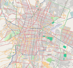 Coyoacán Location within Mexico City | |||||||||||
General information
The station logo depicts a coyote.[2][3] In fact, the Náhuatl word of Coyohuacan means place of coyotes.[2] According to early plans for Line 3, the station was originally destined to be known as Metro Bancomer, after Centro Bancomer, a banking center located above the station. This being a commercial name, metro authorities decided instead to name the station after nearby Avenida Coyoacán which leads to the popular downtown section of Coyoacán. The station opened on 30 August 1983 as part of a southward extension of the line.[4]
This station has a cultural display, which houses temporary exhibits by art students.[2]
Metro Coyoacán serves the Colonia del Valle and Xoco neighborhoods as well as Coyoacán.[2]
Nearby
- Cineteca Nacional, cinematheque.
Exits
- Northeast: Avenida Universidad and Real Mayorazgo street, Xoco
- Southeast: Avenida Universidad and Real Mayorazgo street, Xoco
- West: Martín Mendalde street, Colonia del Valle
References
- "Afluencia de estación por línea 2018" (in Spanish). Sistema Transporte Colectivo Metro. 2019. Archived from the original on 6 June 2019. Retrieved 8 April 2020.
- "Coyoacán" (in Spanish). Sistema de Transporte Colectivo. Archived from the original on 10 October 2011. Retrieved 20 August 2011.
- Archambault, Richard. "Coyoacán » Mexico City Metro System". Retrieved 20 August 2011.
- Monroy, Marco. Schwandl, Robert (ed.). "Opening Dates for Mexico City's Subway". Retrieved 14 August 2011.
External links

| Areas | |
|---|---|
| Schools |
|
| Universities | |
| Mexico City Metro stations | |
| Landmarks |
|
| |
Mexico City Metro stations | |
|---|---|
| Line 1 | |
| Line 2 | |
| Line 3 |
|
| Line 4 | |
| Line 5 | |
| Line 6 | |
| Line 7 | |
| Line 8 | |
| Line 9 | |
| Line A | |
| Line B | |
| Line 12 | |