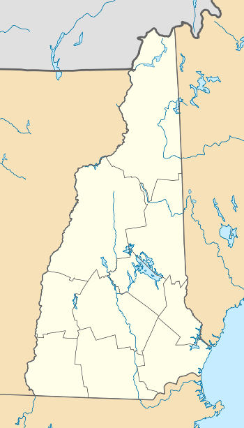
Meredith (CDP), New Hampshire
Meredith is a census-designated place (CDP) and the main village in the town of Meredith in Belknap County, New Hampshire, United States. The population was 1,718 at the 2010 census,[1] out of 6,241 people in the entire town of Meredith.
Meredith, New Hampshire | |
|---|---|
 Meredith  Meredith | |
| Coordinates: 43°39′26″N 71°30′0″W | |
| Country | United States |
| State | New Hampshire |
| County | Belknap |
| Town | Meredith |
| Area | |
| • Total | 1.9 sq mi (4.8 km2) |
| • Land | 1.5 sq mi (3.8 km2) |
| • Water | 0.4 sq mi (1.0 km2) |
| Elevation | 520 ft (160 m) |
| Population (2010) | |
| • Total | 1,718 |
| • Density | 1,166/sq mi (450.2/km2) |
| Time zone | UTC-5 (Eastern (EST)) |
| • Summer (DST) | UTC-4 (EDT) |
| ZIP code | 03253 |
| Area code(s) | 603 |
| FIPS code | 33-47060 |
| GNIS feature ID | 2378081 |
Geography
The CDP is slightly northeast of the geographic center of the town of Meredith, situated between Lake Waukewan to the west and Meredith Bay on Lake Winnipesaukee to the east. The CDP extends north to Philbrook Avenue and the southern edge of the Meredith Village Cemetery, and northeast to Keyser Road. The CDP border then turns southwest down New Hampshire Route 25 to the head of Meredith Bay. The CDP extends south along the bay as far as Bay Shore Drive, then follows U.S. Route 3 south to Reservoir Road. The CDP border follows an unnamed brook north from Reservoir Road to Lake Waukewan.[2]
U.S. Route 3 and New Hampshire Route 25 intersect on the eastern side of the CDP at the north end of Meredith Bay. US 3 and NH 25 together lead north 8 miles (13 km) to Holderness at the outlet of Squam Lake. US 3 leads south 5 miles (8 km) to Weirs Beach and 11 miles (18 km) to the center of Laconia, while NH 25 leads northeast 5 miles (8 km) to Center Harbor and 9 miles (14 km) to Moultonborough. New Hampshire Route 104 leaves US 3 in the south part of the CDP, leading west 8 miles (13 km) to Interstate 93 in New Hampton. New Hampshire Route 106 leaves US 3 just south of the CDP border, providing a direct route to the center of Laconia, 10 miles (16 km) south of Meredith.
According to the United States Census Bureau, the Meredith CDP has a total area of 1.9 square miles (4.8 km2), of which 1.5 square miles (3.8 km2) are land and 0.4 square miles (1.0 km2), or 20.08%, are water.[1]
Demographics
As of the census of 2010, there were 1,718 people, 740 households, and 434 families residing in the CDP. There were 943 housing units, of which 203 were vacant. 108 of the vacant units were for seasonal use. The racial makeup of the town was 97.1% White, 0.3% African American, 0.1% Native American, 1.0% Asian, 0.1% some other race, and 1.3% from two or more races. 1.3% of the population were Hispanic or Latino of any race.[3]
Of the 740 households, 26.2% had children under the age of 18 living with them, 39.5% were headed by married couples living together, 15.5% had a female householder with no husband present, and 41.4% were non-families. 33.5% of all households were made up of individuals, and 14.7% were someone living alone who was 65 years of age or older. The average household size was 2.19 and the average family size was 2.77.[3]
In the CDP, 19.3% of the population were under the age of 18, 7.6% were from 18 to 24, 22.3% from 25 to 44, 27.7% from 45 to 64, and 23.0% were 65 years of age or older. The median age was 45.6 years. For every 100 females, there were 84.1 males. For every 100 females age 18 and over, there were 80.7 males.[3]
For the period 2011-2015, the estimated median annual income for a household was $42,880, and the median income for a family was $70,278. The per capita income for the town was $22,694. 31.8% of the population and 28.7% of families were below the poverty line. 50.4% of the population under the age of 18 and 12.2% of those 65 or older were living in poverty.[4]
References
- "Geographic Identifiers: 2010 Demographic Profile Data (G001): Meredith CDP, New Hampshire". U.S. Census Bureau, American Factfinder. Archived from the original on February 13, 2020. Retrieved August 25, 2017.
- "TIGERweb: Meredith CDP, New Hampshire". Geography Division, U.S. Census Bureau. Retrieved August 25, 2017.
- "Profile of General Population and Housing Characteristics: 2010 Census Summary File 1 (DP-1): Meredith CDP, New Hampshire". U.S. Census Bureau, American Factfinder. Archived from the original on February 13, 2020. Retrieved August 25, 2017.
- "Selected Economic Characteristics: 2011-2015 American Community Survey 5-Year Estimates (DP03): Meredith CDP, New Hampshire". U.S. Census Bureau, American Factfinder. Archived from the original on February 13, 2020. Retrieved August 25, 2017.
Municipalities and communities of Belknap County, New Hampshire, United States | ||
|---|---|---|
| City |  Map of New Hampshire highlighting Belknap County | |
| Towns | ||
| CDPs | ||
| Other villages | ||
| Footnotes | ‡This populated place also has portions in an adjacent county or counties | |
| Authority control |
|
|---|