Mayang Miao Autonomous County
Mayang ( "Mayang Miao Autonomous County", simplified Chinese: 麻阳苗族自治县; traditional Chinese: 麻陽苗族自治縣; pinyin: Máyáng Miáozú Zìzhìxiàn; usually referred to as "Mayang County", simplified Chinese: 麻阳县; traditional Chinese: 麻陽縣; pinyin: Máyáng Xiàn) is an autonomous county of Miao people in Hunan Province, China, it is under the administration of the prefecture-level city of Huaihua.
Mayang County 麻阳县 | |
|---|---|
| 麻阳苗族自治县 Mayang Miao Autonomous County | |
 | |
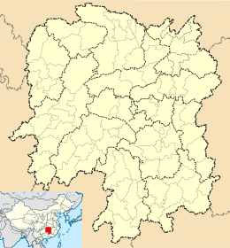 Mayang Location in Hunan | |
| Coordinates: 27°51′50″N 109°48′04″E[1] | |
| Country | People's Republic of China |
| Province | Hunan |
| Prefecture-level city | Huaihua |
| Area | |
| • Total | 1,560.93 km2 (602.68 sq mi) |
| Population (2010)[3] | |
| • Total | 343,309 |
| • Density | 220/km2 (570/sq mi) |
| Time zone | UTC+8 (China Standard) |
| Postal code | 4194XX |
Mayang is located on the west central margin of Hunan Province, adjacent to Guizhou Province. It borders Bijiang District of Tongren, Guizhou to the west, Fenghuang County to the northwest, Luxi County to the northeast, Chenxi County and Hecheng District of Huaihua to the southeast, and Zhijiang County to the south. The county covers 1,568.19 km2 (605.48 sq mi), as of 2015, It had a registered population of 403,400 and a resident population of 349,000.[4] The county seat is the town of Gaocun (高村镇) and it has seven towns and 11 townships under its jurisdiction.[5]
Etymology
Mayang derives its name from Mayangshu (麻阳戍), a military garrison established in the year 562 by the Southern Chen dynasty to guard against southern tribes. The Garrison was located at the mouth of Taiping Creek, where the Creek flows into the Chenshui (Jinjiang River) and forms a wide and deep pond called Matan (麻潭). Seated on the northern bank of the pond, the place was named "Mayang" according to Chinese traditions of naming places.
History[6]
Ancient History
In 562, the Southern Chen dynasty established Mayangshu (麻阳戍) at what is now Taipingxi, Lüjiaping Town (吕家坪镇太平溪).
In 620, the Tang Dynasty established Mayang County, with the county seat located in what is now Jiuxian, Huangsang Township (黄桑乡旧县村).
In 1075, the Song Dynasty incorporated Jinzhou Fort (锦州砦) and Zhaoyu County (诏谕县) into Mayang County, with the county seat located in what is now Jinhe Town (锦和镇).
Modern History (1949-)
On September 29, 1949, Mayang was liberated by the People's Liberation Army.
On March 28, 1950, the People's Government of Mayang County was established.
In March 1953, the county seat was relocated to Gaocun Town.
On October 31, 1988, under the approval of the State Council, the county was renamed "Mayang Miao Autonomous County".
Climate
| Climate data for Mayang (1981−2010) | |||||||||||||
|---|---|---|---|---|---|---|---|---|---|---|---|---|---|
| Month | Jan | Feb | Mar | Apr | May | Jun | Jul | Aug | Sep | Oct | Nov | Dec | Year |
| Record high °C (°F) | 26.1 (79.0) |
30.5 (86.9) |
35.0 (95.0) |
34.5 (94.1) |
36.2 (97.2) |
37.1 (98.8) |
39.5 (103.1) |
40.4 (104.7) |
39.4 (102.9) |
36.5 (97.7) |
31.8 (89.2) |
23.2 (73.8) |
40.4 (104.7) |
| Average high °C (°F) | 8.8 (47.8) |
11.1 (52.0) |
15.5 (59.9) |
21.9 (71.4) |
26.7 (80.1) |
29.7 (85.5) |
33.0 (91.4) |
33.2 (91.8) |
29.3 (84.7) |
22.9 (73.2) |
17.5 (63.5) |
11.7 (53.1) |
21.8 (71.2) |
| Daily mean °C (°F) | 5.4 (41.7) |
7.4 (45.3) |
11.2 (52.2) |
17.2 (63.0) |
21.8 (71.2) |
25.2 (77.4) |
28.3 (82.9) |
27.9 (82.2) |
24.0 (75.2) |
18.3 (64.9) |
12.9 (55.2) |
7.6 (45.7) |
17.3 (63.1) |
| Average low °C (°F) | 2.9 (37.2) |
4.9 (40.8) |
8.2 (46.8) |
13.7 (56.7) |
18.3 (64.9) |
22.0 (71.6) |
24.6 (76.3) |
24.1 (75.4) |
20.3 (68.5) |
15.1 (59.2) |
9.8 (49.6) |
4.7 (40.5) |
14.1 (57.3) |
| Record low °C (°F) | −3.8 (25.2) |
−3.6 (25.5) |
−0.3 (31.5) |
3.6 (38.5) |
9.0 (48.2) |
14.3 (57.7) |
17.9 (64.2) |
17.2 (63.0) |
12.7 (54.9) |
4.9 (40.8) |
−0.5 (31.1) |
−3.2 (26.2) |
−3.8 (25.2) |
| Average precipitation mm (inches) | 47.1 (1.85) |
57.5 (2.26) |
84.5 (3.33) |
139.0 (5.47) |
175.1 (6.89) |
214.5 (8.44) |
181.7 (7.15) |
94.4 (3.72) |
65.3 (2.57) |
98.8 (3.89) |
63.6 (2.50) |
35.0 (1.38) |
1,256.5 (49.45) |
| Average relative humidity (%) | 79 | 78 | 79 | 80 | 80 | 82 | 78 | 76 | 75 | 79 | 78 | 76 | 78 |
| Source: China Meteorological Data Service Center[7] | |||||||||||||
Notable People
- TENG Daiyuan (1904-1974): The first Minister of Railways of the People's Republic of China; Vice-Chairperson (1949-1965) of the CPPCC National Committee (1964-1974).
References
- www.xzqh.org (in Chinese)
- Google (2014-07-02). "Mayang" (Map). Google Maps. Google. Retrieved 2014-07-02.
- Huaihua City Land Use Plan (2006–20)/《怀化市土地利用总体规划(2006-2020年)》.(in Chinese) Accessed 8 July 2014.
- 怀化市2010年第六次全国人口普查主要数据公报 (in Chinese). 怀化市统计局 [Huaihua Bureau of Statistics]. Archived from the original on 14 July 2014. Retrieved 9 July 2014.
- about the population of Mayang County in 2015, according to the 2015年麻阳县国民经济和社会发展统计公报 [Statistical Communiqué of Mayang County on the 2015 National Economic and Social Development]. Mayang County People's Government. or ahmhxc.com
- the divisions of Mayang County in 2015, according to the 《湖南省民政厅关于同意麻阳县乡镇区划调整方案的批复》(湘民行发〔2015〕79号) [result on adjustment of township-level administrative divisions of Mayang County on 25 November 2015]. rednet.cn. 2015-12-04. Archived from the original on 11 August 2016. Retrieved 31 January 2017., also see 《湖南省乡镇区划调整改革109个县市区批复方案》. people.com Hunan. or xinhuanet.com
- "麻阳大事记 - 麻阳苗族自治县人民政府". www.mayang.gov.cn. Retrieved 2020-02-10.
- 中国地面气候标准值月值(1981-2010) (in Chinese). China Meteorological Data Service Center. Retrieved 20 October 2018.
External links
| Authority control |
|
|---|