Pingbian Miao Autonomous County
Pingbian Miao Autonomous County (simplified Chinese: 屏边苗族自治县; traditional Chinese: 屏邊苗族自治縣; pinyin: Píngbiān Miáozú Zìzhìxiàn) is a county located in Honghe Hani and Yi Autonomous Prefecture in the southeast of Yunnan province, People's Republic of China. Its seat is located only 21 kilometres (13 mi) from the border with Lào Cai Province, Vietnam.
Pingbian County 屏边县 | |
|---|---|
屏边苗族自治县 Pingbian Miao Autonomous County | |
 | |
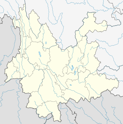 Pingbian Location of the seat in Yunnan | |
| Coordinates: 22°59′13″N 103°40′30″E | |
| Country | People's Republic of China |
| Province | Yunnan |
| Prefecture | Honghe |
| Area | |
| • Total | 1,905 km2 (736 sq mi) |
| Elevation | 1,414 m (4,639 ft) |
| Population | |
| • Total | 150,000 |
| • Density | 79/km2 (200/sq mi) |
| Time zone | UTC+8 (China Standard) |
| Postal code | 661200 |
| Area code(s) | 0873 |
| Website | http://www.ynpb.gov.cn/ |
Climate
Pingbian County has a mild subtropical highland climate (Köppen Cwb) influenced by its elevation, with short, mild, dry winters and warm, humid summers. The monthly 24-hour average temperature ranges from 9.2 °C (48.6 °F) in January to 21.3 °C (70.3 °F) in July, and the annual mean is 16.3 °C (61.3 °F). The greatest rainfall tends to occur during the summer; spring is the sunniest season.
| Climate data for Pingbian County | |||||||||||||
|---|---|---|---|---|---|---|---|---|---|---|---|---|---|
| Month | Jan | Feb | Mar | Apr | May | Jun | Jul | Aug | Sep | Oct | Nov | Dec | Year |
| Record high °C (°F) | 23.3 (73.9) |
27.1 (80.8) |
29.0 (84.2) |
30.6 (87.1) |
31.5 (88.7) |
29.8 (85.6) |
30.7 (87.3) |
31.0 (87.8) |
30.1 (86.2) |
27.6 (81.7) |
26.9 (80.4) |
23.2 (73.8) |
31.5 (88.7) |
| Average high °C (°F) | 13.2 (55.8) |
15.2 (59.4) |
19.5 (67.1) |
23.0 (73.4) |
24.5 (76.1) |
25.1 (77.2) |
25.1 (77.2) |
25.3 (77.5) |
23.7 (74.7) |
20.9 (69.6) |
17.4 (63.3) |
14.4 (57.9) |
20.6 (69.1) |
| Daily mean °C (°F) | 9.2 (48.6) |
10.8 (51.4) |
14.4 (57.9) |
17.8 (64.0) |
20.1 (68.2) |
21.3 (70.3) |
21.2 (70.2) |
20.8 (69.4) |
19.3 (66.7) |
16.9 (62.4) |
13.4 (56.1) |
10.0 (50.0) |
16.3 (61.3) |
| Average low °C (°F) | 6.7 (44.1) |
8.0 (46.4) |
11.0 (51.8) |
14.2 (57.6) |
17.0 (62.6) |
18.7 (65.7) |
18.6 (65.5) |
18.1 (64.6) |
16.8 (62.2) |
14.5 (58.1) |
11.0 (51.8) |
7.4 (45.3) |
13.5 (56.3) |
| Record low °C (°F) | −0.8 (30.6) |
0.0 (32.0) |
−1.7 (28.9) |
3.6 (38.5) |
9.6 (49.3) |
12.8 (55.0) |
13.8 (56.8) |
14.0 (57.2) |
9.9 (49.8) |
6.2 (43.2) |
2.3 (36.1) |
−1.4 (29.5) |
−1.7 (28.9) |
| Average rainfall mm (inches) | 26.9 (1.06) |
38.9 (1.53) |
51.6 (2.03) |
101.9 (4.01) |
171.5 (6.75) |
238.0 (9.37) |
326.6 (12.86) |
301.3 (11.86) |
185.5 (7.30) |
108.8 (4.28) |
64.3 (2.53) |
22.9 (0.90) |
1,638.2 (64.48) |
| Average rainy days (≥ 0.1 mm) | 15.8 | 15.9 | 14.6 | 15.6 | 19.2 | 21.5 | 24.1 | 22.9 | 18.7 | 16.0 | 12.5 | 10.2 | 207 |
| Mean monthly sunshine hours | 96.1 | 105.5 | 151.9 | 180.0 | 182.9 | 132.0 | 133.3 | 145.7 | 123.0 | 102.3 | 96.0 | 111.6 | 1,560.3 |
| Percent possible sunshine | 28 | 33 | 41 | 47 | 45 | 33 | 32 | 36 | 33 | 28 | 29 | 34 | 35 |
| Source 1: China Weather (1971−2000),[1] NOAA [2] | |||||||||||||
| Source 2: HKO (sun only, 1961−1990) [3] | |||||||||||||
- Note that extreme temperature data is combined from NOAA (1961−1990) and China Weather (1971−2000)
Transportation
The narrow-gauge Kunming–Hai Phong Railway crosses Pingbian County. This railway's famous Faux Namti Bridge is located north of the county's Wantang Township (湾塘乡).
References
- (in Chinese). Weather China http://www.weather.com.cn/cityintro/101290310.shtml?. Retrieved 2011-05-31. Missing or empty
|title=(help) - "Pingbian Climate Normals 1961–1990". National Oceanic and Atmospheric Administration. Retrieved December 21, 2012.
- "Climatological Information for Pingbian, China". Hong Kong Observatory. Retrieved 2011-05-02.
External links
| Wikimedia Commons has media related to Pingbian Miao Autonomous County. |