Qiandongnan Miao and Dong Autonomous Prefecture
Qiandongnan Miao and Dong Autonomous Prefecture (simplified Chinese: 黔东南苗族侗族自治州; traditional Chinese: 黔東南苗族侗族自治州; pinyin: Qiándōngnán Miáozú Dòngzú Zìzhìzhōu; Hmu language: Qeef Dongb Naif Dol Hmub Dol Gud Zid Zid Zeb; Kam language: Qeens Donc Nanc Nyenc Miiul Nyenc Gaeml Zil Zl Zous[3]), also known as Southeast Qian Autonomous Prefecture of Miao and Dong (Southeast Qeens Autonomous Prefecture) and can be shortened as S.E. Qian Prefecture (S.E. Qeens Prefecture), is an autonomous prefecture in the southeast of Guizhou province in the People's Republic of China, bordering Hunan to the east and Guangxi to the south. The seat of the prefecture is Kaili. Qiandongnan has an area of 30,337 km2 (11,713 sq mi).
Qiandongnan Prefecture 黔东南州 Qeef Dongb Naif Zeb Qeens Donc Nanc Zous | |
|---|---|
黔东南苗族侗族自治州 Qiandongnan Miao and Dong Autonomous Prefecture | |
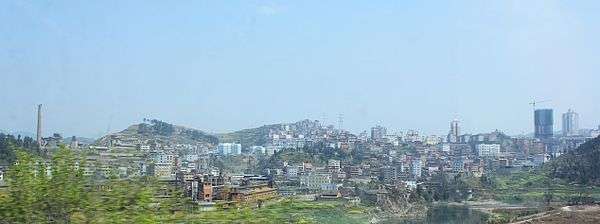
 Xijiang Miao Village | |
.png) Location of Qiandongnan Prefecture in Guizhou | |
| Coordinates: 26°35′N 107°59′E | |
| Country | People's Republic of China |
| Province | Guizhou |
| Area | |
| • Total | 30,337 km2 (11,713 sq mi) |
| Population (2018)[2] | |
| • Total | 3,538,300 |
| Time zone | UTC+8 (China Standard) |
| Area code(s) | 0855 |
| ISO 3166 code | CN-GZ-26 |
Demographics
As of 2018, Qiandongnan had a huji population of 4,811,900, with 3,538,300 (73.53%) of whom were living in the region. 81.3% of the huji population were ethnic minorities: 43.2% were Miao and 30.4% were Dong.[2]
According to the 2010 census, Qiandongnan has 3,480,626 inhabitants. Among them, 1,821,262 (52.33%) were male and 1,659,364 (47.67%) were female. 865,119 (24.86%) were aged 0–14, 2,271,506 (65.26%) were aged 15–64 and 344,002 (9.88%) were aged 65 or above. The urban population was 905,659 (26.02%) while the rural population was 2,574,967 (73.98%).[4]
| Ethnic group | Miao | Dong | Han | Sui | Bouyei | Tujia | She | Unrecognized | Zhuang | Yao | Others |
|---|---|---|---|---|---|---|---|---|---|---|---|
| Population | 1447257 | 1010352 | 756587 | 55357 | 34599 | 33676 | 31397 | 28189 | 24618 | 21732 | 38127 |
| Percentage of total population | 41.57 | 29.02 | 21.73 | 1.59 | 0.99 | 0.97 | 0.90 | 0.81 | 0.71 | 0.62 | 1.10 |
| Percentage of ethnic minorities | 53.10 | 37.07 | --- | 2.03 | 1.27 | 1.24 | 1.15 | 1.03 | 0.90 | 0.80 | 1.40 |
Subdivisions
The prefecture is subdivided into 16 county-level divisions: 1 county-level city and 15 counties.
- County level city: Kaili City (凯里市)
- Counties:
- Shibing County (施秉县)
- Congjiang County (从江县)
- Jinping County (锦屏县)
- Zhenyuan County (镇远县)
- Majiang County (麻江县)
- Taijiang County (台江县)
- Tianzhu County (天柱县)
- Huangping County (黄平县)
- Rongjiang County (榕江县)
- Jianhe County (剑河县)
- Sansui County (三穗县)
- Leishan County (雷山县)
- Liping County (黎平县)
- Cengong County (岑巩县)
- Danzhai County (丹寨县)
| Map |
|---|

References
- 自然环境. www.qdn.gov.cn (in Chinese). Qiandongnan Prefecture People's Government. 27 June 2019. Retrieved 9 September 2019.
- 人口民族. www.qdn.gov.cn (in Chinese). Qiandongnan Prefecture People's Government. 27 June 2019. Retrieved 9 September 2019.
- "Qiandongnan Prefecture Government".
- Qiandongnan Prefecture Bureau of Statistics. 《黔东南苗族侗族自治州2010年第六次全国人口普查主要数据公报》 (in Chinese).
- 贵州省第六次全国人口普查领导小组办公室 (July 2012). 《贵州省2010年人口普查资料》 (in Chinese). China Statistics Print. ISBN 978-7-5037-6534-6.
External links
- Citadel of the Dong Magazine article on the Dong minority village of Zengchong.
- National Geographic article about the Dong of Dimen, Liping County, by Amy Tan (2008)
- NPR story about Dong folk songs, featuring Amy Tan, April 2008