Manappattu
Manappattu is a village[1] in Bahour Commune of Bahour taluk in the Union Territory of Puducherry, India. It lies east of NH-45A at a distance of 2 km from it.
Manappattu | |
|---|---|
Village | |
 Manappattu Location in Puducherry, India  Manappattu Manappattu (India) | |
| Coordinates: 11.799453°N 79.787983°E | |
| Country | |
| State | Puducherry |
| District | Pondicherry |
| Taluk | Bahour |
| Commune | Bahour |
| Languages | |
| • Official | French, Tamil, English |
| Time zone | UTC+5:30 (IST) |
| PIN | 607 402 |
| Telephone code | 0413 |
| Vehicle registration | PY-01 |
| Sex ratio | 50% ♂/♀ |
Geography
Manappattu is bordered by Bahour in the west, Pillaiyarkuppam in the north, Bay of Bengal in east and Krishnavaram, Pudukuppam in the south.
Villages
Following are the list of villages under Manappattu Village Panchayat.
- Manappattu
- Kanniakoil
- Kattukuppam
- Varakalodaipet
Road Network
Manappattu is connected by Kanniakoil - Manappattu road. Also Pannithittu - Pudukuppam road connects Manappattu.
Gallery
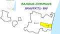 Map of Manappattu Village Panchayat
 Rural Health Training Centre, Manapattu, Bahour Commune
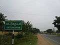 Kattukuppam, Manapattu Village Panchayat, Bahour Commune
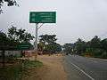 Manappattu Road and Bahour Road meeting at Kanniyakoil
Politics
Manappattu is a part of Bahour (Union Territory Assembly constituency) which comes under Puducherry (Lok Sabha constituency)
References
- "Archived copy" (PDF). Archived from the original (PDF) on 27 September 2013. Retrieved 17 March 2013.CS1 maint: archived copy as title (link)
This article is issued from Wikipedia. The text is licensed under Creative Commons - Attribution - Sharealike. Additional terms may apply for the media files.