Loughton and Great Holm
The civil parish of Loughton and Great Holm includes Loughton, Great Holm, the National Bowl and Elfield Park, West Rooksley, Loughton Lodge, and Knowlhill. It is bordered by H4 Dansteed Way to the north, V4 Watling Street to the west, a tiny stretch of H8 Standing Way to the south, and the West Coast Main Line to the east.[2] It was renamed from Loughton to Loughton and Great Holm in 2013[3]
| Loughton and Great Holm | |
|---|---|
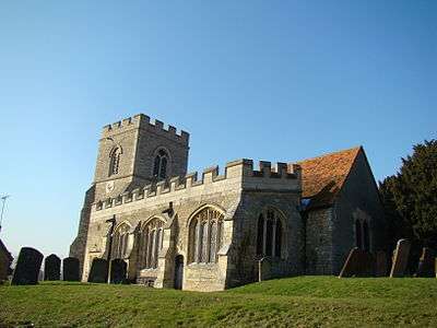 All Saints Church, Loughton | |
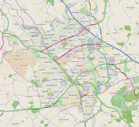 Loughton and Great Holm Mapping © OpenStreetMap 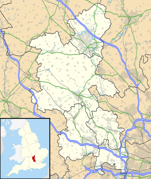 Loughton and Great Holm Location within Buckinghamshire | |
| Population | 6,363 [1][lower-alpha 1] |
| OS grid reference | SP836379 |
| Civil parish |
|
| Unitary authority |
|
| Ceremonial county | |
| Region | |
| Country | England |
| Sovereign state | United Kingdom |
| Post town | MILTON KEYNES |
| Postcode district | MK5, MK8 |
| Dialling code | 01908 |
| Police | Thames Valley |
| Fire | Buckinghamshire |
| Ambulance | South Central |
| UK Parliament | |
References
- The 2011 census was taken before the parish was renamed but the area included is the same
- UK Census (2011). "Local Area Report – Loughton (1170221294)". Nomis. Office for National Statistics. Retrieved 21 January 2019.
- Civil Parish (geographic area): Loughton & Great Holm – Office of National Statistics, 2013
- "Bulletins of change published by the LGBCE, England 2013". Lgbce. Retrieved 2 March 2018.
- Marketing brochures and "Energy Park News" produced by MKDC and National Energy Foundation, dated 1990-1
This article is issued from Wikipedia. The text is licensed under Creative Commons - Attribution - Sharealike. Additional terms may apply for the media files.