Fairfields
Fairfields is a civil parish that covers a large new development area on the western flank of Milton Keynes, As the first tier of Local Government, the parish council is responsible for the people who live and work in this area of Milton Keynes.
| Fairfields | |
|---|---|
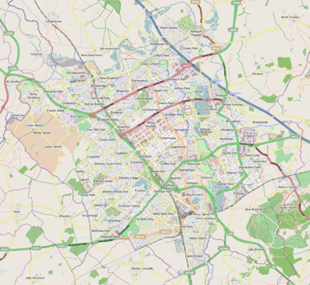 Fairfields Mapping © OpenStreetMap 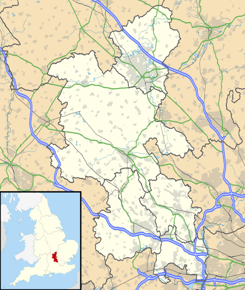 Fairfields Location within Buckinghamshire | |
| Population | [lower-alpha 1] |
| OS grid reference | SP798390 |
| Civil parish |
|
| Unitary authority | |
| Ceremonial county | |
| Region | |
| Country | England |
| Sovereign state | United Kingdom |
| Post town | MILTON KEYNES |
| Postcode district | MK11 4 |
| Dialling code | 01908 |
| Police | Thames Valley |
| Fire | Buckinghamshire |
| Ambulance | South Central |
| UK Parliament | |
As of January 2019, it is bounded by Calverton Lane (prospectively, the Monks Way (H3) extension), Watling Street (V4), the Ridgeway (H1) reserve route, and a hedgerow line with Calverton CP.[1] The district covers 123.5 hectares (305 acres) (including open space) and is projected to have 2,220 homes and 9 hectares (22 acres) of employment land.[2]
Origins
The (greenfield) land it occupies was previously part of Calverton, a rural parish outside MK. In 2004, the Government decided on the further expansion of Milton Keynes and accordingly designated land on the eastern and western flanks for this purpose.[3] Along with the adjacent parish of Whitehouse (and Broughton on the eastern flank), this is the part of the implementation of that decision.
Notes
- The parish did not exist at the time of the 2011 census. Its small population was included in the census for Calverton.
References
- "Fairfields". ONS. Retrieved 22 January 2019.
- "Western Expansion Area (WEA)". Milton Keynes Council. 4 June 2019. Retrieved 16 October 2016.
- Milton Keynes to double in size over next 20 years – Peter Hetherington, regional affairs editor, The Guardian, 6 Jan 2004
| Wikimedia Commons has media related to Fairfields. |