Castlethorpe
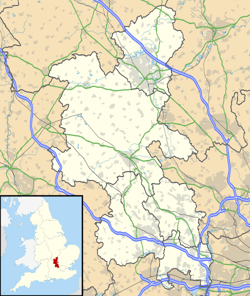
Castlethorpe is a village and civil parish with a population of about 1000 in the Borough of Milton Keynes, Buckinghamshire, England.[2] It is about 3 miles (4.8 km) north-east of Stony Stratford, 4 miles (6.4 km) north-west of Newport Pagnell and 7 miles (11 km) north of Central Milton Keynes. It is separated from the county of Northamptonshire by the River Tove.
| Castlethorpe | |
|---|---|
 Castlethorpe Location within Buckinghamshire | |
| Population | 1,047 (2011 Census)[1] |
| OS grid reference | SP795445 |
| Civil parish |
|
| Unitary authority |
|
| Ceremonial county | |
| Region | |
| Country | England |
| Sovereign state | United Kingdom |
| Post town | MILTON KEYNES |
| Postcode district | MK19 |
| Dialling code | 01908 |
| Police | Thames Valley |
| Fire | Buckinghamshire |
| Ambulance | South Central |
| UK Parliament | |
History

The village is relatively more recent than those around it, and it started out in life as a castle belonging to the lord of the manor of nearby Hanslope.[3] A settlement of servants and manual workers grew up around the castle and this became the village of Castlethorpe (thorpe is an Old Norse language (particularly Danish) word for homestead, and it is not unreasonable to assume that there may well have been a Danish settlement nearby as the area was, if not part of, certainly close to, the Danelaw). The castle was damaged in 1215 in a feud between Foulkes de Brent – who had been sent by King John – and William Mauduit, the castle's owner.[3] Mauduit was reputedly in rebellion against the King. Although Mauduit returned to claim his seat after the King's death, the castle was demolished shortly afterward.[3] All that is left today are the grassy mounds of the former Motte-and-Bailey castle.
Ecclesiastic parish
Church of St Simon and St Jude, the parish church, is dedicated to St Simon and St Jude, and dates back to Anglo-Saxon times, though the present church is of mainly Norman design. The church at Castlethorpe was originally superior to that of Hanslope but Bishop Grosteste changed the precedence in about 1250.[3] Castlethorpe has grown up around the church and some traditional old stone cottages at the centre of the village which is designated a conservation area.
Rail and canal
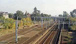
The West Coast Main Line runs alongside the west side of Castlethorpe, and the village had its own railway station until September 1964 when, to the outrage of the village, it was closed down.[4]
The Grand Union Canal also runs by on the outskirts of the village, and it is a short walk along the towpath to the neighbouring village of Cosgrove.
References
- UK Census (2011). "Local Area Report – Castlethorpe (E04001249)". Nomis. Office for National Statistics. Retrieved 17 November 2019.
- Parishes in Milton Keynes Archived June 8, 2009, at the Wayback Machine - Milton Keynes Council.
- 'Parishes : Hanslope with Castle Thorpe', Victoria History of the Counties of England, A History of the County of Buckingham: Volume 4 (1927), pp. 348-362.
- Castlethorpe Station Closure - 6 September 1964 - Milton Keynes Heritage Association
External links
| Wikimedia Commons has media related to Castlethorpe. |
- Parish Website for the village of Castlethorpe in Milton Keynes
- Castlethorpe page at UK & Ireland Genealogy
- Castlethorpe Village Historical Records & Photographs