Leutenheim
Leutenheim is a commune in the Bas-Rhin department in Grand Est in north-eastern France. It lies 20 kilometres (12 mi) east of Haguenau and a short distance west of the Rhine, which here defines the frontier between France and Germany.
Leutenheim Littenem | |
|---|---|
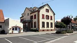 The town hall in Leutenheim | |
.svg.png) Coat of arms | |
Location of Leutenheim 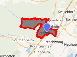
| |
 Leutenheim  Leutenheim | |
| Coordinates: 48°50′37″N 8°01′17″E | |
| Country | France |
| Region | Grand Est |
| Department | Bas-Rhin |
| Arrondissement | Haguenau-Wissembourg |
| Canton | Bischwiller |
| Government | |
| • Mayor (2014–2020) | Gérard Lehmann |
| Area 1 | 10.39 km2 (4.01 sq mi) |
| Population (2017-01-01)[1] | 837 |
| • Density | 81/km2 (210/sq mi) |
| Time zone | UTC+01:00 (CET) |
| • Summer (DST) | UTC+02:00 (CEST) |
| INSEE/Postal code | 67264 /67480 |
| Elevation | 115–139 m (377–456 ft) |
| 1 French Land Register data, which excludes lakes, ponds, glaciers > 1 km2 (0.386 sq mi or 247 acres) and river estuaries. | |
History
In eighth- and ninth-century records the village appears as Lithaim.
In around 1140 Königsbrück Abbey was founded here, a Cistercian nunnery, dissolved during the French Revolution.
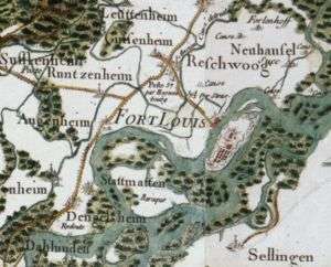
'Leuttenheim' (top), between the Forest of Haguenau and the River Rhine, from the 18th century Cassini map.
Before the Rhine was channeled, the landscape here was marshy and criss-crossed by branches of the river. Accordingly, the settlement is constructed on warfts.
See also
References
- "Populations légales 2017". INSEE. Retrieved 6 January 2020.
| Wikimedia Commons has media related to Leutenheim. |
| Authority control |
|
|---|
This article is issued from Wikipedia. The text is licensed under Creative Commons - Attribution - Sharealike. Additional terms may apply for the media files.