Lake Township, Missaukee County, Michigan
Lake Township is a civil township of Missaukee County in the U.S. state of Michigan. The population was 2,468 at the 2000 census.
Lake Township, Michigan | |
|---|---|
%2C_MI_location.png) Location within Missaukee County and an administered portion of the Jennings CDP (pink) | |
 Lake Township Location within the state of Michigan | |
| Coordinates: 44°17′18″N 85°16′32″W | |
| Country | United States |
| State | Michigan |
| County | Missaukee |
| Government | |
| • Supervisor | Rob Hall |
| • Clerk | Korinda Winkelmann |
| Area | |
| • Total | 36.0 sq mi (93.3 km2) |
| • Land | 31.7 sq mi (82.0 km2) |
| • Water | 4.4 sq mi (11.3 km2) |
| Elevation | 1,253 ft (382 m) |
| Population (2000) | |
| • Total | 2,468 |
| • Density | 77.9/sq mi (30.1/km2) |
| Time zone | UTC-5 (Eastern (EST)) |
| • Summer (DST) | UTC-4 (EDT) |
| ZIP code(s) | |
| Area code(s) | 231 |
| FIPS code | 26-44380[1] |
| GNIS feature ID | 1626577[2] |
| Website | Official website |
Communities
- Jennings is an unincorporated community in the north of the township at 44°19′58″N 85°17′53″W.[3] It was a lumbering center founded by Austin and William Mitchell, who named it for William Jennings Bryan. A post office opened on March 8, 1883, with J. Frank Schryer as the first postmaster. The office was discontinued on July 31, 1956. Jennings was a terminus of the Missukee spur of the Grand Rapids and Indiana Railroad, with a junction on the main line named Round Lake.[4] [5]
- The city of Cadillac is to the west in Wexford County, and the Cadillac post office with ZIP code 49601 also serves a small portion of southwest Lake Township.[6]
- The city of Lake City is to the east, and the Lake City post office with ZIP code 49651 also serves most of Lake Township.[7]
- The city of McBain is to the southeast, and the McBain post office with ZIP code 49657 also serves a small area in southern Lake Township.[8]
Geography
According to the United States Census Bureau, the township has a total area of 36.0 square miles (93 km2), of which 31.7 square miles (82 km2) is land and 4.3 square miles (11 km2) (12.08%) is water.
Demographics
As of the census[1] of 2000, there were 2,468 people, 1,005 households, and 756 families residing in the township. The population density was 77.9 per square mile (30.1/km²). There were 1,689 housing units at an average density of 53.3 per square mile (20.6/km²). The racial makeup of the township was 97.61% White, 0.12% African American, 0.53% Native American, 0.49% Asian, 0.04% from other races, and 1.22% from two or more races. Hispanic or Latino of any race were 1.09% of the population.
There were 1,005 households out of which 28.9% had children under the age of 18 living with them, 64.1% were married couples living together, 7.0% had a female householder with no husband present, and 24.7% were non-families. 20.2% of all households were made up of individuals and 8.6% had someone living alone who was 65 years of age or older. The average household size was 2.45 and the average family size was 2.78.
In the township the population was spread out with 22.9% under the age of 18, 6.2% from 18 to 24, 27.3% from 25 to 44, 27.2% from 45 to 64, and 16.5% who were 65 years of age or older. The median age was 42 years. For every 100 females, there were 98.7 males. For every 100 females age 18 and over, there were 99.5 males.
The median income for a household in the township was $36,934, and the median income for a family was $42,059. Males had a median income of $30,339 versus $22,148 for females. The per capita income for the township was $18,332. About 7.0% of families and 9.4% of the population were below the poverty line, including 11.3% of those under age 18 and 6.9% of those age 65 or over.
References
- "U.S. Census website". United States Census Bureau. Retrieved 2008-01-31.
- U.S. Geological Survey Geographic Names Information System: Lake Township, Missaukee County, Michigan
- U.S. Geological Survey Geographic Names Information System: Jennings, Michigan
- U.S. Geological Survey Geographic Names Information System: Jennings Post Office (historical)
- Romig, Walter (1986) [1973]. Michigan Place Names. Detroit, Michigan: Wayne State University Press. ISBN 0-8143-1838-X.
- 49601 5-Digit ZCTA, 496 3-Digit ZCTA - Reference Map - American FactFinder, U.S. Census Bureau, 2000 census
- 49651 5-Digit ZCTA, 496 3-Digit ZCTA - Reference Map - American FactFinder, U.S. Census Bureau, 2000 census
- 49657 5-Digit ZCTA, 496 3-Digit ZCTA - Reference Map - American FactFinder, U.S. Census Bureau, 2000 census
Municipalities and communities of Missaukee County, Michigan, United States | ||
|---|---|---|
| Cities | 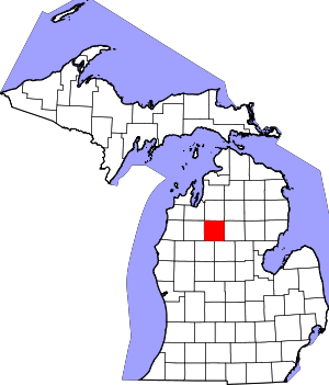 Map of Michigan highlighting Missaukee County.svg | |
| Civil townships | ||
| CDP | ||
| Unincorporated communities |
| |