Clam Union Township, Michigan
Clam Union Township is a civil township of Missaukee County in the U.S. state of Michigan. The population was 882 at the 2000 census.
Clam Union Township, Michigan | |
|---|---|
 Location within Missaukee County | |
 Clam Union Township Location within the state of Michigan | |
| Coordinates: 44°12′23″N 85°01′54″W | |
| Country | United States |
| State | Michigan |
| County | Missaukee |
| Government | |
| • Supervisor | Brad VanHaitsma |
| • Clerk | Steven Ebels |
| Area | |
| • Total | 36.0 sq mi (93.3 km2) |
| • Land | 35.8 sq mi (92.7 km2) |
| • Water | 0.2 sq mi (0.5 km2) |
| Elevation | 1,142 ft (348 m) |
| Population (2000) | |
| • Total | 882 |
| • Density | 24.6/sq mi (9.5/km2) |
| Time zone | UTC-5 (Eastern (EST)) |
| • Summer (DST) | UTC-4 (EDT) |
| ZIP code(s) | |
| Area code(s) | 231 |
| FIPS code | 26-15900[1] |
| GNIS feature ID | 1626084[2] |
Communities
- Falmouth is an unincorporated community in the northwest of the township at 44°14′36″N 85°05′13″W[3]
- Prosper is an unincorporated community in the northern part of the township at 44°14′34″N 85°01′59″W[4] A post office operated from July 5, 1901 until May 31, 1914.[5] [6]
- Vogel Center or Centre, is an unincorporated community in the township at 44°11′33″N 85°03′09″W[7] It was named for John Vogel, the first settler in the township. A post office opened in his store on February 25, 1879, with Arie de jong as the first postmaster. The office was discontinued on May 31, 1914.[8] [6]
- The city of McBain is to the southwest and the McBain post office with ZIP code 49657 also serves a portion of central Clam Union Township.[9]
- The village of Marion is to the south-southwest in Osceola County, and the Marion post office with ZIP code 49665 also serves an area in southwest Clam Union Township.[10]
Geography
According to the United States Census Bureau, the township has a total area of 36.0 square miles (93 km2), of which 35.8 square miles (93 km2) is land and 0.2 square miles (0.52 km2) (0.56%) is water.
Demographics
As of the census[1] of 2000, there were 882 people, 311 households, and 238 families residing in the township. The population density was 24.6 per square mile (9.5/km2). There were 473 housing units at an average density of 13.2 per square mile (5.1/km2). The racial makeup of the township was 98.53% White, 0.23% Native American, 0.11% Asian, 0.68% from other races, and 0.45% from two or more races. Hispanic or Latino of any race were 1.25% of the population.
There were 311 households, out of which 40.5% had children under the age of 18 living with them, 68.8% were married couples living together, 5.1% had a female householder with no husband present, and 23.2% were non-families. 21.2% of all households were made up of individuals, and 10.0% had someone living alone who was 65 years of age or older. The average household size was 2.84 and the average family size was 3.29.
In the township the population was spread out, with 33.2% under the age of 18, 8.8% from 18 to 24, 26.4% from 25 to 44, 18.4% from 45 to 64, and 13.2% who were 65 years of age or older. The median age was 33 years. For every 100 females, there were 95.6 males. For every 100 females age 18 and over, there were 96.3 males.
The median income for a household in the township was $35,542, and the median income for a family was $36,793. Males had a median income of $30,078 versus $20,547 for females. The per capita income for the township was $13,542. About 7.7% of families and 10.4% of the population were below the poverty line, including 14.2% of those under age 18 and 6.1% of those age 65 or over.
References
- "U.S. Census website". United States Census Bureau. Retrieved 2008-01-31.
- U.S. Geological Survey Geographic Names Information System: Clam Union Township, Michigan
- U.S. Geological Survey Geographic Names Information System: Falmouth, Michigan
- U.S. Geological Survey Geographic Names Information System: Prosper, Michigan
- U.S. Geological Survey Geographic Names Information System: Prosper Post Office (historical)
- Romig, Walter (1986) [1973]. Michigan Place Names. Detroit, Michigan: Wayne State University Press. ISBN 0-8143-1838-X.
- U.S. Geological Survey Geographic Names Information System: Vogel Center, Michigan
- U.S. Geological Survey Geographic Names Information System: Vogel Center Post Office (historical)
- 49657 5-Digit ZCTA, 496 3-Digit ZCTA - Reference Map - American FactFinder Archived 2012-10-09 at Archive.today, U.S. Census Bureau, 2000 census
- 49665 5-Digit ZCTA, 496 3-Digit ZCTA - Reference Map - American FactFinder, U.S. Census Bureau, 2000 census
Municipalities and communities of Missaukee County, Michigan, United States | ||
|---|---|---|
| Cities | 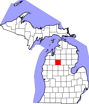 Map of Michigan highlighting Missaukee County.svg | |
| Civil townships | ||
| CDP | ||
| Unincorporated communities |
| |