Kotorosl
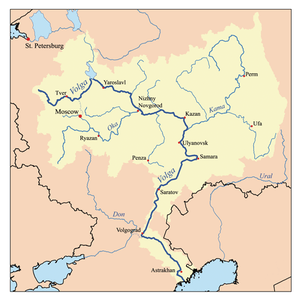
The Kotorosl (Russian: Ко́торосль) is a right tributary of the Volga in the Yaroslavl Oblast of Russia. The river flows from Lake Nero near Rostov past Karabikha and enters the Volga in Yaroslavl. It is 132 kilometres (82 mi) long, and has a drainage basin of 6,370 square kilometres (2,460 sq mi).[1] In the medieval ages, the river was highly important strategically, for it connected Rostov with major waterways of Russia. The Kotorosl's main tributary is the Ustye, which flows past Semibratovo to Borisogleb.
| Kotorosl | |
|---|---|
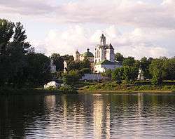 Kotorosl River in Yaroslavl | |
| Native name | Которосль |
| Location | |
| Country | Russia |
| Physical characteristics | |
| Mouth | Volga |
⁃ coordinates | 57.6161°N 39.9058°E |
| Length | 132 km (82 mi) |
| Basin size | 6,370 km2 (2,460 sq mi) |
| Basin features | |
| Progression | Volga→ Caspian Sea |
References
- «Река Которосль (Которость, Котороть, Векса)», Russian State Water Registry
The river Volga | ||
|---|---|---|
| Tributaries |
|  |
| Reservoirs | ||
| Hydroelectric stations | ||
| Canals | ||
| Cities | ||
This article is issued from Wikipedia. The text is licensed under Creative Commons - Attribution - Sharealike. Additional terms may apply for the media files.