Komárom-Esztergom County
Komárom-Esztergom (Hungarian: Komárom-Esztergom megye, pronounced [ˈkomaːrom ˈɛstɛrɡom]; German: Komitat Komorn-Gran; Slovak: Komárňansko-ostrihomská župa) is an administrative Hungarian county in Central Transdanubia Region; its shares its northern border the Danube with Slovakia. It shares borders with the Hungarian counties of Győr-Moson-Sopron, Veszprém, Fejér and Pest and the Slovakian Nitra Region (Nové Zámky District, Komárno District). Its county seat is Tatabánya.
Komárom-Esztergom County Komárom-Esztergom megye | |
|---|---|
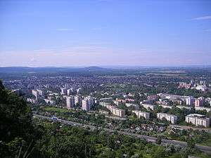
   Descending, from top: ramsons in the Gerecse Mountains, Szelim cave, and Turul Monument in Tatabánya | |
 Flag  Coat of arms | |
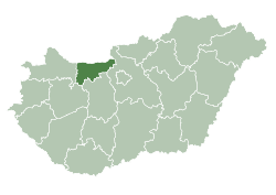 Komárom-Esztergom County within Hungary | |
| Country | |
| Region | Central Transdanubia |
| County seat | Tatabánya |
| Districts | |
| Government | |
| • President of the General Assembly | György Popovics (Fidesz-KDNP) |
| Area | |
| • Total | 2,264.52 km2 (874.34 sq mi) |
| Area rank | 19th in Hungary |
| Population (2015) | |
| • Total | 299,110[1] |
| • Rank | 15th in Hungary |
| Postal code | 2027 – 2028, 2067, 25xx, 28xx – 29xx |
| Area code(s) | (+36) 33, 34 |
| ISO 3166 code | HU-KE |
| Website | www |
History
After World War I and the break-up of empires, the Hungarian Soviet Republic came to power in 1919, followed quickly by the Hungarian Republic, eventually until the re-establishemnt of the Kingdom of Hungary. Komárom-Esztergom was created from the Hungarian parts of the pre-1920 counties Komárom and Esztergom, formerly part of the Austro-Hungarian Empire.
The pre-1920 situation was temporarily restored during World War II. Between 1950 and 1990, during the Communist regime, the county was called Komárom. Since the establishment of Hungary, it was named Komárom-Esztergom to refer to its historic past.
Demographics
Religion in Komárom-Esztergom County (2011 census)
In 2015, it had a population of 299,110 and the population density was 132/km².
| Year | County population[2] | Change |
|---|---|---|
| 1949 | 220,914 | n/a |
| 1960 | 22.59% | |
| 1970 | 12.43% | |
| 1980 | 6.05% | |
| 1990 | -1.83% | |
| 2001 | -0.12% | |
| 2011 | -3.80% |
Ethnicity
Hungarians constitute the majority of the population. The chief minorities are ethnic Germans (approx. 9,000), Roma (4,000) and Slovaks (3,000).
Total population (2011 census): 304,568
Ethnic groups (2011 census):[3]
Identified themselves: 270 933 persons:
- Hungarians: 252 432 (93,13%)
- Germans: 9 168 (3,38%)
- Gypsies: 4 261 (1,57%)
- Slovaks: 3 174 (1,17%)
- Others and indefinable: 1 898 (0,70%)
Approx. 48,000 persons in Komárom-Esztergom County did not declare an ethnic group at the 2011 census.
Religion
Religious adherence in the county according to 2011 census:[4]
- Catholic – 111,919 (Roman Catholic – 110,656; Greek Catholic – 1,227);
- Reformed – 30,517;
- Evangelical – 4,505;
- other religions – 4,101;
- Non-religious – 61,384;
- Atheism – 4,262;
- Undeclared – 87,880.
Regional structure

| № | English and Hungarian names |
Area (km²) |
Population (2011) |
Density (pop./km²) |
Seat | № of municipalities |
| 1 | Esztergom District Esztergomi járás |
537.26 | 93,784 | 175 | Esztergom | 24 |
| 2 | Kisbér District Kisbéri járás |
510.55 | 20,284 | 40 | Kisbér | 17 |
| 3 | Komárom District Komáromi járás |
378.78 | 39,863 | 105 | Komárom | 9 |
| 4 | Oroszlány District Oroszlányi járás |
199.39 | 26,163 | 131 | Oroszlány | 6 |
| 5 | Tatabánya District Tatabányai járás |
331.65 | 85,691 | 258 | Tatabánya | 10 |
| 6 | Tata District Tatai járás |
306.71 | 38,783 | 126 | Tata | 10 |
| Komárom-Esztergom County | 2,264.52 | 304,568 | 130 | Tatabánya | 76 | |
|---|---|---|---|---|---|---|
Politics

The Komárom-Esztergom County Council, elected at the 2014 local government elections, is made up of 15 counselors, with the following party composition:[5]
| Party | Seats | Current County Assembly | |||||||||
|---|---|---|---|---|---|---|---|---|---|---|---|
| Fidesz-KDNP | 9 | ||||||||||
| Movement for a Better Hungary (Jobbik) | 3 | ||||||||||
| Hungarian Socialist Party (MSZP) | 2 | ||||||||||
| Democratic Coalition (DK) | 1 | ||||||||||
Municipalities
Komárom-Esztergom County has 1 urban county, 11 towns, 3 large villages and 61 villages.
The county is ranked second in terms of population density among counties in Hungary: 66% of people live in towns.
- Cities with county rights
(ordered by population, as of 2011 census)
- Tatabánya (67,753) – county seat
- Towns
- Villages
- Aka
- Almásfüzitő
- Annavölgy
- Ácsteszér
- Ászár
- Baj
- Bajna
- Bajót
- Bakonybánk
- Bakonysárkány
- Bakonyszombathely
- Bana
- Bársonyos
- Bokod
- Csatka
- Császár
- Csém
- Csép
- Csolnok
- Dad
- Dág
- Dömös
- Dunaalmás
- Dunaszentmiklós
- Epöl
- Ete
- Gyermely
- Héreg
- Kecskéd
- Kerékteleki
- Kesztölc
- Kisigmánd
- Kocs
- Kömlőd
- Környe
- Leányvár
- Máriahalom
- Mocsa
- Mogyorósbánya
- Nagyigmánd

- Nagysáp
- Naszály
- Neszmély
- Piliscsév
- Pilismarót
- Réde
- Sárisáp
- Süttő
- Súr
- Szákszend
- Szárliget
- Szomód
- Szomor
- Tardos
- Tarján
- Tárkány
- Tokod
- Tokodaltáró
- Úny
- Várgesztes
- Vérteskethely
- Vértessomló
- Vértesszőlős
- Vértestolna
![]()
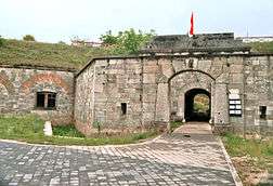
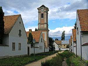
Gallery
_9.jpg)


References
| Wikimedia Commons has media related to Komárom-Esztergom County. |
| Wikivoyage has a travel guide for Komárom-Esztergom County. |
- nepesseg.com, population data of Hungarian settlements
- népesség.com, "Komárom-Esztergom megye népessége 1870-2015"
- 1.1.6. A népesség anyanyelv, nemzetiség és nemek szerint – Frissítve: 2013.04.17.; Hungarian Central Statistical Office (in Hungarian)
- 2011. ÉVI NÉPSZÁMLÁLÁS, 3. Területi adatok, 3.12 Komárom-Esztergom megye, (in Hungarian)
- Komárom-Esztergom Megyei Közgyûlés, (in Hungarian)
- Önkormányzati választások eredményei (in Hungarian)
External links
- Official site in Hungarian, English and German
- 24 Óra (kemma.hu) - The county portal
| City with county rights |
| |
|---|---|---|
| Towns | ||
| Large villages | ||
| Villages |
| |
| Other topics |
| |
| Authority control |
|---|