Gerecse Mountains
Gerecse is a mountain range in north-western Hungary, that belongs to the Transdanubian Mountains
| Gerecse | |
|---|---|
 | |
| Highest point | |
| Peak | Nagy-Gerecse |
| Elevation | 634 m (2,080 ft) |
| Dimensions | |
| Area | 850 km2 (330 sq mi) |
| Geography | |
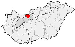 Location of Gerecse Mountains within physical subdivisions of Hungary
| |
| Country | Hungary |
| County | Komárom-Esztergom County |
| Range coordinates | 47°38.6′N 18°24.3′E |
| Geology | |
| Orogeny | Transdanubian Mountains |
| Type of rock | chalk, limestone |
Geography
The range lies in the Central Transdanubian region and connects Vértes Hills with Pilis Mountains in Komárom-Esztergom County, between the town of Tatabánya and the Danube River. Gerecse occupies an area of 850 km2 (20,300 ha). The highest point is Nagy-Gerecse at 634 m.[1] The main rock is limestone and chalk.
Biology
Deciduous oak forests cover the lower slopes, with submontane species of Quercus, Carpinus, Fagus, and at higher altitudes karst scrub. The area is 70% forest, 5% scrubland, 10% grassland, and 15% artificial landscapes.[1] Yearly sunshine duration is around 1,980 hours. The average annual temperature above the height of 350 meters is 9.5 C (in January -2,8 C). The average annual precipitation is 640 millimeters.
Gallery
 Farkasvölgy (Wolf-valley)
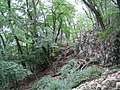 Forest in the Gerecse
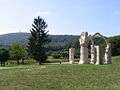 The monument of the Battle of Pusztamarót, 1526
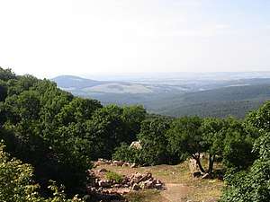
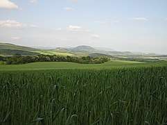 Gerecse near Péliföldszentkereszt
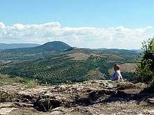
References
- "Gerecse mountains". HungarianBirdwatching.com. 2004. Archived from the original on 2011-07-12. Retrieved 2010-11-22.
External links
- http://www.kektura.click.hu/keret.cgi?/OKT/szovegek/angol/tour_05.htm
- gerecse.lap.hu (in Hungarian)
- Gerecse (in Hungarian)
- Gerecse barlangjai (in Hungarian)
- Gerecsei Tájvédelmi Körzet (in Hungarian)
| West-Hungarian Borderland |
|  Physico-geographical mesoregions of Hungary |
|---|---|---|
| Little Hungarian Plain |
| |
| Transdanubia |
| |
| Transdanubian Mountains |
| |
| Transdanubian Hills |
| |
| North Hungarian Mountains | ||
| Great Hungarian Plain | ||