Kemah, Erzincan
Kemah (Kurdish: Kemax,[3] Armenian: Անի-Կամախ Ani-Kamakh), known historically as Gamakh, Kamacha or Kamachon (Greek: Κάμαχα, Κάμαχον) is a town and district of Erzincan Province in the Eastern Anatolia Region of Turkey.
Kemah | |
|---|---|
 Kemah | |
| Coordinates: 39°36′10″N 39°02′08″E | |
| Country | Turkey |
| Province | Erzincan |
| Government | |
| • Mayor | Osman Kemal Aslan (MHP) |
| • Kaymakam | Hasan Ongu |
| Area | |
| • District | 2,297.98 km2 (887.26 sq mi) |
| Elevation | 1,130 m (3,710 ft) |
| Population (2012)[2] | |
| • Urban | 2,434 |
| • District | 6,905 |
| • District density | 3.0/km2 (7.8/sq mi) |
| Post code | 244xx |
| Website | www.kemah.bel.tr |
Kemah is a town with a present population of 2141 (2010 est.). The town is located almost in the centre of Erzincan Province.
In ancient times, the town was known as Ani-Kammakh, and was the cult center of the Armenian goddess Anahit (Ani).[4]
The necropolis of Armenia's Arsacid Dynasty was located in Kemah, including the tomb of Tiridates III who was instrumental in the conversion of the Armenian people to Christianity.
During the early Middle Ages, Kemah was a strategically important border fortress in the border wars between the Byzantines and the Ummayads and Abbasids. It first fell to the Muslims in 679 and changed hands frequently until the mid-9th century (cf. Siege of Kamacha (766)), when Byzantine control was consolidated. According to Constantine VII, in the late 9th century Kemah formed a tourma in the thema of Koloneia. Under Emperor Leo VI the Wise, Kemah was joined together with the district of Keltzene to form the new thema of Mesopotamia. Little is known of the site thereafter, except that it was the seat of a bishopric named "Armenia". The Byzantines lost control of the area following the Battle of Manzikert in 1071.[5]
Kemah was the scene of massacres during the Armenian Genocide. In one instance, 25,000 Armenians were killed in one day by throwing the victims off a steep gorge and into the Euphrates river.[6][7]
In the 19th century, Armenian Catholic cleric Ghukas Inchichian wrote that the Muslim population in Kemah were of Armenian origin but had converted to Islam during the devastation caused by the Persian-Ottoman wars.[8]
References
- "Area of regions (including lakes), km²". Regional Statistics Database. Turkish Statistical Institute. 2002. Retrieved 2013-03-05.
- "Population of province/district centers and towns/villages by districts - 2012". Address Based Population Registration System (ABPRS) Database. Turkish Statistical Institute. Retrieved 2013-02-27.
- Adem Avcıkıran (2009). Kürtçe Anamnez Anamneza bi Kurmancî (PDF) (in Turkish and Kurdish). p. 56. Retrieved 17 December 2019.
- Petrosyan, Armen The Cities of Kumme, Kummanna and Their God Teššub / Teišeba pp. 143-144.
- Foss, Clive (1991). "Kamacha". In Kazhdan, Alexander (ed.). The Oxford Dictionary of Byzantium. Oxford and New York: Oxford University Press. p. 1097. ISBN 0-19-504652-8.
- Kévorkian, Raymond H. (2011). The Armenian genocide : a complete history. London: I. B. Tauris. pp. 309–310. ISBN 1-84885-561-3. Retrieved 8 October 2011.
- Raymond Kevorkian (June 3, 2008). "The Extermination of Ottoman Armenians by the Young Turk Regime (1915-1916)". Online Encyclopedia of Mass Violence. Retrieved 8 October 2011.
At a point two hours from the town, the men are taken aside and eliminated. 2,833 infants from the kaza of Bayburt are drowned in the Euphrates in the midst of the gorges of Kemah.
- http://www.fundamentalarmenology.am/datas/pdfs/292.pdf
Kemah, Erzincan in Erzincan Province of Turkey | |||||||||||||||||||||||||||
|---|---|---|---|---|---|---|---|---|---|---|---|---|---|---|---|---|---|---|---|---|---|---|---|---|---|---|---|
| Districts | 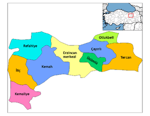 Districts of Erzincan | ||||||||||||||||||||||||||
| |||||||||||||||||||||||||||
Metropolitan municipalities are bolded. | |||||||||||||||||||||||||||