Interstate 85 Business (North Carolina)
In the U.S. state of North Carolina, Interstate 85 Business (commonly referred to as Business 85) is a 29.8-mile-long (48.0 km) business loop of Interstate 85 which serves several cities in the Piedmont Triad. Business 85 is soon to be decommissioned and the route that it travels on will be re-designated only as US 29.
| |
|---|---|
%26groups%3D_ed5e384e94d459ffebb2304c8c5196f40fa1413a.svg)
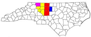
Route of Business 85 highlighted in green | |
| Route information | |
| Maintained by NCDOT | |
| Length | 29.8 mi[1] (48.0 km) |
| Existed | 1984–present |
| Major junctions | |
| South end | |
| |
| North end | |
| Location | |
| Counties | Davidson, Randolph, Guilford |
| Highway system | |

Route description
Business 85, which shares a complete concurrency with US 29 and US 70, begins at a partial Y interchange with I-85 (exit 87) in Lexington. Heading north for 4.4 miles (7.1 km), along with I-285 and US 52, it goes through another partial Y interchange (exit 87) before leaving the freeway. Changing to a semi-limited expressway, it serves as a northern bypass of downtown Lexington, sharing a brief concurrency with US 64.[2] After leaving the city limits, Business 85 heads in a northeast direction in parallel to I-85 further south. After it travels through Thomasville, it enters the city of High Point in Davidson–Randolph county line.[3] Briefly in Randolph County for 1.6 miles (2.6 km), it enters Guilford County.[4] East of downtown High Point, Business 85 shares a unique three-level diamond interchange with I-74/US 311 before leaving the city limits.[5] At the Greensboro city limit, Business 85 completes its 30.7 miles (49.4 km) journey with a trumpet interchange with I-85 (exit 118).[6]
History

Established in 1984 as redesignation of Temp I-85, Business 85 traversed from Lexington to Greensboro, with complete concurrency with US 29 and US 70, when I-85 was completed on a more southern parallel routing.
In May 2005, I-85 was redirected southeast around Greensboro along the Greensboro Urban Loop; its old routing through Greensboro became an extension of Business 85, extending it from 29.8 miles (48.0 km) to 43 miles (69 km).[7][8] The extension included a hidden 2-mile (3.2 km) concurrency along I-85 (between exits 118-120A) before split-off again with US 29 and US 70. In merging onto I-40 (exit 219), it continued easterly before meeting back with I-85 (exit 227) near McLeansville. In October 2018, Business 85 was reverted to its original 29.8-mile (48.0 km) alignment, ending near Jamestown. The justification was to eliminate a redundant route and decrease the number of routing shields and overhead signs through Greensboro.[9][10]
Temporary Interstate 85
| |
|---|---|
| Location | Lexington–Greensboro, NC |
| Length | 30.8 mi[11] (49.6 km) |
| Existed | 1961–1984 |
Temporary Interstate 85 (Temp I-85) was established by 1961 as a temporary designation that directed travelers along US 29/US 70, from the Yadkin River to Greensboro.[12] In 1977, a flyover bridge was completed (dubbed "bridge over nothing," it later became part of I-85 exit 87), truncating Temp I-85 south-end near Lexington.[13][14] In 1984, I-85 was completed on new primary routing between Lexington and Greensboro; Temp I-85 was replaced by I-85 Business.
Future
On Saturday, October 5, 2019, NCDOT submitted an application to the AASHTO, and received approval, for the decommissioning of I-85 Business along its entire route [15], as well as the re-routing of US 70 to continue along Wendover Avenue west-bound through Greensboro to NC Highway 68 (Eastchester Drive) in High Point, and then onto NC 68, south-bound from High Point to Thomasville. [16]. Under the state plan, all I-85 Business and US 70 signs will be removed from the freeway stretch traveling southwesterly from Interstate 40 in Greensboro to NC 68 in Thomasville, and the freeway will remain US 29. The state's justification for this is that the route changes will provide a single continuous route as an alternative (US 70 will take on more direct routing through town), simplify overhead signage on the freeway (eliminate confusion between the I-85 bypass and I-85 Business), and remove traffic from interstate concurrencies in order to improve safety and regional connectivity.[17].
Junction list
| County | Location | mi[1] | km | Destinations | Notes |
|---|---|---|---|---|---|
| Davidson | Lexington | 0.0 | 0.0 | Continuation as I-85/US 29/US 52/US 70; southbound exit and northbound entrance | |
| 0.6 | 0.97 | US 52 exit 84; to Davidson County Airport | |||
| 1.5 | 2.4 | Green Needles Road | US 52 exit 85 | ||
| 2.8 | 4.5 | Salisbury Road – Downtown Lexington | US 52 exit 86 | ||
| 3.7 | 6.0 | US 52 exit 87; north end of I-285/US 52 overlap; northbound exit and southbound entrance | |||
| 4.7 | 7.6 | Old US 64 | |||
| 5.2 | 8.4 | West end of US 64 overlap | |||
| 6.2 | 10.0 | ||||
| 7.1 | 11.4 | East end of US 64 overlap | |||
| Thomasville | 14.3 | 23.0 | Lexington Avenue – Thomasville | Northbound exit and southbound entrance | |
| 16.7 | 26.9 | ||||
| 18.4 | 29.6 | To Piedmont Triad International Airport | |||
| Randolph | High Point | 19.5 | 31.4 | Old Thomasville Road – High Point | |
| Guilford | 20.3 | 32.7 | Prospect Street | ||
| 21.3 | 34.3 | West Green Drive | |||
| 22.1 | 35.6 | Surrett Drive | |||
| 22.8 | 36.7 | Main Street – High Point | |||
| 24.0 | 38.6 | Brentwood Street has a separate exit northbound; three-level diamond interchange | |||
| 25.2 | 40.6 | Baker Road | |||
| 26.2 | 42.2 | Kivett Drive – East High Point | |||
| Greensboro | 28.8 | 46.3 | Vickery Chapel Road / Guildford College Road – Jamestown | ||
| 29.8 | 48.0 | North end of US 29 and west end of US 70 overlap | |||
1.000 mi = 1.609 km; 1.000 km = 0.621 mi
| |||||
References
- Google (December 21, 2018). "Interstate 85 Business (North Carolina)" (Map). Google Maps. Google. Retrieved December 21, 2018.
- Davidson County, North Carolina (PDF) (Map). Cartography by NCDOT. North Carolina Department of Transportation. October 2018. Enlarged Municipal and Suburban Areas inset. § Sheet 2 of 8. Retrieved December 18, 2018.
- Davidson County, North Carolina (PDF) (Map). Cartography by NCDOT. North Carolina Department of Transportation. October 2018. Enlarged Municipal and Suburban Areas inset. § Sheet 5 of 8. Retrieved December 18, 2018.
- Randolph County, North Carolina (PDF) (Map). Cartography by NCDOT. North Carolina Department of Transportation. December 2018. Enlarged Municipal and Suburban Areas inset. § Sheet 3 of 5. Retrieved December 18, 2018.
- Guilford County, North Carolina (PDF) (Map). Cartography by NCDOT. North Carolina Department of Transportation. September 2018. Enlarged Municipal and Suburban Areas inset. § Sheet 8 of 10. Retrieved December 18, 2018.
- Guilford County, North Carolina (PDF) (Map). Cartography by NCDOT. North Carolina Department of Transportation. September 2018. Enlarged Municipal and Suburban Areas inset. § Sheet 9 of 10. Retrieved December 18, 2018.
- "Route Change (2005-05-02)" (PDF). North Carolina Department of Transportation. May 2, 2005. Retrieved December 18, 2018.
- Google (December 21, 2018). "Interstate 85 Business (North Carolina) 2005-2018" (Map). Google Maps. Google. Retrieved December 21, 2018.
- "Route Change (2018-10-31)" (PDF). North Carolina Department of Transportation. October 31, 2018. Retrieved December 18, 2018.
- "Route Change (2018-10-31B)" (PDF). North Carolina Department of Transportation. October 31, 2018. Retrieved January 16, 2019.
- Google (April 17, 2014). "Temporary Interstate 85" (Map). Google Maps. Google. Retrieved April 17, 2014.
- 1970 North Carolina Official Highway Map (PDF) (Map). Cartography by NCDOT. North Carolina Department of Transportation. 1970. Retrieved April 17, 2014.
- "Uglybridges.com: US29&70/I-85 BUS LP over I-85". Retrieved April 17, 2014.
- 1979-80 North Carolina Transportation Map & Guide to Points of Interest (PDF) (Map). Cartography by NCDOT. North Carolina Department of Transportation. 1979. Retrieved April 17, 2014.
- "High Point Urban Area MPO:Removal of "Business 85"". North Carolina Department of Transportation. July 2019. Retrieved January 16, 2020.
- "AASHTO 2019 Annual Meeting: Re-Routing of US-70" (PDF). North Carolina Department of Transportation. October 2019. Retrieved January 16, 2020.
- "AASHTO 2019 Annual Meeting: Re-Routing of US-70" (PDF). North Carolina Department of Transportation. July 2019. Retrieved January 16, 2020.
External links

- NCRoads.com: I-85 Business
- NCRoads.com: I-85 Temp
| ||