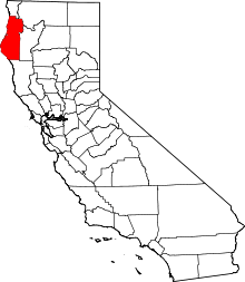
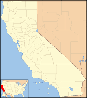
Hoopa, California
Hoopa (formerly, Hupa, Ho-pah, Hoo-pah, Hupo, and Up-pa) is an unincorporated community and census-designated place (CDP) in Humboldt County, California.[1] It is located 10 miles (16 km) south of Weitchpec,[2] at an elevation of 328 feet (100 m).[1] The ZIP Code is 95546.[3]
Hoopa, California | |
|---|---|
 Hoopa  Hoopa | |
| Coordinates: 41°03′01″N 123°40′27″W | |
| Country | United States |
| State | California |
| County | Humboldt County |
| Elevation | 328 ft (100 m) |
| Time zone | UTC-8 (Pacific) |
| • Summer (DST) | UTC-7 (PDT) |
| ZIP code | 95546 |
| Area code(s) | 530 |
| FIPS code | 06-34540 |
| GNIS feature ID | 2585654 |
Hoopa is a rural town located entirely on the reservation of the Hupa. The federal designation of the area is the Hoopa Valley Indian Reservation. Hoopa is on the Trinity River. Hoopa is in the area code of 530.
The Hoopa Valley post office opened in 1861, the name was changed to Hoopa in 1895, to Hupa in 1900, and back to Hoopa in 1902.[2]
Demographics
| Historical population | |||
|---|---|---|---|
| Census | Pop. | %± | |
| U.S. Decennial Census[4] | |||
The 2000 US census recorded 3040 people in Hoopa, and the 2010 census recorded 3,393 people. These figures therefore include people living in Hoopa Valley outside the town of Hoopa. The ethnic composure of the area was 14.1% White, 0.1% Black or African American, 81.7% Native American, 0.3% Asian, 0.8% from other races, and 2.9% from two or more races. 4.5% of the population were Hispanic or Latino of any race.
Politics
In the state legislature, Hoopa is in the 2nd Senate District, represented by Democrat Mike McGuire,[5] and the 2nd Assembly District, represented by Democrat Jim Wood.[6]
Federally, Hoopa is in California's 2nd congressional district, represented by Democrat Jared Huffman.[7]
See also
Climate
Hoopa has average temperatures that range from 34 degrees in January to 95 degrees in July.[8]
References
- U.S. Geological Survey Geographic Names Information System: Hoopa, California
- Durham, David L. (1998). California's Geographic Names: A Gazetteer of Historic and Modern Names of the State. Clovis, Calif.: Word Dancer Press. p. 78. ISBN 1-884995-14-4.
- USPS ZIP Code lookup tool Archived 2010-11-23 at WebCite
- "Census of Population and Housing". Census.gov. Retrieved June 4, 2016.
- "Senators". State of California. Retrieved April 7, 2013.
- "Members Assembly". State of California. Retrieved April 7, 2013.
- "California's 2nd Congressional District - Representatives & District Map". Civic Impulse, LLC. Retrieved March 1, 2013.