Holden, Alberta
Holden is a village in central Alberta, Canada. It is located south of Vegreville. The village is named after former Alberta MLA James Holden.

Holden | |
|---|---|
| Village of Holden | |
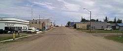 Main street | |
| Motto(s): Share the Charm of Country Living | |
 Holden | |
| Coordinates: 53°13′59″N 112°14′6″W | |
| Country | |
| Province | |
| Region | Central Alberta |
| Census Division | No. 10 |
| Municipal district | Beaver County |
| Incorporated[1] | |
| • Village | April 14, 1909 |
| Government | |
| • Mayor | Douglas Hanson |
| • Governing body | Holden Village Council |
| • CAO | Sherry Garbe |
| Area (2016)[3] | |
| • Land | 1.74 km2 (0.67 sq mi) |
| Elevation | 686 m (2,251 ft) |
| Population (2016)[3] | |
| • Total | 350 |
| • Density | 200.9/km2 (520/sq mi) |
| Time zone | UTC-7 (MST) |
| • Summer (DST) | UTC-6 (MDT) |
| Postal Code | T0B 2C0 |
| Area code(s) | 780 |
| Highways | 14 855 |
| Waterways | Creeks in the area form the head of Vermilion River |
| Website | Official website |
Demographics
In the 2016 Census of Population conducted by Statistics Canada, the Village of Holden recorded a population of 350 living in 146 of its 167 total private dwellings, a change of -8.1% from its 2011 population of 381. With a land area of 1.74 km2 (0.67 sq mi), it had a population density of 201.1/km2 (521.0/sq mi) in 2016.[3]
In the 2011 Census, the Village of Holden had a population of 381 living in 182 of its 213 total dwellings, a change of -4.3% from its 2006 population of 398. With a land area of 1.7 km2 (0.66 sq mi), it had a population density of 224.1/km2 (580.5/sq mi) in 2011.[4]
Notable people
- Dale Armstrong, drag racer
- Ted Newall, businessman
References
- "Location and History Profile: Village of Holden" (PDF). Alberta Municipal Affairs. October 21, 2016. p. 372. Retrieved October 23, 2016.
- "Municipal Officials Search". Alberta Municipal Affairs. September 22, 2017. Retrieved September 25, 2017.
- "Population and dwelling counts, for Canada, provinces and territories, and census subdivisions (municipalities), 2016 and 2011 censuses – 100% data (Alberta)". Statistics Canada. February 8, 2017. Retrieved February 8, 2017.
- "Population and dwelling counts, for Canada, provinces and territories, and census subdivisions (municipalities), 2011 and 2006 censuses (Alberta)". Statistics Canada. 2012-02-08. Retrieved 2012-02-08.
External links
Places adjacent to Holden, Alberta | |
|---|---|
This article is issued from Wikipedia. The text is licensed under Creative Commons - Attribution - Sharealike. Additional terms may apply for the media files.