Cowley, Alberta
Cowley is a village in the Municipal District of Pincher Creek No. 9, Alberta. It is located west of Lethbridge in Southern Alberta.
Cowley | |
|---|---|
| Village of Cowley | |
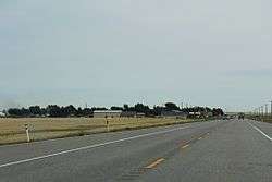 Looking east at Cowley on AB3 (Crowsnest Highway) | |
 Cowley Location of Cowley in Alberta | |
| Coordinates: 49°34′03.7″N 114°04′08.7″W | |
| Country | |
| Province | |
| Region | Southern Alberta |
| Census division | 3 |
| Municipal district | Municipal District of Pincher Creek No. 9 |
| Incorporated[1] | |
| • Village | August 16, 1906 |
| Government | |
| • Mayor | Garry Hackler (Deputy) |
| • Governing body | Cowley Village Council |
| Area (2016)[3] | |
| • Land | 1.37 km2 (0.53 sq mi) |
| Elevation | 1,175 m (3,855 ft) |
| Population (2016)[3] | |
| • Total | 209 |
| • Density | 152.9/km2 (396/sq mi) |
| Time zone | UTC−7 (MST) |
| • Summer (DST) | UTC−6 (MDT) |
| Area code(s) | +1-403, +1-587 |
| Highways | Highway 3 Highway 510 |
| Waterway | Oldman River Reservoir |
It was settled in the 1880s and named by a rancher. Cowley Post Office opened in 1900, and in 1906 Cowley was incorporated as village. The community's name is a combination of "cow" and "lea".[5]
Demographics
In the 2016 Census of Population conducted by Statistics Canada, the Village of Cowley recorded a population of 209 living in 100 of its 113 total private dwellings, a change of -11.4% from its 2011 population of 236. With a land area of 1.37 km2 (0.53 sq mi), it had a population density of 152.6/km2 (395.1/sq mi) in 2016.[3]
In the 2011 Census, the Village of Cowley had a population of 236 living in 104 of its 113 total dwellings, a change of 7.8% from its 2006 population of 219. With a land area of 1.4 km2 (0.54 sq mi), it had a population density of 168.6/km2 (436.6/sq mi) in 2011.[6]
The population of the Village of Cowley according to its 2010 municipal census is 235.[7]
Arts and culture
Cowley was featured in the 2005 motion picture Brokeback Mountain as the fictional town of Signal, Wyoming.
References
- "Location and History Profile: Village of Cowley" (PDF). Alberta Municipal Affairs. October 14, 2016. p. 197. Retrieved October 17, 2016.
- "Municipal Officials Search". Alberta Municipal Affairs. September 22, 2017. Retrieved September 25, 2017.
- "Population and dwelling counts, for Canada, provinces and territories, and census subdivisions (municipalities), 2016 and 2011 censuses – 100% data (Alberta)". Statistics Canada. February 8, 2017. Retrieved February 8, 2017.
- "Alberta Private Sewage Systems 2009 Standard of Practice Handbook: Appendix A.3 Alberta Design Data (A.3.A. Alberta Climate Design Data by Town)" (PDF) (PDF). Safety Codes Council. January 2012. pp. 212–215 (PDF pages 226–229). Retrieved October 8, 2013.
- Place-names of Alberta. Ottawa: Geographic Board of Canada. 1928. p. 38.
- "Population and dwelling counts, for Canada, provinces and territories, and census subdivisions (municipalities), 2011 and 2006 censuses (Alberta)". Statistics Canada. 2012-02-08. Retrieved 2012-02-08.
- "2010 Official Population List" (PDF). Alberta Municipal Affairs. 2010-09-15. Retrieved 2011-01-19.
Places adjacent to Cowley, Alberta | ||||||||||
|---|---|---|---|---|---|---|---|---|---|---|
| ||||||||||