Geokaun
Geokaun Mountain (Irish: an Geocán) is the highest mountain on Valentia Island,[2] County Kerry.
| Geokaun | |
|---|---|
| an Geocán | |
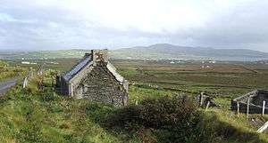 The mountain (on the right) from Coonanaspig | |
| Highest point | |
| Elevation | 266 m (873 ft) [1] |
| Prominence | 266 m (873 ft) [1] |
| Listing | Marilyn |
| Coordinates | 51.9227°N 10.3466°W |
| Naming | |
| Language of name | Irish |
| Geography | |
 Geokaun Location in Ireland | |
| Location | Valentia Island, County Kerry, Ireland |
| OSI/OSNI grid | V386770 |
Geography
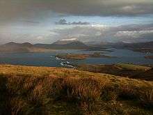
On Geokaun's northern face the 180-metre (600 ft) Fogher Cliffs (Irish: an Fhoithir) meet the sea.
From the summit there are views of the Skellig Islands, Dingle Peninsula, the Blasket Islands, Beginish Island, Cahersiveen, Portmagee and MacGillycuddy's Reeks, including three of Ireland's six highest mountains: Carrauntoohil, Beenkeragh and Caher.
Access
The summit of Geokaun Mountain is privately owned, and a fee is required to access the mountain via the main track to the summit.
Situated along the main path up the mountain are 4 viewing areas with 36 information plaques on topics of social, environmental and historical interest in the area. These plaques include information on subjects such as:
- The Skellig Islands
- The first transatlantic telegraph cable
- Bray Tower
- St Brendan's Well
- The Knight of Kerry
- Local birdlife
- Seine fishing
- Valentia Island lighthouse
- The tetrapod trackway
See also
- List of mountains in Ireland
- List of Marilyns in Ireland
References
- Iveragh NW Area - GeokaunMountainViews.ie
- Geokaun, Ireland, www.peakbagger.com
External links
- Geokaun Mountain – Official Geokaun Mountain tourist website
Mountains and hills of Munster | |||||||
|---|---|---|---|---|---|---|---|
| Ballyhoura Mountains | 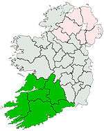 | ||||||
| Boggeragh Mountains | |||||||
| Caha Mountains | |||||||
| Comeragh Mountains | |||||||
| Derrynasaggart Mountains | |||||||
| Dingle Peninsula |
| ||||||
| Galty Mountains | |||||||
| Iveragh Peninsula | |||||||
| Knockmealdown Mountains | |||||||
| MacGillycuddy's Reeks |
| ||||||
| Mangerton Mountains | |||||||
| Shehy Mountains | |||||||
| Silvermine Mountains | |||||||
| Slieve Miskish Mountains | |||||||
| Others |
| ||||||