Geography of Guam
This article describes the geography of the United States territory of Guam.
- Location
- Oceania, island in the North Pacific Ocean, about a quarter of the way from the Philippines to Hawaii, United States
- Geographic coordinates
- 13°26′31″N 144°46′35″E
- Map references
- Oceania
- Area
-
- Total: 544 km²
- Land: 544 km²
- Water: 0 km²
- Area (comparative)
- Three times the size of Washington, D.C.
- Land boundaries
- Approximately 30 miles (48 km) long and 9 miles (14 km) wide, narrowing to 4 miles (6.4 km) at the center.
- Coastline
- 125.5 km (78.0 mi)
- Maritime claims
-
- Territorial sea: 12 nmi (22 km)
- Exclusive economic zone: 200 nautical miles (370 kilometres)
- The southern maritime boundary of Guam forms a border with the Federated States of Micronesia, and the northern maritime boundary forms a border with the Commonwealth of the Northern Marianas Islands.
- Climate
- Tropical marine; generally warm and humid, moderated by northeast trade winds; dry season from January to June, wet season from July to December; little seasonal temperature variation.
- Terrain
- Volcanic origin, surrounded by coral reefs; relatively flat coralline limestone plateau (source of most freshwater), with steep coastal cliffs and narrow coastal plains in north, low-rising hills in center, mountains in south. Soils are mostly silty clay or clay and may be gray, black, brown or reddish brown; acidity and depth vary.[2]
- Elevation extremes
-
- Lowest point: Pacific Ocean, 0 metres (0 feet)[3]
- Highest points:
- Mount Lamlam, 406 meters (1,332 ft)[3]
- Mount Jumullong Manglo, 391 meters (1,283 ft)
- Mount Bolanos, 368 meters (1,207 ft)
- Natural resources
- Commercial fishing (mostly servicing and unloading of longline fleets and commercial vessels), recreational fishing of Indo-Pacific Blue Marlin (Makaira mazara), Wahoo (Acanthocybium solandri), Mahi-mahi (Coryphaena hippurus), Yellowfin tuna (Thunnus albacares), and deepwater reef fish, tourism (especially from Japan but increasingly from China and South Korea).
- Land use
-
- Arable land: 1.85%
- Permanent crops: 16.67%
- Other: 81.48% (2012 est.)
- Irrigated land
- 2 km2
- Natural hazards
- Frequent squalls during wet season; relatively rare, but potentially very destructive typhoons (typhoons are possible in any season but most common from August through December)
- Environment - current issues
- Extirpation of native bird population by the rapid proliferation of the Brown tree snake (Boiga irregularis), an exotic species. Island also supports feral populations of introduced deer, Pigs (Sus scrofa) and Carabao (Bubalus bubalis carabanesis).
- Geography - note
- Largest and southernmost island in the Mariana Islands archipelago; strategic location in western North Pacific Ocean.
| Native name: Guåhån | |
|---|---|
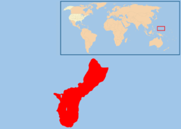
 Map of Guam (See detailed map) | |
 | |
| Geography | |
| Location | Pacific Ocean |
| Coordinates | 13°26′31″N 144°46′35″E |
| Archipelago | Mariana Islands |
| Area | 544 km2 (210 sq mi) |
| Length | 51 km (31.7 mi) |
| Width | 15 km (9.3 mi) |
| Highest elevation | 406 m (1,332 ft) |
| Highest point | Mount Lamlam |
| Administration | |
| Territory | Guam |
| Largest settlement | Dededo (pop. 46,000) |
| Demographics | |
| Population | 167,358 [1] (July 2017 est.) |
| Pop. density | 320.44/km2 (829.94/sq mi) |
| Ethnic groups | Native Chamorros (57%), Filipino (25.5%), White (10%), Chinese, Japanese and Korean ancestry |
Extreme points
This is a list of the extreme points of Guam, the points that are farther north, south, east or west than any other location.
- Northernmost point – Ritidian Point
- Easternmost point – Pati Point
- Southernmost point – Cocos Island
- Southernmost point (mainland) – Aga Point
- Westernmost point – Orote Point
References
- The World Factbook: Guam CIA. Retrieved on October 18, 2017.
- https://casoilresource.lawr.ucdavis.edu/gmap/
- "Elevations and Distances in the United States". U.S. Geological Survey. 29 April 2005. Retrieved November 9, 2006.
Hagåtña (capital) | |
| Topics |
|
| Islands | |
| Villages | |
| Peaks |
|
| Healthcare | |
This article is issued from Wikipedia. The text is licensed under Creative Commons - Attribution - Sharealike. Additional terms may apply for the media files.