Fontevraud-l'Abbaye
Fontevraud-l'Abbaye is a commune in the western French department of Maine-et-Loire. It is situated both in the Loire Valley, a UNESCO World Heritage Site between Chalonnes-sur-Loire and Sully-sur-Loire, and the Loire Anjou Touraine French regional natural park.
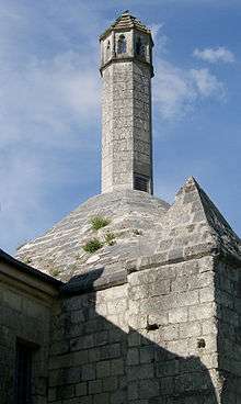
The lantern of the dead of St Catherine's chapel
- Population (1999): 1,189
- Area: 1,482 ha
- Average altitude: 80 m
Fontevraud-l'Abbaye | |
|---|---|
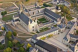 Aerial view of Fontevraud Abbey | |
.svg.png) Coat of arms | |
Location of Fontevraud-l'Abbaye 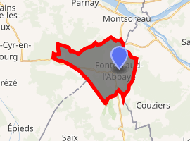
| |
 Fontevraud-l'Abbaye  Fontevraud-l'Abbaye | |
| Coordinates: 47°10′59″N 0°03′02″E | |
| Country | France |
| Region | Pays de la Loire |
| Department | Maine-et-Loire |
| Arrondissement | Saumur |
| Canton | Saumur |
| Intercommunality | CA Saumur Val de Loire |
| Government | |
| • Mayor (2008–2014) | Régine Catin |
| Area 1 | 14.86 km2 (5.74 sq mi) |
| Population (2017-01-01)[1] | 1,536 |
| • Density | 100/km2 (270/sq mi) |
| Demonym(s) | Fontevriste |
| Time zone | UTC+01:00 (CET) |
| • Summer (DST) | UTC+02:00 (CEST) |
| INSEE/Postal code | 49140 /49590 |
| Elevation | 37–114 m (121–374 ft) (avg. 80 m or 260 ft) |
| Website | Site de la mairie de Fontevraud-l'Abbaye |
| 1 French Land Register data, which excludes lakes, ponds, glaciers > 1 km2 (0.386 sq mi or 247 acres) and river estuaries. | |
Notable buildings
- The royal abbey of Fontevraud
- Saint Catherine's chapel with its lantern of the dead
- Chapelle Notre-Dame-de-Pitié (chapel of Our Lady of Compassion)
- Église Saint-Michel (church of St Michael)
References
- "Populations légales 2017". INSEE. Retrieved 6 January 2020.
External links
| Wikimedia Commons has media related to Fontevraud-l'Abbaye. |
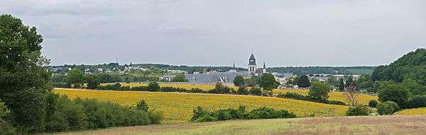
The town as viewed from the east
| Authority control |
|
|---|
This article is issued from Wikipedia. The text is licensed under Creative Commons - Attribution - Sharealike. Additional terms may apply for the media files.