Armaillé
Armaillé is a commune in the Maine-et-Loire department in western France.
Armaillé | |
|---|---|
 A general view of Armaillé | |
Location of Armaillé 
| |
 Armaillé 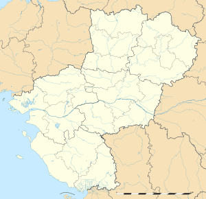 Armaillé | |
| Coordinates: 47°42′54″N 1°07′39″W | |
| Country | France |
| Region | Pays de la Loire |
| Department | Maine-et-Loire |
| Arrondissement | Segré |
| Canton | Segré |
| Intercommunality | Anjou Bleu Communauté |
| Government | |
| • Mayor (2014-2020) | Bernard Gaultier |
| Area 1 | 16.78 km2 (6.48 sq mi) |
| Population (2017-01-01)[1] | 314 |
| • Density | 19/km2 (48/sq mi) |
| Time zone | UTC+01:00 (CET) |
| • Summer (DST) | UTC+02:00 (CEST) |
| INSEE/Postal code | 49010 /49420 |
| Elevation | 39–100 m (128–328 ft) (avg. 97 m or 318 ft) |
| 1 French Land Register data, which excludes lakes, ponds, glaciers > 1 km2 (0.386 sq mi or 247 acres) and river estuaries. | |
Geography
The village lies on the right bank of the Verzée, which flows east-southeast through the commune.
Population
| Historical population | ||
|---|---|---|
| Year | Pop. | ±% |
| 1793 | 779 | — |
| 1800 | 515 | −33.9% |
| 1806 | 657 | +27.6% |
| 1821 | 670 | +2.0% |
| 1831 | 810 | +20.9% |
| 1836 | 797 | −1.6% |
| 1841 | 762 | −4.4% |
| 1846 | 736 | −3.4% |
| 1851 | 793 | +7.7% |
| 1856 | 726 | −8.4% |
| 1861 | 731 | +0.7% |
| 1866 | 713 | −2.5% |
| 1872 | 697 | −2.2% |
| 1876 | 736 | +5.6% |
| 1881 | 755 | +2.6% |
| 1886 | 729 | −3.4% |
| 1891 | 650 | −10.8% |
| 1896 | 613 | −5.7% |
| 1901 | 622 | +1.5% |
| 1906 | 611 | −1.8% |
| 1911 | 597 | −2.3% |
| 1921 | 537 | −10.1% |
| 1926 | 507 | −5.6% |
| 1931 | 509 | +0.4% |
| 1936 | 514 | +1.0% |
| 1946 | 475 | −7.6% |
| 1954 | 495 | +4.2% |
| 1962 | 453 | −8.5% |
| 1968 | 403 | −11.0% |
| 1975 | 335 | −16.9% |
| 1982 | 307 | −8.4% |
| 1990 | 297 | −3.3% |
| 1999 | 289 | −2.7% |
| 2006 | 298 | +3.1% |
| 2009 | 285 | −4.4% |
| 2015 | 313 | +9.8% |
References
- "Populations légales 2017". INSEE. Retrieved 6 January 2020.
| Wikimedia Commons has media related to Armaillé. |
| Authority control |
|
|---|
This article is issued from Wikipedia. The text is licensed under Creative Commons - Attribution - Sharealike. Additional terms may apply for the media files.