Bécon-les-Granits
Bécon-les-Granits is a commune in the Maine-et-Loire department in western France.
Bécon-les-Granits | |
|---|---|
 The town hall of Bécon-les-Granits | |
 Coat of arms | |
Location of Bécon-les-Granits 
| |
 Bécon-les-Granits 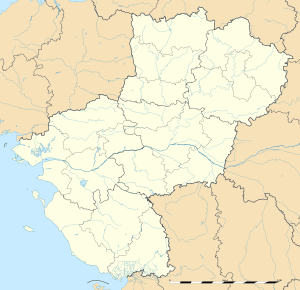 Bécon-les-Granits | |
| Coordinates: 47°30′12″N 0°47′59″W | |
| Country | France |
| Region | Pays de la Loire |
| Department | Maine-et-Loire |
| Arrondissement | Segré |
| Canton | Chalonnes-sur-Loire |
| Intercommunality | Ouest-Anjou |
| Government | |
| • Mayor (2008–2014) | Marcel Pichavant |
| Area 1 | 46.17 km2 (17.83 sq mi) |
| Population (2017-01-01)[1] | 2,803 |
| • Density | 61/km2 (160/sq mi) |
| Time zone | UTC+01:00 (CET) |
| • Summer (DST) | UTC+02:00 (CEST) |
| INSEE/Postal code | 49026 /49370 |
| Elevation | 18–88 m (59–289 ft) (avg. 65 m or 213 ft) |
| 1 French Land Register data, which excludes lakes, ponds, glaciers > 1 km2 (0.386 sq mi or 247 acres) and river estuaries. | |
Population
| Historical population | ||
|---|---|---|
| Year | Pop. | ±% |
| 1793 | 1,444 | — |
| 1800 | 1,292 | −10.5% |
| 1806 | 1,335 | +3.3% |
| 1821 | 1,310 | −1.9% |
| 1831 | 1,543 | +17.8% |
| 1836 | 1,563 | +1.3% |
| 1841 | 1,651 | +5.6% |
| 1846 | 1,914 | +15.9% |
| 1851 | 1,924 | +0.5% |
| 1856 | 1,962 | +2.0% |
| 1861 | 2,006 | +2.2% |
| 1866 | 2,132 | +6.3% |
| 1872 | 2,057 | −3.5% |
| 1876 | 2,155 | +4.8% |
| 1881 | 2,236 | +3.8% |
| 1886 | 2,272 | +1.6% |
| 1891 | 2,187 | −3.7% |
| 1896 | 2,042 | −6.6% |
| 1901 | 2,036 | −0.3% |
| 1906 | 2,061 | +1.2% |
| 1911 | 1,981 | −3.9% |
| 1921 | 1,905 | −3.8% |
| 1926 | 1,830 | −3.9% |
| 1931 | 1,691 | −7.6% |
| 1936 | 1,611 | −4.7% |
| 1946 | 1,658 | +2.9% |
| 1954 | 1,704 | +2.8% |
| 1962 | 1,606 | −5.8% |
| 1968 | 1,563 | −2.7% |
| 1975 | 1,432 | −8.4% |
| 1982 | 1,820 | +27.1% |
| 1990 | 2,252 | +23.7% |
| 1999 | 2,325 | +3.2% |
| 2004 | 2,489 | +7.1% |
| 2006 | 2,551 | +2.5% |
| 2009 | 2,672 | +4.7% |
External links
| Wikimedia Commons has media related to Bécon-les-Granits. |
| Authority control |
|
|---|
This article is issued from Wikipedia. The text is licensed under Creative Commons - Attribution - Sharealike. Additional terms may apply for the media files.