Chalonnes-sur-Loire
Chalonnes-sur-Loire is a commune in the Maine-et-Loire department in western France. It is located on the left bank of the Loire River in the Loire Valley UNESCO World Heritage Site area.
Chalonnes-sur-Loire | |
|---|---|
.jpg) The Chalonnes-sur-Loire bridge | |
 Coat of arms | |
Location of Chalonnes-sur-Loire 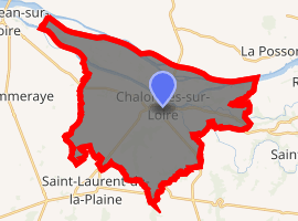
| |
 Chalonnes-sur-Loire 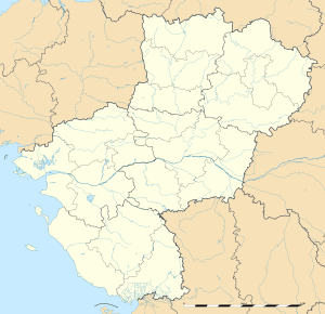 Chalonnes-sur-Loire | |
| Coordinates: 47°21′05″N 0°45′45″W | |
| Country | France |
| Region | Pays de la Loire |
| Department | Maine-et-Loire |
| Arrondissement | Angers |
| Canton | Chalonnes-sur-Loire |
| Government | |
| • Mayor | Stella Dupont |
| Area 1 | 38.56 km2 (14.89 sq mi) |
| Population (2017-01-01)[1] | 6,535 |
| • Density | 170/km2 (440/sq mi) |
| Time zone | UTC+01:00 (CET) |
| • Summer (DST) | UTC+02:00 (CEST) |
| INSEE/Postal code | 49063 /49290 |
| Elevation | 10–99 m (33–325 ft) (avg. 28 m or 92 ft) |
| 1 French Land Register data, which excludes lakes, ponds, glaciers > 1 km2 (0.386 sq mi or 247 acres) and river estuaries. | |
Geography
The town is in the heart of the Anjou, a historical agricultural region southwest of Angers renowned for Loire Valley wines. The Layon flows into the Loire River at the commune.
The airport nearest to Chalonnes-sur-Loire for regional flights is Angers – Loire Airport (41 km), and for international flights is Nantes Atlantique Airport (67 km).[2]
Twin towns
Chalonnes-sur-Loire is twinned with:


References
- "Populations légales 2017". INSEE. Retrieved 6 January 2020.
- "information" Archived 2011-10-05 at the Wayback Machine
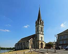
Saint-Maurille church of Chalonnes-sur-Loire
| Wikimedia Commons has media related to Chalonnes-sur-Loire. |
| Authority control |
|---|
This article is issued from Wikipedia. The text is licensed under Creative Commons - Attribution - Sharealike. Additional terms may apply for the media files.