Fiskdale, Massachusetts
Fiskdale (or Fiskedale[1]) is a census-designated place (CDP) in the town of Sturbridge in Worcester County, Massachusetts, United States. The population was 2,583 at the 2010 census.
Fiskdale, Massachusetts | |
|---|---|
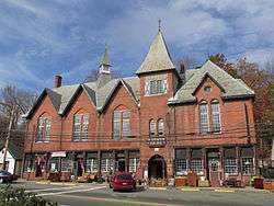 Blackington Building | |
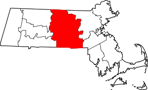
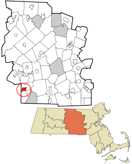 Location in Worcester County and the state of Massachusetts. | |
| Coordinates: 42°6′54″N 72°6′42″W | |
| Country | United States |
| State | Massachusetts |
| County | Worcester |
| Area | |
| • Total | 3.3 sq mi (8.5 km2) |
| • Land | 3.2 sq mi (8.3 km2) |
| • Water | 0.1 sq mi (0.3 km2) |
| Elevation | 627 ft (191 m) |
| Population (2010) | |
| • Total | 2,583 |
| • Density | 780/sq mi (300/km2) |
| Time zone | UTC-5 (Eastern (EST)) |
| • Summer (DST) | UTC-4 (EDT) |
| ZIP code | 01518 |
| Area code(s) | 508 |
| FIPS code | 25-23840 |
| GNIS feature ID | 0610057 |
Geography
Fiskdale is located at 42°6′54″N 72°6′42″W (42.114994, -72.111547).[2]
According to the United States Census Bureau, the CDP has a total area of 8.5 km² (3.3 mi²). 8.3 km² (3.2 mi²) of it is land and 0.3 km² (0.1 mi²) of it (3.04%) is water.
Fiskdale is generally regarded by residents of Sturbridge to include the northwestern corner of the town, containing Tantasqua Regional High School, the densely populated areas around Route 148 (Brookfield Road), Holland Road area, as well as much of Route 20 to the west of Interstate 84. Big Alum Pond, Long Pond, and part of East Brimfield Lake are located in Fiskdale.
Demographics
At the 2000 census there were 2,156 people, 873 households, and 568 families in the CDP. The population density was 261.0/km² (676.8/mi²). There were 914 housing units at an average density of 110.6/km² (286.9/mi²). The racial makeup of the CDP was 95.87% White, 0.60% African American, 0.60% Native American, 0.42% Asian, 0.09% Pacific Islander, 0.93% from other races, and 1.48% from two or more races. Hispanic or Latino of any race were 2.23%.[3]
Of the 873 households 34.8% had children under the age of 18 living with them, 50.7% were married couples living together, 11.7% had a female householder with no husband present, and 34.9% were non-families. 30.2% of households were one person and 14.7% were one person aged 65 or older. The average household size was 2.46 and the average family size was 3.09.
The age distribution was 27.2% under the age of 18, 5.7% from 18 to 24, 29.3% from 25 to 44, 23.9% from 45 to 64, and 13.9% 65 or older. The median age was 37 years. For every 100 females, there were 90.3 males. For every 100 females age 18 and over, there were 88.0 males.
The median household income was $48,924 and the median family income was $60,032. Males had a median income of $47,609 versus $26,496 for females. The per capita income for the CDP was $24,118. About 8.6% of families and 11.4% of the population were below the poverty line, including 16.5% of those under age 18 and 20.3% of those age 65 or over.
References
- CIS: Unincorporated and Unofficial Names of Massachusetts Communities
- "US Gazetteer files: 2010, 2000, and 1990". United States Census Bureau. 2011-02-12. Retrieved 2011-04-23.
- "U.S. Census website". United States Census Bureau. Retrieved 2008-01-31.